Featured

Precolonial North American History: The Indigenous People of Maine in 1600

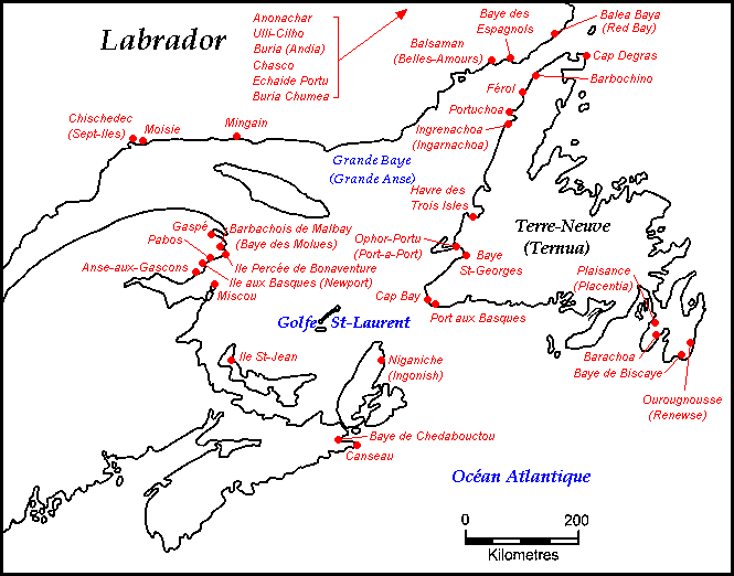
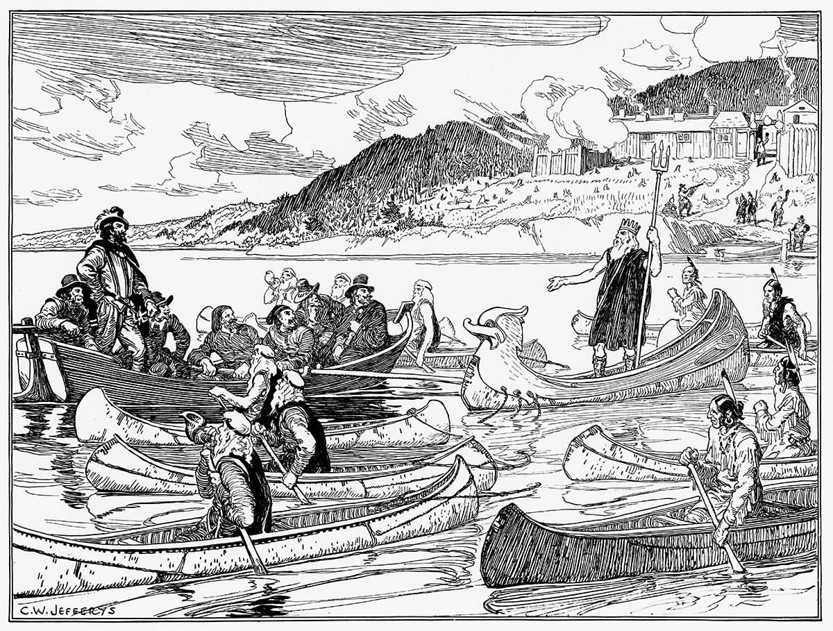
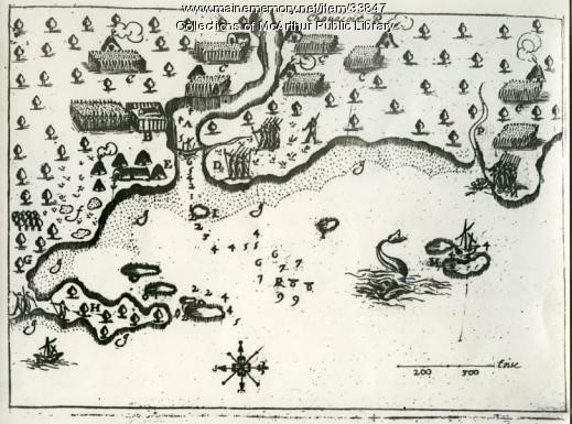
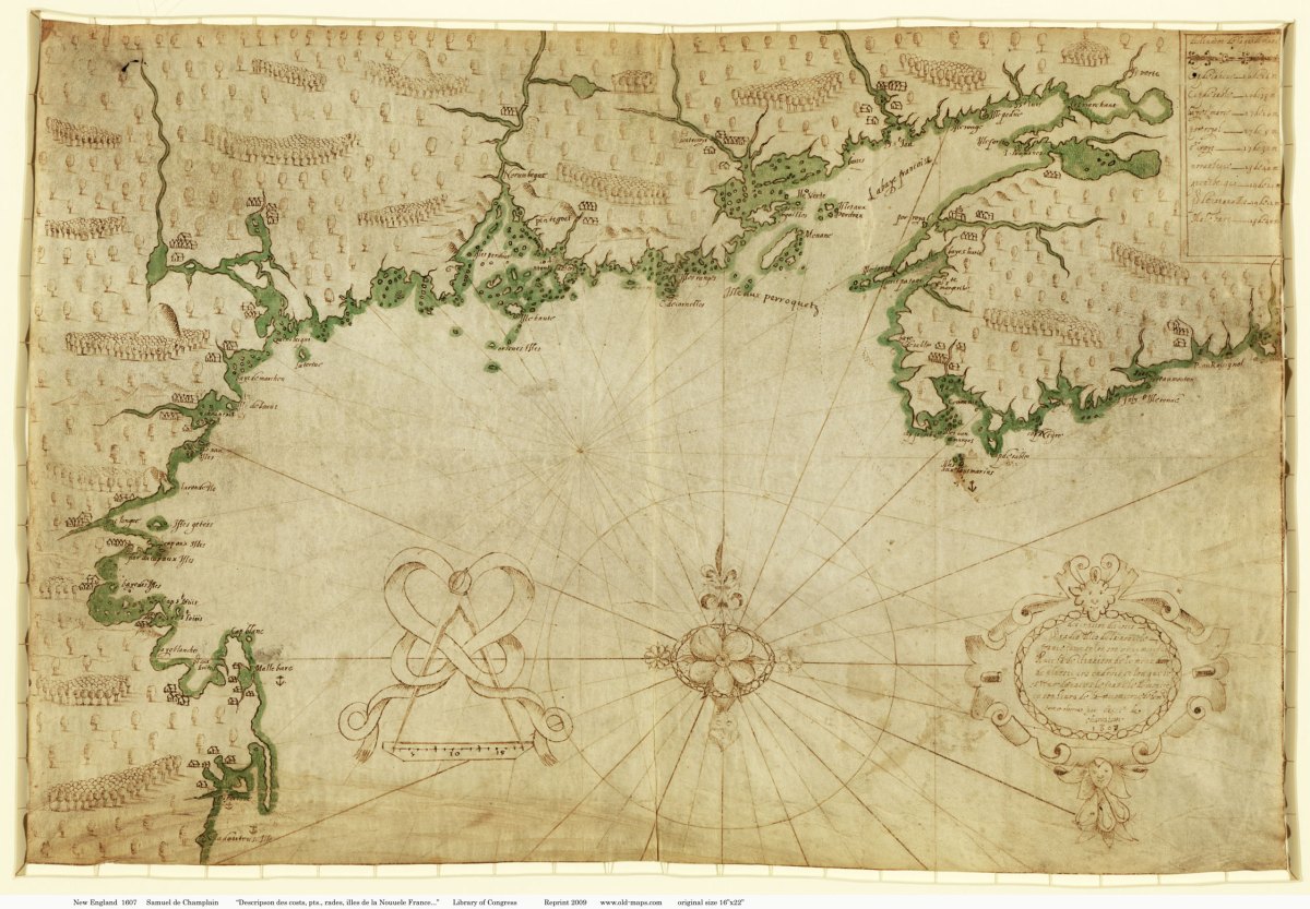
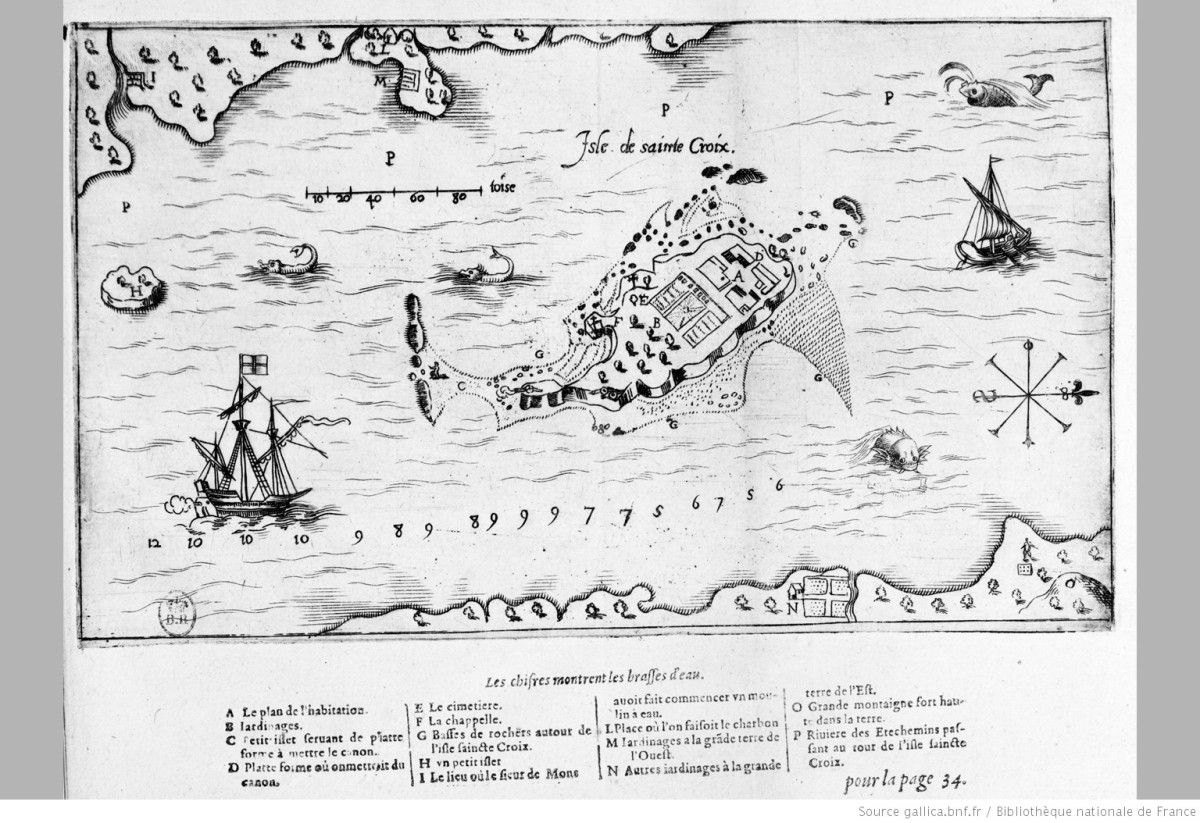
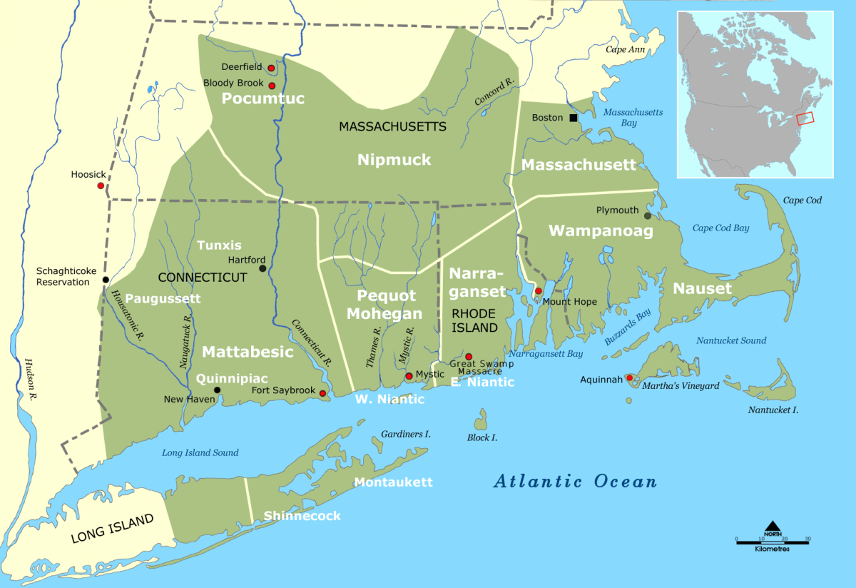
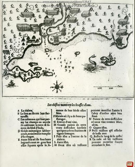
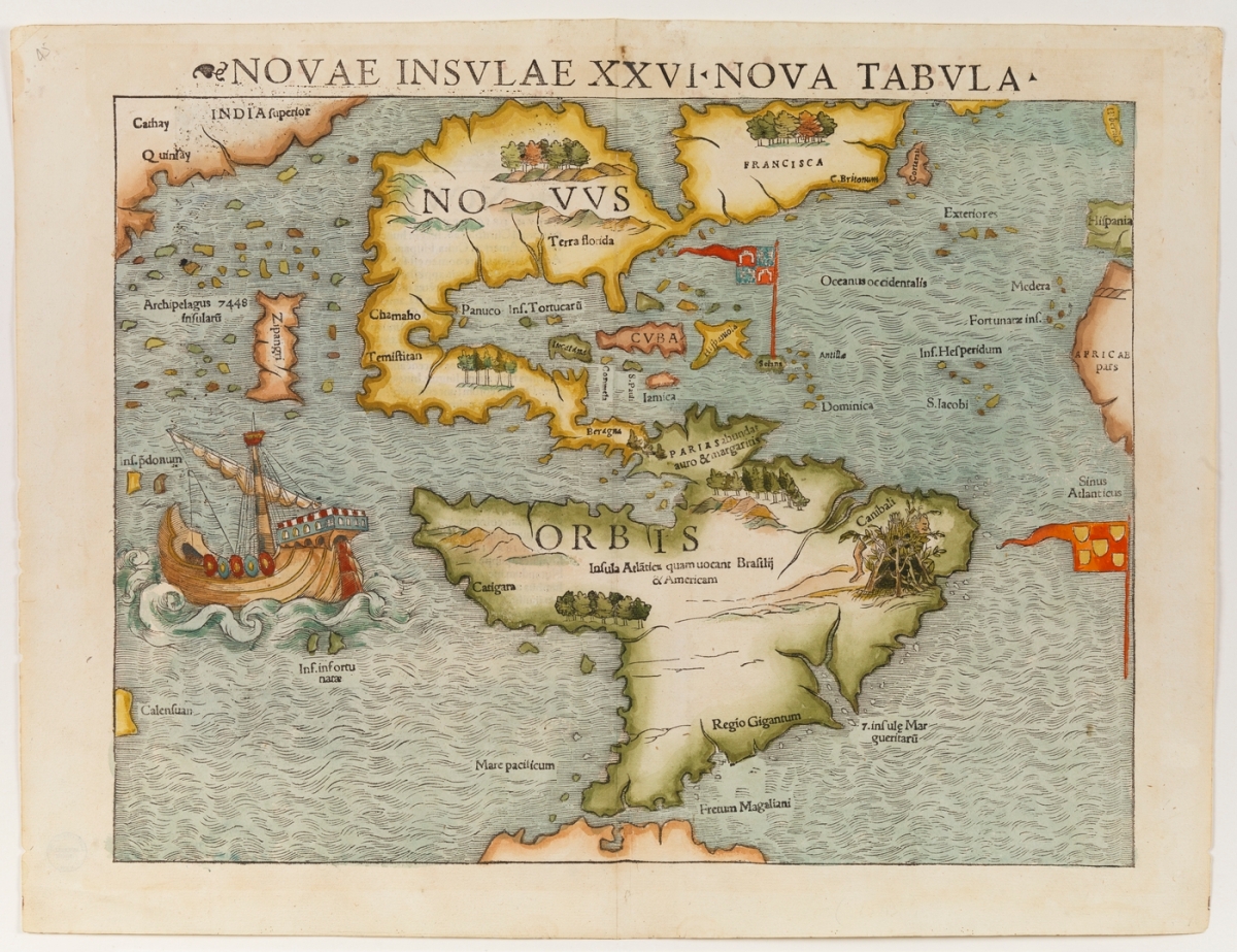
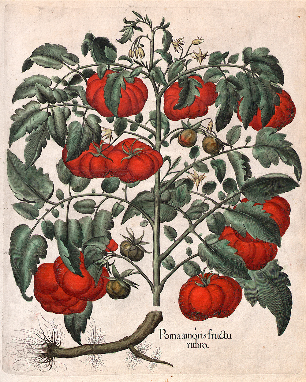
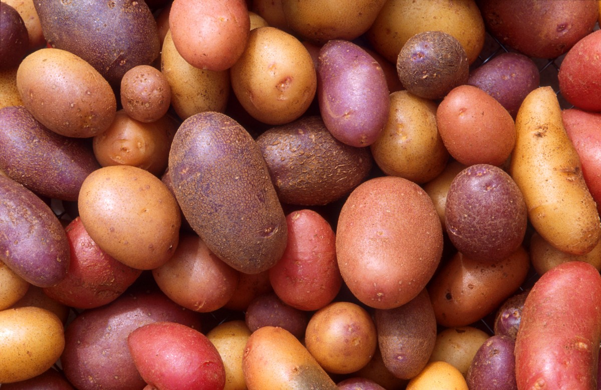
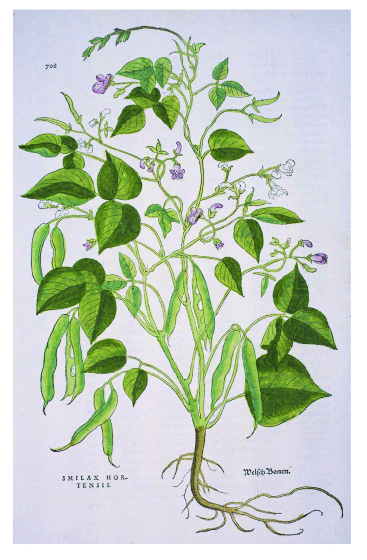
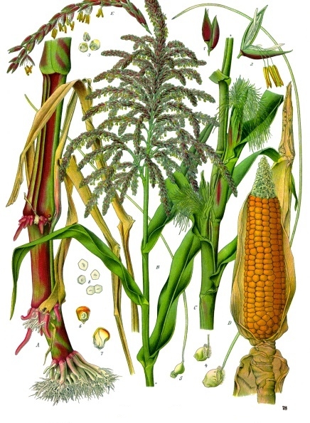
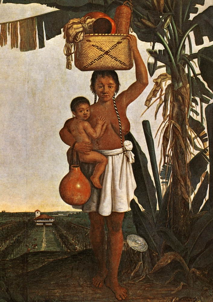
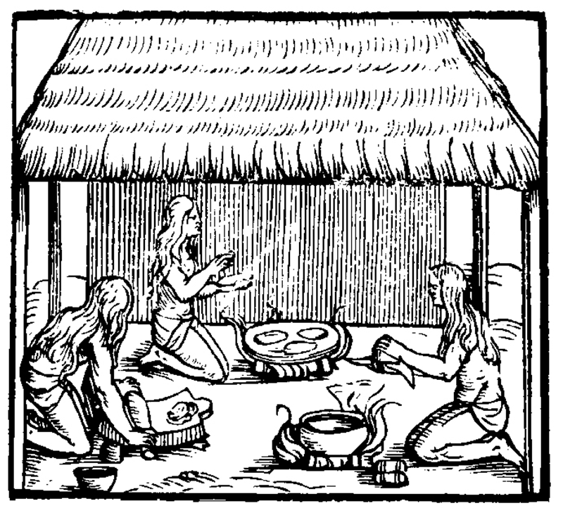
When the first Europeans began to arrive on the coast of Maine in the late 16th century, they encountered a rich tapestry of indigenous cultures. The region was inhabited by three distinct Algonquin-speaking ethnic groups, each with their own unique customs and ways of life. Samuel de Champlain would be the first European to come in contact with all three groups, and he called them Etchemin, Souriquios, and Armouchiquois. The Etchemin were located along the central coast in the woodlands between the Kennebec and St John River Valleys. They were flanked on their northeast by the Souriquios and to their southwest by the Armouchiquois.  The Armouchiquois and Abenaki were corn, bean, and squash farmers, while the Souriquios and Etchemin were strictly hunter-gatherers. This diversity of lifestyles and cultures is a testament to the richness and complexity of the indigenous societies in Maine.

‘Souriquois’ was a French term meaning ‘saltwater men’.  The word ‘Etchemin’ is believed to be either a French alteration of an Algonquian word for canoe or a translation of ‘skidijn’, the native word for people. ‘Armouchiquois’ was a French corruption of the Souriquois word ‘Alemousiski ‘, which meant ‘land of the little dog ‘. This term was intentionally derogatory, reflecting the power dynamics between the Souriquois and Armouchiquois. It’s important to note these derogatory terms to understand the historical context and the unequal power relations between the indigenous people and the European colonizers. 

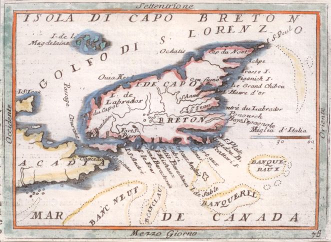
The Souriquois were found not only in Northeastern Maine but in Canada’s Atlantic Provinces, including Nova Scotia, New Brunswick, Prince Edward Island, and Newfoundland, as well as on the Gaspé Peninsula of Quebec. Their name for themselves was U’nu’k meaning humans or people.

The Etchemin contained two groups – the Eastern Etchemins, who allied with the Souriquois and were found east of the Narraguagus River – and the Western Etchemins, who allied with the Armouchiquois and ranged along the coast and into the forested hinterland from the Narraguagus to the Kennebec River.

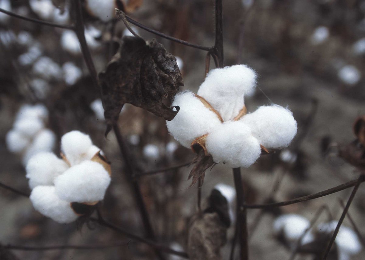
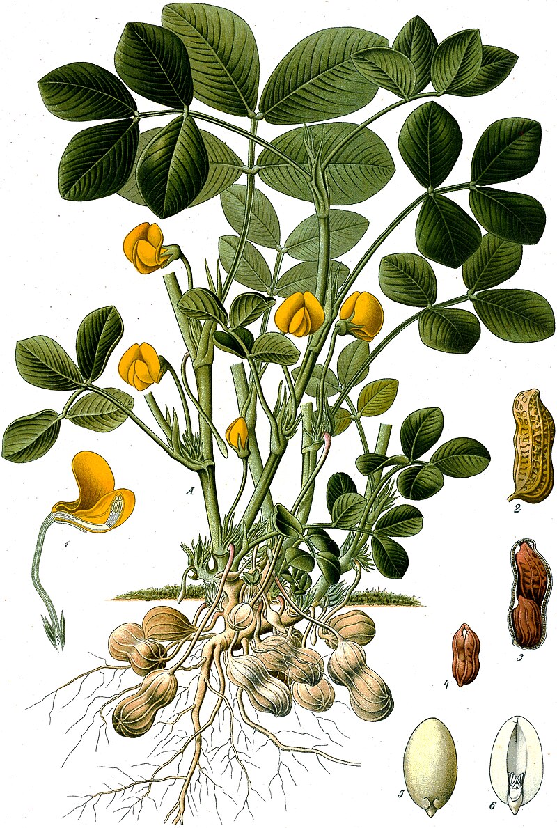
The Armouchiquois were spread from western Maine to Cape Cod and comprised several ethnic groups. They included corn-growing peoples from the Kennebec to Cape Cod: Abenaki, Penacook, Massachusett, and Wampanoag. Other names used to describe people in western Maine were Sacos, Pigwackers, Ossipees, and Pennacook-Abenaki. They called themselves “alnamback” or real people (Haviland, 2017).

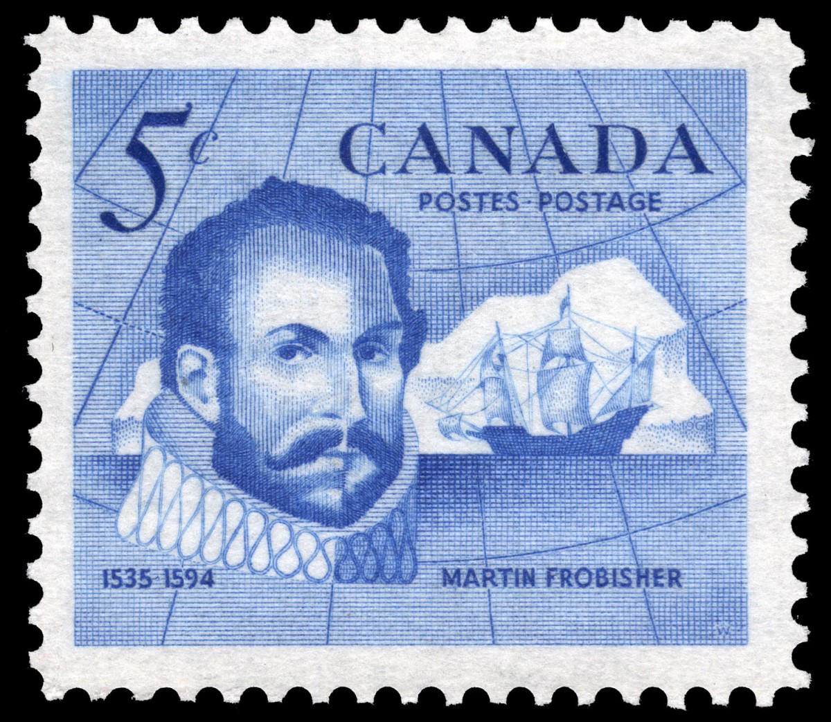
What the French and English would call the Peoples of Maine would evolve over the next century. The term Armouchiquois would soon disappear, although the labels  Etchemen and Souriquois would survive through most of the 17th century. Today’s Passamaquoddy and Maliseet trace to the eastern Etchemen. The Souriquois are now most commonly called Micmac or Mi’kmaq. The name Wabanaki (“People of Dawnland”) would eventually come to represent all the Peoples of Maine after the Wabanaki Confederacy was formed in the 1680s to combat the growing encroachment of colonists and challenge Iroquois hostilities  (Snow, 1976).

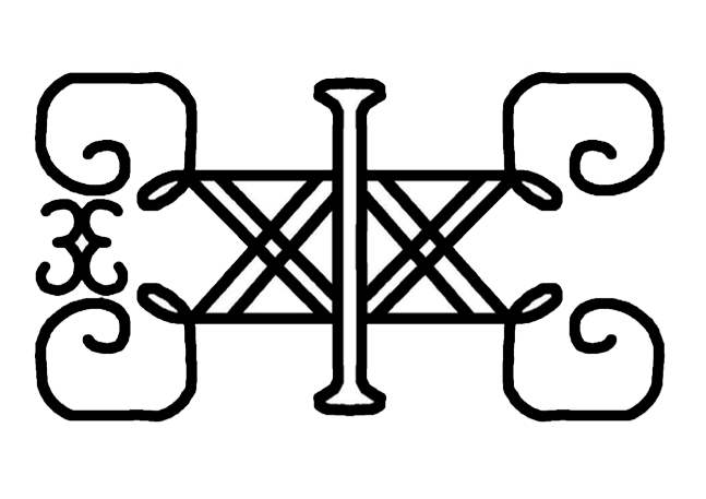
Illustration: Symbol of the Wabanaki Union of Tribes, still in use. It was originally embroidered onto the ceremonial clothing of sakoms. Frank Speck (1927) Symbols In Penobscot art. https://en.wikipedia.org/wiki/Wabanaki_Confederacy#/media/File:Wabanaki_Union_Symbol.png

Bibliography

Anonymous (Undated). The Almouchiquois. The Falmouth Historical Society. https://thefhs.org/almouchiquois

Baker, E. W. (2004). Finding the Almouchiquois: Native American Families, Territories, and Land Sales in Southern Maine. Ethnohistory, 51(1),  73-100.

Bourque, B. J. (1989) Ethnicity on the Maritime Peninsula, 1600-1759. Ethnohistory,  36 (3),  257-284

Haviland, B. (2017). Who was here first? Abbe Museum. https://www.abbemuseum.org/blog/2017/3/10/up-from-the-depths-a-stone-axe-and-sea-level-change

Hoffman, B. G. (1955). The Souriquois, Etechemin, and Kwĕdĕch–A Lost Chapter in American Ethnography. Ethnohistory, 2(1), 65-87

Prins, H. E. L., & McBride, B. (2007). Asticou’s Island Domain: Wabanaki Peoples at Mount Desert Island 1500-2000. Acadia National Park. Ethnography Program. National Park Service. 

Featured

Precolonial North American History: Second Arctic voyage of John Davis

Embarking on another significant historical journey, John Davis set sail from Dartmouth on 7 May 1586, leading his second expedition to the Arctic Sea. This voyage, marked by the presence of four ships-the Mermaid (120 tons), Sunshine (60 tons), Moonshine (35 tons), and North Star (10 tons)-would lead to several great adventures.  

On the 15th, Davis came in sight of the southern extremity of Greenland, but the pack ice rendered it impossible to land, so Davis named it “Cape Farewell” and continued along the strait that now bears his name. Here, he encountered severe gales of wind, and it was not until the 29th that he again sighted the towering mountains of Greenland near Gilbert Sound. He then took shelter among the islands along the coast and commenced examining the shore.

As his chronicler Jayne tells the story: “… we sent our boats to search for shole water … the people of the country having spied them, came in their canoes towards them with many shoutsand cries … After I perceived their joy … myself with the merchants and others of the company went ashore, bearing with me twenty knives. I had no sooner landed, but they leaped out of their canoes, came running to me and the rest, and embraced us with many signs of hearty welcome: at this present, there were eighteen of them, and to each of them, I gave a knife: they offered skins to me for reward, but I made signs that it was not sold, but given them of courtesy …”  (Markham, 1880, p. 16)

The next day, the pinnace was landed on an island for assembly, and while the carpenters got to work, they were surrounded by many Inuit who were again very friendly. Davis records that as many as 100 kayaks came up to the ship at one time and that the Inuit were “very diligent to attend to us, and to help us up the rocks, and likewise down.(Markham, 1880, p. 17)

The pinnace was launched on 4  July, with forty people helping them. The English were almost constantly surrounded wherever they went by Inuit in their kayaks, and thieving started to become a major problem.  One night, the Inuit began firing stones upon a ship with slings, and a large rock knocked down the boatswain of the Moonshine. Davis finally lost his patience and chased after the perpetrators in their kayaks but without success. The next day his crew did manage to capture one of the ringleaders who they hoped to exchange for their anchor. However, the wind came up, and this poor soul was carried out to sea.  

As Davis and crew traveled southward of Gilbert Sound, they came upon “an enormous iceberg on the 17th of July. Its extent and height were so extraordinary that the pinnace was sent to ascertain whether it was land or really ice. The report was that it was indeed one gigantic mass of ice, floating on the sea, with bays and capes, plateaus and towering peaks, [which] excited great astonishment.”  (Markham, 1889, p. 42)

Soon, masses of ice began to collect around the ships, and the ropes and sails became frozen and covered with ice. Further progress was checked, and the men began to despond, telling the captain: ”That he should regard the safety of his own life and the preservation of his people, and that he should not through over-boldness run the risk of making children fatherless and wives desolate.” (Markham, 1889, pp. 47-48) 

At this point, Davis decided to send the Mermaid home with the sick and feeble, while he continued on in the Moonshine.  He sailed westward and made land on the opposite side of the strait, near Exeter Sound. Then, sailing southwest, he entered the Cumberland Gulf again, passed the entrance to Hudson Strait without observing it, and sailed along the coast of Labrador. Here, they fished for cod, which they salted to take home.

While they were at anchor, several men were sent on shore to collect some fish which had been laid out on the rocks to cure. Unknown to them, several Mi’kmaq were hiding in the woods, “who sent a murderous round of arrows at the sailors. Seeing this unfold from the boat, Davis sailed towards the shore and discharged his muskets at the savages, which scattered them. Unfortunately, two of his men were killed by arrows, two were seriously wounded, and just one escaped with an arrow wound to the arm, by swimming off toward the ship.” (Markham 1889, p. 56)

Davis and the crew were then caught up in a furious gale that lasted for three days. This proved to be the tipping point for Davis, and he decided to give up and return home. He left for England on 11 September and arrived home in early October 1586.

Illustration: Map showing Davis’s northern voyages. From C. R. Markham’s The life of John Davis, the navigator (1889).

Bibliography

Markham, A. H. (ed.) (1880) The voyages and works of John Davis, the navigator. London: The Hakluyt Society.

Markham, C. R. (1889). The life of John Davis, the navigator (1550 – 1605). Discoverer of the Davis Straits. Dodd Mead and Company, New York.

Featured

Precolonial North American history: The first Arctic voyage of John Davis

Martin Frobisher failed in his attempt to extract wealth from Arctic Canada in the 1570s, but England’s passion remained strong for finding a Northwest Passage to China. John Davis would be the next in line to make that quest in three missions between 1585 and 1587.

On his first voyage, Davis left Dartmouth on 7 June 1585 with two ships, the Sunshine (50 tons, 23 crew, including a four-man band) and Moonshine (35 tons, 19 crew). The trip was backed by William Sanderson and a group of merchants from London and the West Country.   

After battling strong westerly winds, the two ships arrived on the west coast of Greenland and dropped anchor at the present site of Nuuk.  Here, they had a most pleasing interaction with the local Inuit. The encounter began with the crew hearing a “lamentable noise” that they thought must be wolves. It turned out to be the Inuit’s making a ruckus to get their attention. In response, the crew went on shore with their band, which began to play while the officers and sailors danced and “allured the Inuit by friendly embraces and signs of courtesy.” (Markham, 1980). The sailors then placed some stockings, caps, and gloves on the ground as gifts and danced and sang their way back into their boats and rowed back to the mother ships.

This strange behavior apparently proved effective, and the next day, the Inuit came back and actively traded with them. Despite Frobisher’s previous altercations with them, the Inuit reacted quite favorably towards Davis and his crew. As Davis’s chronicler, Jayne tells the story:  

The ships being within tile sounds, we sent our boats to search for shole water, where we might anchor, which in this place is very hard to find: and as the boat went sounding and searching, the people of the country having spied them, came in their canoes towards them with many shoutsand cries: but after they had spied in the boat, some of our company that was the year before here with us, they presently rowed to the boat, and took hold in the oar, and hung about the boat with such comfortable joy as would require a long discourse to be uttered: they came with the boats to our ships, making signs that they all those that yere before had been with them. 

After I perceived their joy … myself with the merchants and others of the company went ashore, bearing with me twenty knives. I had no sooner landed, but they leaped out of their canoes and came running to me and the rest and embraced us with many signs of hearty welcome: at this present, there were eighteen of them, and to each of them, I gave a knife: they offered skins to me for reward, but I made signs that it was not sold, but given them of courtesy: and so dismissed them for that time, with signs that they should return again after certain hours.

The next day, with all possible speed, the pinnace was landed upon an Isle there to be finished …  During the time that the pinnace was there setting up, the people came continually unto us, sometimes a hundred canoes at a time, sometimes forty, fifty, more and Jess, asoccasion served.  They brought with them sealskins, stag  skins, white hares, seal fish, salmon, small cod, dry caplin, with  other  fish, and  birds, such  as the country  did yield.” (Markham, 1880: 16).

The expedition then sailed west across the cold, icy waters of what is now called Davis Strait and discovered a wide and deep sound that Davis was certain was the opening to the Northwest Passage. They sailed for miles into this waterway (now called Cumberland Gulf), but by August 20th, the blustery wintry winds convinced Davis and his officers that they had better turn and head home or risk spending the winter icebound.  Unbeknownst to them, they had not gone far enough to find that the waterway was not the Passage at all but, in fact, ended in the center of Baffin Island.

Davis and crew arrived back at Dartmouth on the 30th of September. On his return, Davis immediately wrote a letter to Sir Frances Walsingham Knight, a member of Her Majesty’s Privy Council, in which he enthusiastically boasted he had found the Northwest Passage:  “Right honorable most dutifully craving pardon for this my rash boldness, I am herby, according to my duty, to signify to your honor that the north-west passage is a matter nothing doubtful! but at any time almost to be passed, the sea navigable, the air tolerable, and the waters very deep.  I have also found a very great quantity, not in any globe or map described, yielding a sufficient trade of fur and leather. Although this passage hath been supposed very impassible, yet through God’s mercy, I am in experience and eye witness to the contrary, yea in this most desperate climate;  which,  by Gods help, I will very shortly most at large reveal onto your honor so soon as I can possibly take orders for my mariners and shipping.  Thus, depending on your honors good favor, I humbly commit you to God this third of October.” (Markham, 1880: xix).

Illustration: A miniature portrait (1624) of John Davis from the title page of Samuel Purchas’s collection of travel stories, Hakluytus Posthumus or Purchas his Pilgrimes.

Bibliography

Markham, A. H. (ed.) (1880) The voyages and works of John Davis, the navigator. London: The Hakluyt Society.

Markham, C. R. (1889). The life of John Davis, the navigator (1550 – 1605). Discoverer of the Davis Straits. Dodd Mead and Company, New York.

Featured

Precolonial North American History: Tarrentine Wars

About the time the English and French began to explore the northern coast of Atlantic America,  what had been mostly friendly trading interactions between the Tarrentines and the other coastal New England nations turned to violence. The Etcheman west of the Kennebec (Penobscot, Kennebec) and the southern Almouchiquois would ally, form the Mawooshen Confederation, and become the sworn enemies of the Tarrentines.

The arrival of French fur traders in the St. Lawrence Valley stimulated a crisis among the Indigenous nations that lasted over 25 years. A growing scarcity of fur-bearing animals intensified inter-tribal competition, and a major power imbalance arose when the French provided the Tarrentines with firearms.

While there are few European eyewitness reports of these battles, Champlain and Lescarbot published numerous accounts of the Indigenous participants. During the Champlain and Poutrincourt excursions along the Maine coast, Lescarbot writes that in 1606 at the village of Chouacoet near Saco Bay, Almouchiquois chiefs Marchin and Onemechin “brought Monsieur de Poutrincourt a Souriquois [Mi’kmaq] prisoner, and therefore their enemy, whom they freely handed over to him” (Biggar, 1928: 99).

During the same visit, Champlain told of two Sagamos who came there from the east in their own shallot, an Etchemin named Messamouet and a Souriquios [Mi’kmaq] named Secoudon. These two Tarrentine had come to trade with French merchandise gained by barter, even though they were traditional enemies of the Almouchiquois. After a long oratory by Messamouet, he made presents of kettles, axes, knives, and other manufactured articles, to which Onemechin gave him back Indian corn, squashes, and Brazilian beans. This produce did not altogether satisfy Messamouet, “who departed much displeased because he had not been suitably repaid for what he had given them, and with the intention of making war upon them before long…” (Bigger, 1922: 395-396). After this encounter, Secoudon stayed with Champlain’s expedition while Messamouet returned to Nova Scotia.

During Champlain’s return voyage, as he passed Great Wass Island on the coast of Maine, a group of Eastern Etchemin informed Secoudon that a Mi’kmaq chieftain named “Iouaniscou and his companions had killed some other [Armouchiquois] and carried off some women as prisoners, and that near Mount Desert Islandthey had put these to death.” (Biggar, 1922: 426). When Champlain dropped Secoudon off at St. Croix after the voyage, Champlain reported that the Etchemin chief returned with scalps he had obtained at Cape Cod, although the details of how these were obtained are not given.

In the autumn of 1606, the murders of Iouaniscou were avenged by the Etchemin with the murder of the Mi’kmaq Panonias, who had guided Champlain the previous summer. He was killed by Mawooshen warriors in the Penobscot Bay area.  After his death, the Eastern Etchemin chief  Ouagimout of  Passamaquoddy  Bay asked  Bashaba, the grand chief of Mawooshen, for Panonias’ body. The body was then delivered by Ouagimout, wrapped in moosehide, to a Mi’kmaq encampment near Port Royal. Membertou, Panonias’s father-in-law and grand chief, welcomed Ouagimout and presented ritual gifts of mourning to Panonias’ relatives. Panonias was then buried on an island near Cape Sable.

In response, Membertou, with 500 warriors, attacked the town of Chouacoet, that Champlain had previously visited on July 1607, killing twenty people, including two grand chiefs, Onmechin and Marchin.  The Tarrentine also suffered losses in this raid, including Chief Ouagimout of Passamaquoddy Bay, who was grievously wounded, and Chief Secoudon. who was killed.   

Membertou conducted his attack as a surprise offensive. He appeared before the Abenakis unarmed, pretending that he wanted to negotiate, and then, he and his men seized hidden weapons and attacked. Membertou’s force was composed of Mi’kmaqs from his band and Messamouet’s, along with Eastern Etchemins from the St. John River under Chief Secoudon and from the Passamaquoddy Bay area under Chief Ouagimout (Prins and McBride, 2000).

Thus began what has been called the Tarratine or Mi’kmaq Wars, where bands of Tarrentine warriors in fleets of canoes and shallops began raiding Mawooshen villages, killing people and taking captives along with corn, furs, and moose hides. These wars culminated with the slaughter of the Mawooshen grand chief Basaba in 1615. This was followed by the great plague (“Great Dying’) of 1616-19. An estimated 2,500 out of 7,500 eastern Etchemins died, while as many as  9,000 out of 12,000 western Etchemins perished. The Almouchiquois must have also suffered staggering casualties. 

Even after the collapse of the western Etchemin, Mik’maq raids against the Amouchiquois continued until as late as 1631. However, the Tarrentine entrepreneurs’ fortunes declined rapidly after Europeans appeared in the Gulf and began trading directly with local fur producers.

Illustration: Alan Syliboy’s portrait of Grand Chief Henri Memberton that was presented to Queen Elizabeth the Second on 28 June 2010 by Grand Chief Benjamin Sylliboy and placed on permanent display in Government House Halifax.

Bibliography:

Biggar, H. P. (1922). The works of Samuel de Champlain. Vol. 1: 1599 – 1607. The Champlain Society.

Prins, H. E. L., & McBride, B. (2007). Asticou’s Island Domain: Wabanaki Peoples at Mount Desert Island 1500-2000. Acadia National Park. Ethnography Program. National Park Service. 

Featured

Precolonial North American History: Third Arctic voyage of Martin Frobisher

On 31 May 1578, Frobisher, in the Ayde, led a fleet of 15 vessels from Harwich. He was directed to bring back 2,000 tons of ore and establish a settlement to gather more. McFee (1928, p. 80) suggests that “without being aware of it, we are now witnessing the inception of the first authentic scheme of colonial expansion in the history of North America.”

The plan was to leave one hundred miners there with enough supplies for the winter and summer. Three ships would be left behind in case the colonists needed to return home before the supply ships came back the next year. Unfortunately, this was a flawed strategy, as the sea in the area was frozen from late November until July, and the miners could not have left even if they had wanted to.

The expedition arrived at Greenland on 20 June and found it to be a forbidding place.   As McFee (1928, p. 65) describes: “Frisland, or Greenland as we call it now, was a singularly unpromising coast. The shore was practically inaccessible, the visible highland consisted of grim snow-covered ranges, and the fogs came down with terrifying suddenness whenever the Admiral wanted to seek a landing. Frobisher had the natural horror of a shipmaster losing sight of his ship. He gave it up and set forward for Meta Incognita.”

From Greenland, the group traveled towards Frobisher’s Strait and, according to Frobisher’s chronicler, Best, met with many great whales. One of the ships, named the Salamander, struck a great whale “with such a blow that the ship stood still neither forward nor backward. The whale made a great and ugly noise and cast up his body and tail, and so went underwater, and within two days after, there was found a great whale dead, swimming above the water, which we supposed was that of the Salamander stroke.” (Collinson, 1867, p.  234) 

The fleet then suffered a period of great difficulty where they were forced to battle ice floes, strong currents, and foul weather.   They were driven south into an unknown strait, which Frobisher named the “Mistaken Strait.” He was, of course, sure that this was a Northwest Passage but left without further investigation, as the fabled passage was now outside his voyage’s specific mission. It would be determined later that his “Mistaken Strait” was the Hudson Strait leading into Hudson Bay and not to Cathay. A similar misconception would lead to Henry Hudson’s death 30 years later. 

Windswept ice floes kept the fleet from its intended destination for about a month, during which time the ship carrying most of their building materials was crushed in the ice, and another one deserted and went back to England. Finally, at the end of July, Frobisher found the strait he was looking for, and the miners were deployed to dig for ore on an island he named the Countess of Warwick.

Using the building materials they still had on hand, a house was built near the mining site, but the idea of a winter colony was dropped because they had too few remaining materials to build any other structures. The remains of this house are still clearly visible on the summit of Kodlunarn Island. These are the oldest known remains of a European house built in America north of the Caribbean.

As soon as the miners began working at the ore, Best went exploring. He climbed to the top of what became known as Hatton’s Headland, to look at the fleet and set up a cross of stone, “in token of Christian possession.” A week later, he and some other officers chased and killed “a great white bear, which adventured and gave a fierce assault upon twenty men being weaponed. And he served them for good meat many days” (McFee, 1928, p. 101).

Within a month after beginning the dig,  the ships were fully loaded with bags of ore and were ready for the voyage home. After seeing a massive display of the Aurora Borealis, which Frobisher took as a warning that they should leave, “they all departed, or more appropriately escaped, on the thirty-first of August 1578 (McCoy, 2014).

At the end of August, the vessels arrived home and the refiners immediately set out to extract the gold, but none was ever found. Repeated attempts went on until 1583, but there was no longer any room for denial, and the Queen and all the investors were forced to accept failure. Seas of litigations followed “and needing a scapegoat, they focused their anger on poor Michael Lok. In gross unfairness, the gullible investors accused Lok of dishonesty, with Frobisher himself among the accusers. Michael Lok furiously accused Frobisher of bringing back valuable ore on the first voyage but worthless ore on other trips … Lok became the focus of creditors’ efforts to collect, and he was bankrupted, sued, and imprisoned. Lok later claimed to have seen the inside of every jail in London. (McCoy, 2014b,  n.p.)

Frobisher would continue his naval service in many capacities over the next 16 years but would never return to the Arctic.

Illustration: Canadian commemorative postage stamp of Martin Frobisher issued in 1963.

Bibliography

Collinson, R. (1867) The three voyages of Martin Frobisher, in search of a passage to Cathaia and India by the North-west, A.D. 1576-8. Reprinted from the first ed. of Hakluyt’s Voyages, with selections from manuscript documents in the British Museum and State Paper Office. Hakluyt Society, London.

McCoy, R.M. (2014) Explorer Martin Frobisher infects the Queen with gold fever. Part 2. Explorer’s tales. https://www.newworldexploration.com/explorers-tales-blog/explorer-martin-frobisher-infects-the-queen-with-gold-fever-part-2

McFee, W. (1928) Sir Martin Frobisher. John Lane the Bodley Head LTD: London

Featured

Precolonial North American History: The second Arctic voyage of Martin Frobisher

On Frobisher’s second voyage to the Arctic, all thoughts of the Northwest Passage were forgotten, and the quest became simply to find gold. On 31 May 1577, Frobisher sailed from Harwich with three ships and about 120 men. He captained Queen Elizabeth’s ship the Ayde, piloted by the expedition’s chronicler George Best. Aboard the three ships were a group of miners, and the artist John White who would produce the first pictures of Inuits and later would gain fame as the artist of the Raleigh’s Roanoke Colony.

They arrived at the shore of Greenland on 4 July, but ice prevented them from landing. On 17 July they reached the island from which the now famous little black stone had originally been taken that led to the gold speculation. Little additional ore was found there but on another nearby island (now Kodlunarn Island) they did discover a large quantity. While five miners and some of the crew dug ore and loaded it into the Ayde, Frobisher and a group of 40 men explored the Island.

Frobisher began by claiming this land and its supposed riches for England. In a brief ceremony, Frobisher and crew piled a cairn of stones to mark possession at the island’s highest point, which Frobisher dubbed Mount Warwick in honor of the Earl of Warwick, one of the investors in the expedition.

The land claim did not go unnoticed by the Inuit. As Best described: “… marching towards our boats, we spied a certain number of the country people on the top of Mount Warwicke with a flag, waving us back again and making a great noise, with cries like the mowing of bulls, seemingly desirous of a conference with us … “(Collinson, 1867, p.129)

Each side sent two unarmed representatives to the center of the mountain to trade. The English representatives were Frobisher and a compatriot who tried to take captive one of the  Inuit’s in a prearranged plan. The man proved to be too slippery to grab and ran away, and the two Inuits recovered their weapons, and then chased the two Englishmen down the mountain to their boats, wounding Frobisher with an arrow in the buttock. A volley from the English guns sent the two fleeing, but a man named Nicolas Conyer charged after them and was able to capture one and bring him back to the boat.  

Frobisher and the landing party then rowed to the other side of the island, where they were assaulted by another group of Inuit on the bluffs above them. Frobisher and his party were eventually able to land, located an abandoned village, and destroyed a group of Inuit tents.  They then attacked a nearby settlement, where five or six Inuit were killed, and one Englishman was seriously wounded. The English aptly named the location “Bloody Point.”

They also captured two women and a child. One of the women they described as being so old and ugly that they were sure she must be a witch. They had “her buskins picked off to see if she had cloven feet” and they let her go when her feet proved normal. The other woman and the child were taken back to their ship (Morison, 1971, p. 523).

Best suggested that the female captive was taken on board for the comfort of their male captive: “The two were brought together, surrounded by a circle of Englishman to see what would happen.” The Inuit behaved with great dignity, and even though the two were forced to bunk together on the voyage home, they “did never use as man and wife.” (Collinson, 1867:144-145)

A few days after visiting “Bloody Point,” the crew discovered on a small island  “a tomb, wherein the bones of a dead man lay together … Here they also found hid under stones a good store of fish and other things of the inhabitants including sleds, bridles, kettles of fish skins, knives of bone and such other like.” Their male captive “took in his hand one of these country bridles, he caught one of our doggies, and hampered him handsomely therein, as we do our horses, and with a whip in his hand, he taught the dog to draw a sled.” (Collinson, 1867, p. 136)

Another discovery, which gave them particular delight, was a dead narwhal on the shore with a two yard long unicorn-like nose. The horn was taken back to England and given to Queen Elizabeth, who kept it in her wardrobe, handy for bringing out to stimulate the art of bawdy conversation that she is said to have loved.  (Collinson, 1867, p.136)

On 20 August, the mining work was done. The minors had gathered 200 tons of supposed gold ore while Frobisher and the others were exploring. The ice was now forming around their ship at night, signaling it was time to return home. On 22 August, after lighting bonfires and firing Volleys into the sky, Frobisher and crew headed back to England. 

Once home, the ore samples were sent to a number of assessors who again produced a wide range of estimates on the amount of gold in the ore. Several reported no sign of gold, while others claimed it contained up to ten profitable ounces of gold per hundred pounds. The Queen chose to believe the highest estimate, and incredibly, another larger expedition was organized without any ore having been processed.

Illustration:

A painting by John White of a violent encounter with Inuit during the second Arctic voyage of Martin Frobisher. (British Museum, London) https://www.worldhistory.org/image/12371/inuit-skirmish-by-john-white/

Bibliography:

Collinson, R. (1867) The three voyages of Martin Frobisher, in search of a passage to Cathaia and India by the North-west, A.D. 1576-8. Reprinted from the first ed. of Hakluyt’s Voyages, with selections from manuscript documents in the British Museum and State Paper Office.  Hakluyt Society, London.

Cooke, A. (2003) Frobisher, Sir Martin.  In: Dictionary of Canadian Biography,vol. 1, University of Toronto/Université Laval, http://www.biographi.ca/en/bio/frobisher_martin_1E.html.

McCoy, R.M. (2014a) Explorer Martin Frobisher infects the Queen with gold fever. Part 1. Explorer’s tales. https://www.newworldexploration.com/explorers-tales-blog/archives/08-2014

McCoy, R.M. (2014b) Explorer Martin Frobisher infects the Queen with gold fever. Part 2. Explorer’s tales. https://www.newworldexploration.com/explorers-tales-blog/explorer-martin-frobisher-infects-the-queen-with-gold-fever-part-2

McFee, W. (1928) Sir Martin Frobisher. John Lane the Bodley Head LTD: London

Featured

Precolonial North American History: The first Arctic expedition of Martin Frobisher

In 1576, Queen Elizabeth’s seadog Martin Frobisher decided that he would find the Northwest Passage to China through the bitter cold of the Arctic. With the backing of merchant Michael Lok, a ship of about 20 tons was built for the mission named the Gabriel, and two ships were purchased – the Michael of 25 tons, and a pinnace of 10 tons. To man the ships, a crew of 35 was employed. On 7 June 1576, the fleet sailed from Ratcliff with Frobisher as its admiral and pilot, Christopher Hall as captain of the Gabriel, and Owen Griffyn as captain of the Michael.  

On 1 July, they sighted the east coast of Greenland, where they were hit by a massive storm. The three ships got separated, and the pinnace was lost.  The captain of the Michael became so intimidated by the ice that he turned back, and the Gabriel was nearly swamped and wound up on its side. Frobisher kept the ship afloat by ordering the men to cut the mizzenmast to lighten the weight and right the ship. This saved the day, but the ship was full of water, and they had lost many supplies.

Undaunted Frobisher continued westward, and on 28 July he sighted a barren rocky headland which he dubbed “Queen Elizabeth’s Foreland”, now known as Resolution Island, the most easterly outpost of Arctic Canada. From here, Frobisher headed west in a great bay reaching into the heart of Baffin Island, and at its head, Frobisher dispatched a party on a small island, he named Hall’s,  after the master of Gabriel. As they departed, he told the group to bring him anything that they found “in token of Christian possession” of the land.

In McFee’s biography of Frobisher’s life, he relates: “Some of his company brought flowers, some green grass, and one brought a piece of a black stone, much like to a Seacoal in color, which by the weight seemed to be some metal or Mineral. This was a thing of no account, in the judgment of the Captain at the first sight. And yet for novelty, it was kept, in respect of the place from whence it came.” (1928: 48)

This little rock would later lead to a mad search for gold in Frobisher Bay.

Frobisher then sailed into a “greate gutte bay”, which he assumed was the Northwest passage. Frobisher traveled about 60 leagues into the bay and named it Frobisher’s Strait.  Unfortunately, it was not the Northwest Passage at all but a dead end inside Baffin Island, a mistake that would go uncorrected until the middle of the 19th century.

At this point, Frobisher decided to visit Hall’s Island himself and, for the first time, realized that the country was inhabited. “He saw a number of small things fleeting in the Sea afar off, which he supposed to be Porpoises, or Seals, or some kind of strange fish: but coming nearer, he discovered them to be men, in small boats made of leather.” (Collinson, 1867, p. 73)

These were the Inuit of Baffin Island.

Over the next several days, the two groups traded cautiously with one another, sometimes ashore and sometimes aboard the Gabriel. The Inuit seemed familiar with ships such as the Gabriel, and they willingly consumed English food, drank wine, and competed in acrobatics with the mariners among the ropes of the ship’s rigging.

One of the Inuit, through signs, agreed to show them the way to a western sea and Frobisher sent him with five seamen back to the shore to prepare for the journey. These five sailors disobeyed their orders to stay in sight of the ship and were never seen again. Frobisher waited three days for their return and then searched the coast in vain for his men or some Inuit that might be captured and ransomed. He did not find any of his men and was able to capture only one poor local who had inadvertently come to the ship in his kayak to trade. Frobisher would take this unfortunate man back to England as proof to Queen Elizabeth that he had reached a far and strange land. Sadly, the Inuit died shortly after reaching England.

Frobisher now realized that it was time to turn homeward, as snow had begun falling on deck, and the seas were beginning to freeze around the Gabriel. He claimed Baffin Island as a possession of Queen Elizabeth and then sailed back to England.  

Soon after his return, Frobisher gave the black stone that had been collected on Hall’s Island to Lok, who took pieces of it to three different assessors to determine its worth. All three deemed it worthless as marcasite, a sulfide of iron very similar to pyrite (fool’s gold). Disappointed but undaunted, Lok took one more piece of it to another person named Giovanni Agnello, who gave the opposite opinion and claimed he could extract gold from it with a special process known only to himself.

Lok wrote Queen Elizabeth an account of all these findings, and she decided to support a second voyage, even with the shaky evidence of gold. In  March 1577,  the Cathay Company was formed and given a royal charter, with Lok as governor and Frobisher as “high admiral.” All was now in place for an expedition to specifically find gold.

Illustration: Martin Frobisher Frobisher from the Heroologia Anglica, a collection of engraved portraits of illustrious English people (1620).

Bibliography:

Collinson, R. (1867) The three voyages of Martin Frobisher, in search of a passage to Cathaia and India by the North-west, A.D. 1576-8.  Hakluyt Society, London.

McFee, W. (1928) Sir Martin Frobisher. John Lane the Bodley Head LTD: London

Featured

Precolonial North American History: The colony of Bartholomew Gosnold

A largely forgotten man named Bartholomew Gosnold made the first English attempt to colonize New England.

Gosnold was born in 1561 into an East Anglian manorial family. He got his first taste at sea in the Essex/Raleigh Expedition to the Azores in 1597, and upon his return, somehow got the colonization bug. It had been fifteen years since Walter Raleigh’s third attempt to settle at Roanoke had resulted in the famous “lost colony.” Gosnold ignored the fact that Sir Walter had the royal charter authorizing him to explore, colonize, and rule unoccupied North American territory.

Gosnold was initially backed by Robert Devereux, Earl of Essex, but his plan got stalled when the earl was beheaded in 1601 for conspiring against Queen Elizabeth. Gosnold regrouped and obtained the support of Henry Wriothesley, third earl of Southampton, although he too was imprisoned for a while as part of the Essex plot.

On March 26, 1602, Gosnold’s expedition departed Falmouth on the ship Concord, carrying twenty gentleman colonists and a dozen crewmembers. The Concord was a small, uncomfortable ship that had a keel length of only 39 feet, a breadth of 17½ feet, and leaked badly. Instead of making a circuitous route to North America by the Canary Islands as other explorers had done, Gosnold traveled due west and was the first to travel a direct route to New England. In only seven weeks, he made landfall at what is now Cape Elizabeth, near Portland, Maine. While exploring the area, he famously encountered a Mi’kmaq who was wearing black serge breeches and a European waistcoat. 

In May 1602,  Gosnold continued southward in search of an appropriate site for settlement. He navigated around a peninsula he named Cape Cod, after the large number of fish swimming in the surrounding waters. He went ashore there and was among the first Europeans to trade with the Nauset people. Continuing on, he discovered a large island he named Martha’s Vineyard in memory of his first child and the wild grapes that covered it.  

At Martha’s Vineyard, Gosnold encountered the Wampanoag people, who proved to be friendly, bringing the Englishman cooked fish, deerskins, and tobacco. Gosnold  kept on moving, and finally selected the small island of Cuttyhunk, west of Martha’s Vineyard, for his settlement. Here he built a small fort on an island in the middle of a large freshwater lake, which he reached with a flat-bottomed boat.   

The colonists found fertile land and plenty of sassafras to harvest, which would bring them a high profit in England. In the early 1600s, sassafras was believed to be a wonder drug that could cure just about anything. It became so popular that by the mid-1600s, it was America’s number two export to Europe, second only to Virginia tobacco.

As the summer progressed, Gosnold and the locals traded actively and had mostly congenial interactions. A group of six or seven of them even worked side-by-side with Gosnold’s men, helping cut and carry the sassafras.

As the summer progressed, the colonists began to lose their enthusiasm for settlement, realizing that their supplies were likely too short to last the winter. They also had an unfortunate skirmish where two Englishmen hunting for shellfish were attacked by four locals who shot one in the side with an arrow. This incident scared the colonists, making clear how vulnerable their little settlement was to the whims of the Indigenous people.

The original plan was for the colonists to split into two groups when their ship was full of sassafras – one group was to sail back to England with their harvested bounty and the other was to stay through the winter. After a sharp dispute as to who would go and who would stay, Gosnold gave in to a majority vote, and after only a month on the island, everyone sailed back to England, carrying a profitable cargo of cedar wood, sassafras, furs, and a stolen Wampanoag canoe.

Soon after their return, Sir Walter Raleigh found out about Gosnold’s mission and laid claim to the cargo.  However, the two quickly make peace. Gosnold had many powerful friends like the Earl of Southampton and Raleigh came to see the success of the mission as a good advertisement for future ventures that he might conduct.  

The colony of  Gosnold’s would be ephemeral, but its story would live long after. William Shakespeare based his play “The Tempest” on Gosnold’s 1602 voyage, with Prospero’s island being drawn from the descriptions of Martha’s Vineyard.

Gosnold would go on to be one of the key organizers of the successful Jamestown settlement.  Now mostly forgotten, he deserves much greater recognition. Dana Huntley (2023) calls Gosnold: “a man who perhaps more than any other single individual is responsible for the establishment of British North America, a man whom history ought to have recognized in one sense as at least the Founding Grandfather of these fair colonies.”

Illustration:

Artist’s conception of the fort built by Bartholomew Gosnold’s expedition on Elizabeth Islet, Cuttyhunk in May/June 1602. Robert Maitland Brereton, Reminiscences of an Old English Civil Engineer 1858-1908.

Bibliography:

Quinn, D. B. and Quinn, A. M. (1983) Gabriel Archer’s account of Captain Bartholomew Gosnold’s voyage to ‘North Virginia’ in 1602. In: The English New England voyages, 1602-1608. Hakluyt Society, London. pgs 112-138.

Huntley, D. (2023) Bartholomew Gosnold – How England settled in the New World. British Heritage Travel. https://britishheritage.com/history/bartholomew-gosnold-englands-settled-new-world

Levermore, C. H. (1912) Forerunners and Competitors of the Pilgrims and Puritans. 2 vols. Brooklyn: New England Society.

Featured

Precolonial North American History: Indigenous traders in the Gulf of Maine

When the English began exploring the coast of Maine in the early 17th century, they were astonished to find that the local people already had European manufactured goods. Incredibly, the first Englishman to land in Maine (at Cape Elizabeth) in 1602, Bartholomew Gosnold, was hailed from a Biscay shallop by a man wearing black serge breeches and a European waistcoat.

As Gosnold’s chronicler Gabriel Archer described:  “… there came towards us a Biscay shallop with sails and oars, having eight people in it, whom we supposed at first to be Christians distressed, but approaching us near, we perceived them to be savages. These coming within call hailed us and we answered. Then, after signs of peace and a long speech by one of them, they came boldly aboard us, all naked, having about their shoulder’s certain loose deerskins, and near their waists sealskins tied fast to Irish trousers. One that seemed to be their commander wore a waistcoat of black, a pair of breeches, cloth stockings, shoes, a hat, and a band … they spoke diverse Christian words and seemed to understand much more than we …”  (Quinn and Quinn, 1967a:117).

So, while Europeans themselves had had no contact with the coast of Maine before 1602, their manufactured goods had already found their way into the region. The only source of these materials could have been Basque–Eastern Eichmann contacts along the far-off coasts of Newfoundland, Labrador, and the Gulf of St. Lawrence. Incredibly, soon after the first Europeans touched  Atlantic Canada, an extensive indigenous trade route evolved across Eastern Canada and New England for coveted manufactured goods.  

Rapidly following Cabot’s discovery of the cod fisheries of the Great Banks of Newfoundland in 1497,  Breton, Norman, and Basque fishing crews began exploiting the rich fishing beds along the coast of eastern Canada, setting up numerous temporary fishing camps to salt and dry the cod. By the 1540s, merchants in the Spanish and French Basque provinces had also begun to mount whaling voyages to this region and established numerous stations to extract whale oil.

Fur trading emerged in the second half of the 16th century as a means for fisherman and whalers to diversify their income. When the fishermen and whalers began visiting the coast, they came in increasing contact with the local Indigenous people. The fisherman began trading primarily metal objects for robes made of native-tanned beaver pelts, called castor gras by the French. Initially, the robes were used by the fisherman for warmth on the cold Atlantic crossings, but in the second half of the 16th century, it was discovered that these pelts could be converted into felt to make hats. A new industry was subsequently born when beaver-felt hats became the rage in Europe. 

Fishermen from the Province of Normandy, in northwestern France, were the first to take up trading in North America.  Notarial records show the first outfitting for the fur trade began about  1550.  These traders were bound for what was referred to as “Florida”, which then constituted all of eastern North America from Florida to Cape Breton Island.

Basque whalers soon followed the Norman fishermen into fur trading, with 15 ships being outfitted annually in the 1580s. They combined whaling with trading near the mouth of the Saguenay River (Turgeon, 1998). Brittany fishermen joined the Basques as fur traders in the late 16th century.

Bourque and Whitehead (1985) propose two routes for European goods to get to the Gulf of Maine. In the first, Etchemin carried furs and hides up the St. John and Penobscot Rivers and down the Riviere du Loup and Chaudiere in return for trade goods from those areas. The second route was taken by shallop-sailing Amerindians ranging the entire Gulf Coast bartering European goods brought from the St. Lawrence. By the time this pattern of trade was first observed in 1602 by Gosnold, it may have been in place for decades and probably ranged as far west as Massachusetts Bay. Thus, a massive exchange network was extending from Newfoundland to Cape Cod and stretching inland from the Gulf of Maine to far beyond the St. Lawrence Valley.

The people moving the goods across Nova Scotia to the Gulf of Maine and Cape Cod by boat were called by the English “Terrantines”. The exact nature of this term is disputed but these Indigenous traders probably represented what Champlain called the Souriquois (Mi’kmaq) of Nova Scotia and their neighboring Etchemin (Passamaquoddy and Maliseet) across the Bay of Fundy. Secoudon and Messamouet, who would later travel with Champlain in 1606 from St. Croix Island to Saco, Maine were Terrantines.  

Illustration: Basque settlement sites dating from the 16th and 17th centuries.Based on a map by Gérard Galliene (Quebec), illustrating the ”Les Basques dans l’estuarie du Saint-Laurent” by René Belanger. 1971. 

Bibliography

Bourque, B. J. and Whitehead, R. H. (1985) Tarrentines and the introduction of European trade goods in the Gulf of Maine. Ethnohistory 32(4): 327 – 341.

Prins, H. E. L. and McBride, B. (2007) Asticou’s Island Domain: Wabanaki Peoples at Mount Desert Island 1500-2000. Acadia National Park. Ethnography Program. National Park Service, Boston, MA. 

Turgeon, L. (1998). French fishers, fur traders, and Amerindians during the sixteenth century: History and Archaeology. The William and Mary Quarterly 55(4), 585-610.

Quinn, D. B. and Quinn, A. M.  (1983) The English New England voyages 1602 – 1608. Volume 161 of the Hakluyt Society, London

Featured

Precolonial North American History: The French colony at Port Royal

To avoid another bitter cold winter at St. Croix, de Monts decided to move the colony – lock, stock, and barrel – to the much more benevolent Port Royal across the Bay of Fundy in Nova Scotia. According to Champlain, “When this decision was arrived, all the buildings, provisions, people, stores, and animals were transported across the Bay of Fundy. The buildings were again set up here, not scattered about as at Ste. Croix, but in the form of a large square to protect the colonists against winter and the Indians” (Bigger 1901: 59). Champlain, Gravé Du Pont and 45 men would stay the winter, while the other two leaders of the mission, de Monts and Poutrincourt, would return to France to get their affairs in order. Gravé Du Pont was made governor.

The settlers were blessed with a much milder winter than before, and although scurvy again proved to be a problem, the colony lost only five of its residents to the disease this time. Water and game were readily available, and the local Mi’kmaq came to the settlement to trade fresh meat for French bread. The Frenchman became great friends with two of the local chiefs Secoudon and Messamouet.

When spring arrived, Gravé Du Pont had a pinnace fitted for another voyage of discovery along the coast of New England. With pilot Champdoré (Pierre Angibaut) at the helm, they set out on March 16 but crashed on Manan Island and, after repair, had to return to Port Royal. On April 9, they set out again and suffered another crash, this time destroying the boat. They were rescued by the local chief, Secoudon, and his companions. Champdoré was blamed for this accident and put in chains by Gravé Du Pont. 

By this time the colonists were becoming quite concerned that no relief vessels had arrived from France. When none had appeared by 15 June, Gravé Du Pont decided they must build another pinnace to travel to Cape Breton or Gaspé to find a ship to take them back to France. Many French fishermen had been chasing cod in the region for the last century. Champdoré, as an expert carpenter, was released to build the pinnace, and on July 17 they departed.  

It was another momentous journey, with Champdoré again playing a central role. As Champlain relates: “We came to anchor in Long Island strait, where during the night our cable broke, and we were in danger of being lost because of the great tidal currents which dash against numerous rocky points that lie within and at the outlet of this place: but by the efforts of all, this was avoided, and we managed that time to escape. On the twenty-first of the month, between Long Island and Cape Fourchu, there arose a heavy squall that broke our rudder-irons and placed us in such a predicament that we did not know what to do; for the fury of the sea did not permit us to land, since the breakers ran mountains high along the coast … Champdoré, who had again been handcuffed, said to some of us that if Pont-Grave were willing, he would find a means of steering our pinnace … Champdoré was accordingly set free for the second time; and thereupon, taking a rope and cutting it, he very cleverly mended the rudder, and made it act as well as ever it had done. In this way he makes amends for the mistakes he had committed on the first pinnace … and he was freed from the accusation against him. (Biggar, 1922: 385 – 386)

The group finally arrived at Cape Breton, where they learned upon landing that a relief vessel was on the way Port Royal. They turned back and, on July 22, found Poutincourt at Port Royal with 50 men, including Marc Lescarbot, a famous French author, poet, and lawyer. He would later become famous for his Histoire de la Nouvelle-France (1609), based on his Acadia experiences and other research.

As soon as the new and old groups of settlers were united, they got busy improving the colony for the next year. Leaving them to their work, Champlain, Poutrincourt, and the irrepressible Champdoré set out on another voyage along the coast of New England to Nauset Harbor, returning in the late fall (previous blog).

The colonists fared very well in the winter of 1606-07. Champlain organized the first social club in North America, the Ordre de Bon Temps (Order of Good Cheer), to maintain spirits and keep them occupied. Members took turns providing fresh game and leading a ceremonial procession to the table. During this winter, the first theatre event in Canadian history also took place – Marc Lescarbot’s Le Théâtre de Neptune.

When spring came, Poutrincourt set his men to work once more to till and hoe the ground and plant new seed. Plants from the seed that had been sowed the previous fall were now growing nicely. Great numbers of fish were coming up the river to spawn, and overall, the future looked very bright for the colony.

All seemed to promise well for the colonies’ future when, out of the blue, a  boat arrived to inform Poutrincourt and the colony that de Monts’ monopoly, originally granted for ten years, had been revoked during the winter. Everybody would have to return to France. The costs of maintaining the colony had risen so much that support for it could no longer be justified. Also, excluding other traders to maintain a monopoly had proven impossible.

Illustration: The first play in Canada – The Theatre of Neptune. Charles Williams Jefferys (1869 -1951). Library and Archives Canada.

Bibliography:

Biggar, H. P. (1901). The Early Trading Companies of New France: A contribution to the history of commerce and discovery in North America (Vol. 1). University of Toronto Library.

Biggar, H. P. (1922). The works of Samuel de Champlain. Vol. 1: 1599 – 1607. The Champlain Society, Toronto.

De Costa, B.F. (1891) The voyage of Pierre Angibaut, known as Champdoré, a captain in the marine of New France, made to the coast of Maine, 1608. Maine History Documents. 634. https://digitalcommons.library.umaine.edu/mainehistory/634

Featured

Precolonial North American History: Champlain’s third voyage down the coast of New England

On 29 August 1606, Champlain left Port Royal on his third voyage down the coast of New England.  He stopped briefly at St. Croix where he picked up the Mi’kmaq chieftains  Secoudon and Messamouet, who wanted to travel with him to Saco to ally with the people there.

The group left St. Croix on September 12, paused for a while in Casco Bay, and arrived at Saco on the 21st.  As Champlain relates: “On the 21st we reached Saco, where we saw Onemechin, chief of that river, and Marchin, who had finished harvesting their corn … In this place, we  rescued a prisoner from Onemechin, to whom Messamouet made presents of kettles, axes, knives, and other articles.  Onemechin made return in Indian corn, squashes, and Brazilian beans; but these did not altogether satisfy Messamouet, who departed much displeased because he had not been suitably repaid for what he had given them” (Biggar, 1922: 396). He would return the next year and conduct a brutal raid.

The group then proceeded to Cape Ann and then onto Gloucester Harbor, where they had a friendly interaction with a large group of locals. They then sailed to Cape Cod and Mallebarre.  Here, their interactions with the Nauset began well, but after a couple of weeks Champlain “observed that the Indians were taking down their wigwams and were sending into the woods their wives, children and provisions … This made us suspect some evil design  … ” (Biggar, 1922: 416)

Sure enough, a few days later, a small party of Frenchmen on the shore were attacked.“The Indians, to the number of four hundred, came quietly over a little hill, and shot such a salvo of arrows at them as to give them no chance of recovery before they were struck dead. Fleeing as fast as they could towards our pinnace, and crying out, “Help, help, they are killing us,” some of them fell dead in the water, while the rest were all pierced with arrows, of whom one died a short time afterward. These Indians made a desperate row, with war-whoops which it was terrible to hear” (Biggar, 1922: 421). 

The French attempted a counteroffensive, but the Nauset fled inland, and all that could be done was bury the dead bodies and raise a cross. Soon, as French historian Lescarbot writes, “the Nauset returned to the place of their murderous deed, uprooted the Cross, dug up one of the dead, took off his shirt, and put it on, holding up the spoils which they had carried off; and with all this they also turned their backs to the long-boat and made mock at us by taking sand in their two hands and casting it between their buttocks, yelping the while like wolves (Biggar, 1922: 423)

On October 16, Champlain decided to set sail, but his group didn’t get very far due to contrary winds before returning to Mallebarre Harbor. Forced to stay put, they decided that it was time to extract revenge. As Champlain relates, they would “seize a few Indians of this place, to take them to our settlement and make them grind corn at a hand mill as a punishment for the murderous assault committed upon five or six of our men … [But to do this they would have] to resort to stratagem … when they should come to make friends with us again, we should coax them, by showing them beads and other trifles, and should reassure them repeatedly; then we should take the shallop well-armed, and the stoutest and strongest men we had, each with a chain of beads and a match and should set these men on shore, where … we were to coax them with soft words to draw them into the shallop; and, should they be unwilling to enter, each of our men as he approached was to choose his man, and throwing the beads about his neck should at the same moment put a cord around the man to drag him on board by force …” (Bigger 1922: 478 – 479).

Champlain then states that “This was very well carried out, as arranged,” but gives no details. We can only assume that things actually did not go well, as later in his account he speaks of four or five sick and wounded compatriots and there is never a mention of any captives. Lescarbot reported that “over haste frustrated the design to capture the Indians, though six or seven of them were hacked and hewed in pieces(Bigger, 1922: 478).

Finally, on October 28, 1606, Champlain decided it was time to return to Port Royal. Their trip back would not be easy, as they suffered several misfortunes at sea. Most notably, the rudder of their ship would be damaged when their shallop surged at the end of its tow line and smashed into the rudder. They only made it back because their pilot Champdore managed a miraculous repair at sea.   

Illustration:  Champlain’s (1613) chart of the harbor of Beauport, present-day Gloucester, Massachusetts.

Literature cited:

Bigger, 1922. The works of Samuel de Champlain. Vol. 1: 1599 – 1607. The Champlain Society, Toronto.

Featured

Precolonial North American History: Samuel de Champlain’s visit to Massachusetts in 1605

After de Monts and Chaplain’s pleasant visit with the farmers of Saco Bay, they continued south to Cape Ann. Here they encountered another dense population of agricultural people, who also treated them warmly. Champlain recorded that they “saw a canoe containing five or six savages, who came out near our barque, and then went back and danced on the beach. Sieur de Monts sent me on shore to observe them, and to give each one of them a knife and some biscuit, which caused them to dance again better than before … The savages told us that all those inhabiting this country cultivated the land and sowed seeds like the others, whom we had before seen …. Sailing half a league farther, we observed several savages on a rocky point, who ran along the shore, dancing as they went, to their companions to inform them of our coming. After pointing out to us the direction of their abode, they made a signal with smoke to show us the place of their settlement. We anchored near a little island [Thatchers Island] and sent our canoe with knives and cakes for the savages … We saw here a great many little houses, scattered over the fields where they plant their Indian corn” (Grant, 1907: 67)

As they continued south, they had many more positive interactions with the Amerindians, until things turned ugly at what they named Port de Mallebarre (“Port of Dangerous Shoals” – now Nauset Harbor). De Monts, with nine or ten others (including Champlain), may have instigated the whole affair when they went tromping through fields of flowering corn, tobacco, beans, and squash. As they passed through, they helped themselves freely to the bounty without asking permission, surely riling the inhabitants.  

On the 23rd of July, the French had a deadly skirmish with the local Nauset people. As de Champlain relates: “four or five seamen having gone on shore with some kettles to get fresh water, some of the savages, coveting them, watched the time when our men went to the spring, and then seized one out of the hands of a sailor, who was the first to dip, and who had no weapons.  One of his companions, starting to run after him, soon returned, as he could not catch him, since he ran much faster than himself.  The other savages, of whom there was a large number, seeing our sailors running to our barque, and at the same time shouting to us to fire at them, took to flight.  At the time there were some of them in our barque, who threw themselves into the sea, only one of whom we were able to seize.  Those on the land who had taken to flight, seeing them swimming, returned straight to the sailor from whom they had taken away the kettle, hurled several arrows at him from behind, and brought him down. Seeing this, they ran at once to him and dispatched him with their knives.  Meanwhile,  haste was made to go on shore, and muskets were fired from our barque: mine, bursting in my hands, came near killing me.

The savages, hearing this discharge of firearms, took to flight, and with redoubled speed when they saw that we had landed, for they were afraid when they saw us running after them.  There was no likelihood of our catching them, for they are as swift as horses. We brought in the murdered man, and he was buried some hours later. Meanwhile, we kept the prisoner bound by the feet and hands on board of our barque, fearing that he might escape.  But Sieur de Monts resolved to let him go, being persuaded that he was not to blame and that he had no previous knowledge of what had transpired  … “Some hours later there came some savages to us, to excuse themselves, indicating by signs and demonstrations that it was not they who had committed this malicious act, but others farther off in the interior. We did not wish to harm them, although it was in our power to avenge ourselves.”  (Biggar, 1922: 353-354)

This encounter may have signaled a difference in attitude between the Abenaki in the relatively unsettled north and the Nauset in the more densely settled south. McManamon (2022) points out that: “the French were seeking a settlement located in an area that was already densely occupied … Vacant land in these locations might have been scarce, mainly fallow land set aside for subsequent use when their fertility was replenished. Such land would not have been available for new settlers to set up trading colonies or residences.”

It is also possible that the Nauset were reacting to previous insults from Europeans. In 1524, Giovanni Verrazano marched through the countryside of North Carolina and abducted a small boy. An English colony at Roanoke, North Carolina became “lost” in 1585 after the visitors burned down a village and fowled the corn of the locals. The Nauset had just recently been visited at Cape Cod by Bartholomew Goswald in 1602 and Martin Pring in 1603.  Both these expeditions ended with major confrontations, although the causes were unreported.  

At any rate, after their ugly skirmish with the Nauset, de Monts and Champlain decided it was time the go back to St. Croix. They had worn out their welcome, did not relish any more conflict and their supplies were getting dangerously low.

Figure: Champlain’s 1607 drawing of Nauset Harbor

Bibliography:

Bigger, H. P. (1922) The works of Samuel de Champlain. Volume 1: 1599 – 1607. The Champlain Society: Toronto.

Grant,  W. L. (ed.) (1907) Voyages of Samuel de Champlain 1604 – 1618. Charles Scribner’s Sons, New York.

McManamon F.P. (2022)The French Along the Northeast Coast—1604-1607, Saint Croix Island International Historic Site. National Park Service, Boston, MA.

Related blog:

Featured

Precolonial North American History: Samuel de Champlain’s second voyage to Maine

On the eighteenth of June, 1605, Samuel de Champlain and the Sieur de Monts set out from Ste. Croix Island, accompanied by nineteen sailors, and two Indigenous guides – Panounias, an eastern Wabanaki that spoke the language of northern Maine, and his wife, unnamed, a western Wabanaki who spoke the language of the south.

The group traveled down the coast of Maine, sailed past Mount Desert Island, and coasted into the Kennebec River. After traveling for some distance, they were met by two canoes of Wabanaki hunting birds. As Champlain describes: “ We accosted these Indians through our own, who went towards them with his wife, and she explained to them the reason for our coming. We made friends with them and with the Indians of that river who acted as our guides.” (Biggar, 1922: 315)

Coasting along Westport Island, they landed at Wiscasset, where the Wabanaki chief  Manthoumermer awaited them with twenty-five or thirty others. Champlain writes: “Drawing near our pinnace he made us a speech, in which he expressed his pleasure at seeing us, and said he desired an alliance with us, and through our mediation to make peace with their enemies. He added that the next day he would send word to two other Indian chiefs who were up country, one called Marchin, and the other Sasinou, chief of the Kennebec River.” (Biggar, 1922: 316)

The next day they were guided to Merrymeeting Bay, where the Kennebec and Androscoggin Rivers meet. They waited here for a day for Marchin and Sasinou, who did not show. They were then led back down the main Kennebec River to its mouth, where they caught “a great number of fine fish” (Biggar, 1922:320). Their guides subsequently went off hunting and did not return.

The Sieur de Monts and Champlain then sailed into Casco Bay and spent the night near Portland. Continuing the next day along the coast, Champlain describes: “We caught sight of two clouds of smoke which some Indians were making for us, and heading towards them we came to anchor behind a small island close to the mainland [Ram Island]. Here we saw more than eighty Indians, who ran along the shore to observe us, dancing and showing by signs their pleasure thereat. The Sieur de Monts sent two men with our Indian to go and fetch them, and after these had spoken to them for some time and had assured them of our friendship, we left one of our men with them, and they delivered to us one of their companions as a hostage.” (Biggar, 1922: 323)

They anchored for a while in Saco Bay and then entered the Saco River. Here Champlain describes:  “a large number of Indians came towards us upon the bank of the river and began to dance. Their chief, whose name was Honemechin, was not then with them; but he arrived about two or three hours later with two canoes, and went circling round and round our pinnace … These people showed that they were much pleased … The Sieur de Monts had certain articles given to their chief, with which he was much pleased, and he came on board several times to visit us.” (Biggar, 1922: 325-327)

The following day the Sieur de Monts and Champlain went on shore and were astonished to find a series of great agricultural fields that ran along the bank of the river. As Champlain tells it: “ We saw their grain, which is Indian corn. This they grow in gardens, sowing three or four grains in one spot, after which, with the shells of the aforesaid sign, they heap about it a quantity of earth …Amongst this com, they plant in each hillock three or four Brazilian beans [Phaseolus vulgaris], which come up in different colors. When fully grown these plants twine around the aforementioned corn, which grows to a height of five to six feet; and they keep the ground very free from weeds. We saw there many squashes, pumpkins, and tobacco, which they likewise cultivate! They plant their corn in May and harvest it in September.” (Biggar,  1922: 327)

The Sieur de Monts and Champlain then headed further south to Cape Ann, leaving Saco Bay extremely impressed with the coast and the people of Maine.  In southern New England, they would observe another great agricultural people, the Nauset,  who would be much more aggressive towards them and essentially would chase them away.

On June 25, they left Nauset harbor and traveled north-east, until they were well clear of the coast, and then swung to the north back to Saco Bay where he met with Marchin, the chief they had hoped to see previously at Kennebec. Biggans (1922: 263) places their meeting site at present-day Prouts Neck in Scarborough, Maine, and their anchorage between Bluff and Stratten Islands. The Sieur de Monts gave Marchin many presents, which pleased him, and in return, he gave them a young Etchemin boy whom he had captured in war.

They then sailed northeast back to Kennebec, where they arrived on June 29.  Here they hoped to meet Sasinou whom they had missed before, but once again he did not show. They did, however, meet another chief named Anassou, whom they bartered with and became friends. The de Monts party then headed back to St. Croix Island, moving briskly along the remaining coast of Maine.

Figure: Champlain’s 1607 map of Saco Bay

Literature cited

Bigger, H. P. (1922) The works of Samuel de Champlain. Vol 1. The Champlain Society, Toronto.

Featured

Precolonial North American History: Samuel de Champlain’s first exploration of coastal Maine

While the artisans were busy building the French settlement at St. Croix, Pierre Dugua sent Samuel de Champlain with 12 sailors and 2 local guides to explore along the coast of what is now Maine.  It would be the first deep European penetration into this region.

They set out on September 2, 1604, and heading down the coast they “passed a great number of islands, sand-banks, shoals, and rocks” and within a few days sighted Mount Desert Island, which Champlain named for the stone mountain peaks, that were bare of trees. He described Mt. Desert Island as: “about four or five leagues in length, of which we were almost lost on a little rock, level with the surface of the water, which made a hole in our pinnace close to the keel. The distance from this island to the mainland on the north is not a hundred paces. It is very high and cleft in places, giving it the appearance of the sea of seven or eight mountains one alongside the other. The tops of them are bare of trees because there is nothing there but rocks. The woods consist only of pines, firs, and birches. I named it Mount Desert Island ” (Bigger, 1922: 282).

On September 6, Champlain came across two local Etchemin [eastern Wabanaki] rowing a canoe. After some initial trepidation, the French exchanged some “trifles” for fish, and the Etchemin led them further south to the mouth of the Penobscot River and up the river about 20 miles to the fall line at present-day Bangor, Maine.

Champlain reported that along the riverbank were: “…neither town nor village, nor any traces that there ever had been any, but only one or two empty Indian wigwams…” He was told by his guides that ”they come there [to the river] and to the islands only for a few months in summer during the fishing and hunting season when the game is plentiful. They are a people of no fixed abode, from what I have discovered and learned from themselves; for they pass the winter sometimes in one place and sometimes in another, wheresoever they perceive the hunting of wild animals is the best” (Bigger, 1922: 292). The Etechemins and other Eastern Wabanakis groups followed a migratory foraging subsistence way of life (Prins and McBride 2007:1-3). 

Near Bangor, Champaign and his party met on shore with another group of Etchemins and two of their leaders, Bessabez and Cabhis. Each was accompanied by at least 30 followers. As Champagne describes the encounter: “I ordered the crew of our pinnace to draw near the Indians and to hold their weapons in readiness to do their duty in case they perceived any movement of these people against us. Bessabez, seeing us on shore, bade us sit down, and began with his companions to smoke, as they usually do before beginning their speeches. They made a present of venison and waterfowl “(Bigger, 1922: 295).

The meeting went smoothly, and strong desires were expressed for cooperation and alliance.  Champlain conveyed: “that the Sieur de Monts had sent me to them, and also their country; that he wished to remain friends with them, and reconcile them with their enemies, the Souriquois and Canadians [Mi’kmaq]; moreover, that he desired to settle in their country and show them how to cultivate it, so that they might no longer lead so miserable an existence as they were doing; and several other remarks on the same subject…I made them presents of hatchets, rosaries, caps, knives, and other little knick-knacks; then we separated. The rest of this day and the following night they did nothing but dance, sing, and make merry, awaiting the dawn when we bartered a certain number of beaver skins.” (Bigger, 1922: 295 – 296)

Thus, the two cultures made their first tentative steps to seek an arrangement that would reward them both. The meeting concluded; Champlain and his men sailed down the river the next day. They explored Penobscot Bay and the mid-coast region a bit more, and then returned to the St. Croix settlement, arriving there on 2 October.

Figure: Samuel de Champlain’s 1607 map of the coast of New England. Library of Congress, Geography & Map Division.

Bibliography:

Bigger, H. P. (1922) The works of Samuel de Champlain. Volume 1: 1599 – 1607. The Champlain Society: Toronto.

Prins, H. E. L. and McBride, B. (2007) Asticou’s Island Domain: Wabanaki Peoples at Mount Desert Island 1500-2000. Acadia National Park. Ethnography Program. National Park Service, Boston, MA. 

Featured

Precolonial North American History: The first French settlement in Maine

In 1603, King Henry of France granted Pierre Degua a monopoly on the fur trade in the New World and asked him to colonize l’Acadie, covering eastern Canada and the northeastern United States.  The goal was to set up a settlement from which furs could be obtained from the Indigenous peoples of New England. 

Degua put together an expedition force of hundred and twenty men and two vessels, one captained by François Gravé Du Pont and another, which he captained himself. On board were also French noble Jean de Biencourt de Poutrincourt and Samuel de Champlain as the cartographer and historian. It would be Champlain’s first visit to New France.

The expedition set sail from Le Havre in April 1603 and arrived at the coast of Nova Scotia in May, in a very rapid crossing. Gravé Du Pont and Champagne then made a careful examination of the coast of Acadia for potential settlement sites. After exploring for a bit, they decided to build their settlement on a small island (now Muttoneguis Island)  in the St. Croix River, which divides what is now Maine and New Brunswick. It caught their eye as a handsome island that would be easy to fortify. Champlain wrote: “This place we considered the best we had seen, both on account of its situation, the fine country, and for the intercourse we were expecting with the Indians of these coasts and the interior, since we should be in their midst…” (Grant, 1907: 40)

On the development of their fort, Champlain continues: “Each worked so efficiently that in a very short time it was put in a state of defense, though the mosquitoes (which are little flies) gave us great annoyance while at work, and several of our men had their faces so swollen by their bites that they could scarcely see … all set to work to clear the island, to fetch wood, to cut timber, to carry earth, and other things necessary for the construction of the buildings” (Grant, 1907: 42).

By the end of September, snow began to fall and the settlers’ preparations for winter were cut short. The river became impassable with treacherous ice flows, and they could no longer cross to the mainland. This left them with a shortage of drinking water and firewood. As the winter progressed. the men began to fall prey to scurvy. Champlain’s descriptions of this disease are quite graphic: “There was engendered in the mouths of those who had it large pieces of superfluous fungus flesh (which caused a great putrification), and this increased to such a degree that they could scarcely take anything except in very liquid form. Their teeth barely held in their places and could be drawn out with the fingers without causing pain.” (Grant, 1907: 53)

Spring came at last in May, and to the settler’s great relief and joy, relief arrived on June 15, 1605 in a ship loaded with supplies. Of the 79 men who wintered at St. Croix, 35 died, and 20 more were severely debilitated when spring came. The selection of St. Croix Island for a settlement turned out to be a great mistake, as it was too exposed to the extreme winter weather. Champlain wrote: “It was difficult to know this country without having wintered there; for on arriving in summer everything is very pleasant on account of the woods, the beautiful landscapes, and the fine fishing for the many kinds of fish we found there …There are six months of winter in that country.” (Grant, 1907: 55)

Illustration: Isle Saint Croix (Ste Croix) as depicted by Samuel de Champlain. Source: Dans”Les voyages de Champlain…”/ Samuel de Champlain, Paris, J. Berjon, 1613

Bibliography

Grant,  W. L. (ed.) (1907) Voyages of Samuel de Champlain 1604 – 1618. Charles Scribner’s Sons, New York.

McManamon F.P. (2022) The French along the Northeast Coast—1604-1607, Saint Croix Island International Historic Site. National Park Service, Boston, MA.

Otis, C. P. (1880) Voyages of Samuel de Champlain: Translated from the French. Prince Society, Boston

Featured

Precolonial North American History: Role of alien abductions

A common practice during the European discovery of Atlantic America was the abduction of Indigenous people. Some abductees were taken as trophies and displayed as exotic wonders, others were grabbed to interrogate and then used as pilots and guides, while still others were snatched to sell as slaves. There were thirteen recorded abductions between 1500 and 1615, spanning the entire eastern seaboard (Table 1). Captives were taken from seven different Indigenous groups.  

Not all expeditions took captives, but the odious practice was very common. This trail of tears started with the very early Portuguese expeditions to northeastern Canada, then the Spanish exploits in Florida and the southeast, followed by the French in  North Carolina and Ontario, and the English in eastern Canada, Virginia, and New England. 

Indigenous people abducted in the 15th and 16th centuries in Atlantic America

1500 – 3 Beothuk, Labrador, Francis Fernandez & Joao Gonzales, Trophies (1)

1508 – 5 Beothuk, Newfoundland, Thomas Aubert, Trophies (2)

1517 – 500 Cusabo, South Carolina, Pedro de Salazar, Slavery (3)

1521 – 150 Cusabo, South Carolina, Francisco Gordillo and Pedro de Quejo, Slavery (5)

1523 – 50 Beothuk, Newfoundland, Estêvão Gomes, Slavery (6)

1524 – 1 Coree, North Carolina, Giovanni da Verrazzano, Trophy (6)

1534 – 2 St. Lawrence Iroquoian, Ontario, Jacques Cartier, Interpreters/guides (7)

1536 – 9 St. Lawrence Iroquoian, Ontario, Jacques Cartier, Interpreters/guides (8)

1577 – 3 Inuit, Greenland, Martin Frobisher, Trophies (9)

1584 – 2 Coree, North Carolina, Philip Amadas and Arthur Barlowe, Interpreters/guides (10)

1605 – 5 Wabanaki, Maine, George Waymouth, Interpreter/guides  (11)

1611 – 5 Wabanaki and Nauset, Maine and Martha’s Vineyard, Edward Harlow, Interpreter/guides (12)

1614 – 27 Nauset, Plymouth and Cape Cod, Thomas Hunt, Slavery (13)

Sources:

1. Biggar, H.P. (1911) The precursors of Jacques Cartier 1497-1534: A collection of documents relating to the early history of the Dominion of Canada. Ottawa Government Printing Bureau.

2. Lanctot, G.(2003b)  La Roche de Mesgouez, Troilus de. Dictionary of Canadian Biography, vol. 1, University of Toronto/Université Laval,

3. Hoffman, P. E. (1980) A New Voyage of North American Discovery: Pedro de Salazar’s Visit to the “Island of Giants” The Florida Historical Quarterly. 58(4) 415-426

4. Johnson, J. G. (1923) A Spanish settlement in Carolina, 1526. The Georgia Historical Quarterly, 7(4): 339-345.

5. Vigneras,  L.A. (2003) Corte-real, Gaspar,” Dictionary of Canadian Biography, Vol. 1, University of Toronto/Université Laval

6. Wroth, L.C. 1970. The voyages of Giovanni da Verrazzano, 1524-1528. Published for the Pierpont Morgan Library by Yale University Press, New Haven.

7, 8, 10 & 11. Burrage, H.S. (ed.) (1906) Early English and French voyages chiefly from Hakluyt 1534-1608. Charles Scribner’s Sons: New York.

9. Collinson, R. (1867) The three voyages of Martin Frobisher, searching for a passage to Cathay and India by the North-west, A.D. 1576-8. Reprinted from the first ed. of Hakluyt’s Voyages, with selections from manuscript documents in the British Museum and State Paper Office.  Hakluyt Society London.

12. Swett, S. (1899) Stories of Maine. American Book Company, New York.  

13. Burrage, H. S. (1923) Gorges and the Province of Maine 1622 grant, A tercentenary memorial. State of Maine.

Illustration: Captain Weymouth’s expedition in Penobscot Bay in Maine, from: “A Book of American Explorers” By Thomas Wentworth Higginson Published by Lee and Shepard, 1877.

Featured

Precolonial North American History: The French begin a fur trading empire

Fur trading emerged in the second half of the 16th century in eastern Canada as a means for fisherman to diversify their income. When they began salting and drying their cod on the Newfoundland coast they came in increasing contact with the local Indigenous People. The fisherman began trading metal objects for robes made of native-tanned beaver pelts, called castor gras by the French. Initially, the fisherman used the robes for warmth on the cold Atlantic crossings, but in the second half of the 16th century, it was discovered that these pelts could be converted into felt to make hats. A new industry was born when beaver-felt hats became the rage in Europe. 

Fishermen from the Province of Normandy, in northwestern France, were the first to take up trading in North America.  Notarial records show the first outfitting for the fur trade after 1550.  These traders were bound for what was referred to as “Florida”, which then constituted all of eastern North America from Florida to Cape Breton Island. Cod fishermen plied the coast from Newfoundland to Cape Cod, the southern boundary of the cod fisheries.

Basque whalers soon followed the Norman fishermen into fur trading, with 15 ships being outfitted annually in the 1580s. They combined whaling with trading near the mouth of the Saguenay River. Brittany fishermen joined the Basques as fur traders in the late 16th century.

Fur trading in the mid-1580s was stimulated by a general expansion in the market for fur, but specifically, the beaver had become the rage due to the popularity of the broad-brimmed felt hat. The downy portion of beaver pelts is far superior to other furs for making felt. The depletion of fur-bearing animals in Western Europe had forced hat makers to look to Atlantic America to supply their needs.

The Estuary of the St. Lawrence River became a hotbed of French trading activity as it could support both whaling and fur trading.  Whales migrated here: “in large numbers, feeding on the phytoplankton and zooplankton that abounded in its waters” and traders “could draw from the south shore of the St. Lawrence for substantial fur resources, from the northern regions via the vast Saguenay-Lac Saint-Jean hydrographic system, and from the Great Lakes region via the St. Lawrence” (Turgeon, 1998).

The St. Lawrence fisheries became: “a powerful pole of attraction for European commerce, mobilizing hundreds of ships annually from midcentury. The fur trade developed concomitantly, amplifying contacts between Europeans and Amerindians. Three French groups were trading in two different regions: Basques and. to a lesser extent. Breton seamen from St. Malo shared the gulf and estuary of St. Lawrence. and Normans plied the waters off Cape Breton and the Florida coast. Norman trade began earlier. probably around 1560, but was less intense than the Basque. which started in earnest in 1580s. The French traded copper goods (kettles, harness bells, pendants, and the like), axes, knives, swords, beads, haberdashery, and fabric for beaver, marten, and otter fur and moose hides.“

The traders of the St. Lawrence Valley

By 1600, the once populous St. Lawrence Iroquoians discovered by Jacquez Cartier in the 1530s  were now gone. They were extinct. It is unclear what happened to them. As Gagné (2015) describes: “In the late 16th century the St Lawrence Iroquoians mysteriously disappeared, abandoning their former territories sometime between the last voyage of the French explorer Jacques Cartier in 1541, and the subsequent expedition of Samuel de Champlain in 1603.  In fact, except for a few pieces of scattered information, very little is known about the fate of the St Lawrence Iroquoians. Researchers have different theories or use a combination of factors to explain the departure of these groups from the St Lawrence Valley. The main causes were likely the impact of diseases transmitted by Europeans, wars of conquest initiated by outside groups (the Huron or Five Nations Iroquois: Mohawk, Cayuga, Onondaga, Oneida, and Seneca), and the control of trade routes with Europeans. To this day, however, none of these hypotheses has been truly validated”

It was now the Innu (Montagnais) who had for centuries migrated in the summer to the St. Lawrence Valley that had become the middleman in the lucrative fur trade. This trade became “their leading source of income, and they did not permit any other traders  – Indian or European – to go up the Saguenay at the pain of death. Control of this artery was vital to their prosperity “ (Fisher, 2008: 137).

Over time vast trade networks would develop between the tribes across Ontario and beyond,  each protecting their part of the trade routes from outsiders. Champlain would describe two major trading networks, one operating on the Saguenay and the other on the Ottawa River. Each of the Algonquian tribes along these rivers strove to control the trade coming from upriver and to prevent the French from making direct contact with the tribes of that region. The first half of the 17th century would become a period of constant conflict over the control of fur supplies.

Illustration: The American beaver

Bibliography:

Fisher, D.H. (2008) Champlain’s dream. Simon and Schuster, New York.

Gagné, M. (2015). St Lawrence Iroquoians. The Canadian Encyclopedia. https://www.thecanadianencyclopedia.ca/en/article/st-lawrence-iroquoians

Turgeon, L. (1998) French Fishers, Fur Traders, and Amerindians during the Sixteenth Century: History and Archaeology. The William and Mary Quarterly 55:585-610

Featured

Indigenous people of Atlantic America: The Wampanoag  

When the first Europeans arrived in Southern New England in the early 1600s, there were about 15,000 Wampanoag in about forty permanent villages in northern Rhode Island and southeastern coastal Massachusetts and its offshore islands (now known as Martha’s Vineyard and Nantucket). They were a large confederation of at least 24 different tribes. Their Algonquian relatives the Nauset inhabited the western half of Cape Cod, and the Narragansett were in Rhode Island.

The Wampanoag were primarily farmers, growing maize, beans, squash, gourds and tobacco, but they also hunted, fished, and gathered fruits, seeds, and the roots of wild plants. Like other Amerindian farmers, they followed a seasonal schedule. They prepared and planted their fields in the spring and summer and subsisted largely on clams, herring, and other fish. Their crops were harvested in the early fall, and the late fall and winter were devoted to hunting deer, bears, and occasionally moose.

The Wampanoag labored mightily to clear, plant, weed, and watch over their fields. The men prepared the fields for planting and then the women took over the farming. They planted three or four maize seeds in hills along with bean seeds that would intertwine the maize as it matured. The hills were spaced about three feet apart and between them were planted the squash and gourds. They used large seashells to move the soil, digging sticks to make holes for seeds, hoes to till the soil, and spades to dig roots. The corn was threshed to remove the kernels from the husk, these were then dried in the sun on mats, and then stored in pits dug in the earth.

Fishing was second to farming as a source of sustenance. Fish could be harvested all year long from rivers and the ocean. The Wampanoag made heavy dugout canoes by hollowing out logs of large trees. Shellfish were also available throughout the year, including oysters, scallops, soft-shelled crabs, and quahogs. Lobsters were used as bait. The Wampanoag fished with spears, lines with bone hooks, nets of woven plant fibers, weirs, and stakes that were driven across rivers.

Foraging by women and children was an important source of food all year. A wide variety of berries could be gathered including strawberries, raspberries, huckleberries, and currents. They also gathered wild leeks and onions and dug groundnuts. In the fall they gathered acorns and chestnuts. 

In the winter, everyone moved inland to hunting camps in family groups of 10 – 20. Many Wampanoag lived in oval-shaped longhouses during the winter. The longhouse villages were surrounded by fencing (palisades) and reinforced with mud. Longhouses were built up to 200 feet long, 20 feet wide and 20 feet high. The longhouses had smoke holes in the roof to allow air and light in and smoke to escape. The smoke hole had a birchbark cover to keep out the rain. The position of the cover could be moved as the direction of the wind changed. Mats for these winter homes were woven from bulrushes. The mats were used for both the outside and interior of the Wampanoag longhouse and frequently painted black and red.

The Wampanoag tribe lived in temporary shelters during the summer known as Wigwams, aka wetus or wikkums. The word ‘Wetu’ means “house”. They are small cone-shaped houses with an arched roof made of wooden frames from saplings (young trees) that are covered with sheets of birchbark. Wide sheets of bark from large, older trees covered the frames of the wetus, which were held in place by ropes or strips of wood. These summer wigwams were covered with woven mats using cattails, tall, stiff plants, growing almost ten feet tall.

The Wampanoag were ruled by hereditary sachems, who had councils of esteemed men to advise them. The Sachems settled disputes, granted land to individuals for farming, and dealt with outsiders. The extent of their power was very dependent on popular support. If the people were unhappy with their leadership, they would desert their villages and move to another.  When the Pilgrims first arrived, the Wampanoag’s leader was Massasoit. He was a supreme sachem who ruled over seven lesser sachems and their villages.

Figure: Historic tribal territories of Southern New England, ca. 16th century (Wikimedia Commons)

Bibliography: Weinstein-Farson, L. (1989) The Wampanoag (Indians of North America). Chelsea House Publishers, New York

Featured

Precolonial North American History: Thomas Dermer’s adventures in New England with the former captives Squanto and Epenow

In an amazing turn of events, while Captain Thomas Dermer was on a voyage to Newfoundland in 1616, he stumbled upon Squanto (Tisquantum), an Amerindian from Cape Cod who had been taken captive by Thomas Hunt in 1615. Incredibly, Squanto had been sold as a slave by Hunt in Spain, rescued by monks, and taken to London by the merchant John Slaney, who had then sent him to Newfoundland as a guide. Dermer immediately realized that Squanto could be invaluable to him as an interpreter in his expeditions and took him back to England. There is no record as to whether he made this additional move willingly.

In 1619, Dermer and Squanto were sent by Ferdinando Gorges to fish, further explore the natural resources of New England, and re-initiate trade with the Indigenous people along that coast. At the end of this expedition, Squanto was to be returned to his original home at Patuxet (Plymouth).  

The expedition started at Mohegan in the Gulf of Maine where  Dermer and Squanto left most of the crew to fish and they set sail southward. They traveled along the New England coast in a small pinnace of five tons.  To their horror, when they eventually arrived at Patuxet, they found that every man, woman, and child had been wiped out by the plague.  Epidemics had swept across New England and the Canadian Maritimes between 1614 and 1620 and had devastated the Wampanoag and Massachusett, with mortality reaching 100% in many mainland villages. 

After surveying the tragedy at Patuxet, Dermer and Squanto, headed inland to search for survivors and information on what had happened. After a day of travel, they found the still-inhabited village of Namasket (Middleton, MA) and learned of the tragedy that had destroyed the local population. Dermer and Squanto then returned to Patuxet and began exploring the islands of Boston Harbor looking for gold. In mid-June, Dermer headed back to Monhegan leaving Squanto behind.  Squanto would later play a central role as an interpreter and guide for the Pilgrims when the Mayflower landed in Plymouth Bay in 1620.

At Mohegan, Dermer dispatched the fishing boats to England and then continued to explore the Eastern coastline in his pinnacle, traveling from Monhegan back towards Cape Cod. During the voyage south, Dermer and crew had to endure many storms, leaks, and attacks. At one critical point, they had to ditch most of their provisions overboard to keep control of the ship before it was dashed upon the rocks.

Dermer’s relations with the local people became very tenuous without Squanto’s help. On the southern tip of Cape Cod, Dermer, and his crew were attacked by a group of Nauset. Dermer was only able to escape by holding a leader and two others as hostages. Remarkably, he was able to ransom them back for a few hatchets and a canoe full of corn.

Dermer then departed for Capawack (Martha’s Vineyard) where he encountered another former captive Amerindian, Epenow (also spelled Epanow) who had been kidnapped by Edward Harlow and four others in 1609. After his abduction, Epenow had been shown as a “wonder” in England for a year or so and was eventually acquired by Ferdinando Gorges and kept on his estate. He got back to Capawak by tricking his “host” Gorges into thinking that he knew the location of a gold mine and then escaped when Gorges sent a mission to find it.

Dermer headed next to Plymouth Harbor where he and his crew wintered in 1619. Dermer would be the last of a long line of explorers who visited Plymouth Harbor before the Pilgrims arrived in 1620. Englishmen Martin Pring and John Smith had been in the bay, and Bartholomew Gosnold had passed by but had not landed. The Frenchman, Sieur de Monts, had also made short stays there.

In the spring Dermer headed north to New England and found that the Dutch had arrived in Manhattan and he warned them that they were trespassing on English ground. He then traveled back to Patuxet, where five months later the Mayflower would arrive carrying 102 Pilgrims.

The final fate of Dermer is a bit cloudy. Most reports suggest he was mortally wounded in an ambush while trying to trade with Amerindians. Epenow may have led this ambush, as Dunn (1993) tells the story: “In 1620 Dermer returned to New England according to Gorges, stopping at Nautican or Nantucket, and Martha’s Vineyard, where Epanow spoke about his escape in English and laughed. Then, after questioning Dermer about Gorges’ intent, Epanow lost faith, and he and his companions attacked Dermer and his crew. Dermer received fourteen or fifteen wounds.   All of Dermer’s men were slain except for one who had stayed in the boat. While Dermer tried to get into the boat, Epanow and company would have cut off Dermer’s head upon a small cabin in the boat, if Dermer’s man had not rescued Dermer with a sword and escaped with him to Virginia, where Denner died from his wounds or from a disease.”

Illustration: Squanto or Tisquantum teaching the Plymouth colonists to plant corn. From: G. A. Bricker, The Teaching of Agriculture in the High School. New York: Macmillan, 1911. Page 112.

Bibliography:

Burrage, H. S. (1923) Gorges and the grant of the province of Maine 1922: A tercentenary memorial. State of Maine, Portland.

Dermer, T. (1905) [1619] Dermer’s letter to Thomas Purchas, 1619. pp. 127-136. In: Winship, G. P. Sailors Narratives of Voyages Along the New England Coast, 1524-1624.Houghton, Mifflin & Company: Boston.

Dunn, J.P. (1993) Squanto before he met the Pilgrims. Bulletin of the Massachusetts Historical Society 54 (1): 38 – 42.

Hunt, E. (2003) Dermer, Thomas. In: Dictionary of Canadian Biography, vol. 1, University of Toronto/Université Laval, 2023, http://www.biographi.ca/en/bio/dermer_thomas_1E.html.

Mark, J. J. (2021).  Jamestown colony of Virginia. World History Encyclopedia. https://www.worldhistory.org/Jamestown_Colony_of_Virginia/

Featured

Precolonial North American History: Captain John Smith maps New England

In 1614, Ferdinando Gorges and the Plymouth Company engaged the former governor of Jamestown, Capt. John Smith, to sail to New England ostensibly to hunt whales for oil, and search for gold and copper. If these endeavors failed, fish and furs were to be the backup. With Smith on this mission were Thomas Hunt, who would go rogue and become a slaver, and Thomas Dermer, who would later explore New England with one of Hunt’s captives.     

It was the backup that proved most profitable. As Smith related in his 1616 book, A Description of New England: “We found this Whalefishing a costly conclusion – we saw many, and spent much time in chasing them; but could not kill any … For our gold, it was rather the Master’s device to get a voyage that projected it, than any knowledge he had at all of such a matter. Fish and Furs was now our guard ….”(Smith, 1865:3).

Smith soon bored with fishing, and left his companions to the task, while he explored what he coined “New England”. In his words: “That part we call New England is betwixt the degrees of 41. and 45: but that part this discourse speaks of, stretched but from Penobscot to Cape Cod, some 75 leagues by a right line distant each from other: within which bounds I have seen at least 40 several habitations upon the Sea Coast and sounded about 2 5 excellent good Harbors; In many whereof, there is anchorage for 500  ships of any burthen; in some of them for 5000: And more than 200 Iies overgrown with good timber, of diverse sorts of wood, which doe make so many harbo.rs as required a longer time than I had, to be well discovered” (Smith, 1616: 25).

During this voyage, Smith traded rifles with the Amerindians for 11,000 beaver skins and 100 each of martin and otter.

Upon his return to England, Smith published in his 1616 book the first map that accurately displays the coast of Maine and Massachusetts. In the book’s dialogue, he raved endlessly about the promise of New England and how the Amerindians could be easily subjugated to serve the settlers. It promoted Smith as a potential travel guide who could serve as an important resource for people wanting to migrate there. The Pilgrims nearly selected him in 1620 to be their advisor but instead selected Miles Standish. They did, however, use his map of New England to find their way to Plymouth.  

The fowl deed of Thomas Hunt

When he had finished exploring New England, Smith returned home leaving his lieutenant Thomas Hunt behind. Hunt’s instructions were to continue fishing and trading until his ship’s hull was full. However, Hunt’s mission took on a dark and ominous turn when he decided to engage in the slave trading business to enhance his personal profit from the voyage. He seized at least twenty-seven people from around Cape Cod and Martha’s Vineyard, to sell into Spanish slavery.

Smith (1616) was convinced that Hunt’s actions were directed at him; by inflaming the local population, Smith said, he could “prevent that intent I had to make a plantation there“, keeping the country in “obscurity” so that Hunt and a few merchants could monopolize it. According to Smith, Hunt had taken his maps and notes of the area to defeat Smith’s settlement plans. He could not believe that Hunt was driven by greed since there was “little private gain” to be gotten; Hunt “sold those silly Salvages for Rials of eight.”

The captives were carried off to Malaga, Spain, where Hunt tried to sell them at £20 each. Some of the local monks discovered what was happening. They took the remaining Indians from Hunt in order “to instruct them in the Christian faith, thus disappointing this unworthy fellow of the hopes of gain he conceived to make by this new and devilish plot.” (Burrage, 1923: 144).

One of the Ameridians named Tisquantum (more commonly known as Squanto) lived with the monks for a year or two until he made his way to London under the care of John Slaney, a merchant, treasurer of the Newfoundland Company, and a shipbuilder. As will be described in another blog, Tisquantum would become a key player in the English exploration and settlement of America.

Illustration: John Smith’s 1616 map of New England

Bibliography:

Burrage, H. S. (1923) Gorges and the grant of the Province of Maine 1622, A tercentenary memorial. State of Maine.

Smith, J. (1865) [1616] A Description of New England or Observations and Discoveries in the North of America in the Year of our Lord, 1615. William Veazie, Boston (1865) Reprint. Originally published: H. Lownes, for R. Clerke, London.

Featured

Indigenous people of Atlantic America: The Wabanaki

There are two major groups within the Wabanaki – the Eastern Wabanaki (Etchemin and Mi’kmaq) located from Newfoundland to the Kennebec River Valley, and the Western Wabanaki (Abenaki) found between the Kennebec and Merrimack River Valley.  The Eastern Wabanaki depended solely on hunting, fishing, and gathering, while the Western Wabanaki also grew maize, squash, and beans in semi-permanent villages.

The Etchemin lived in villages in times of plenty and went through an annual cycle of migration – moving southward to seashore camps for the summer, and then northward to deep woods hunting camps in the fall and winter. They foraged in small extended families, that were part of a larger tribal community that numbered between 300-500 people. The kin groups lived on their own for most of the year, foraging in their familiar areas, but in the spring, rejoined larger kin groups at food-rich sites. Many hundreds of tribal members and visitors from distant regions would then encamp together.

“Each kin group within the small communities had its own vested interests in certain tracts of forest, stretches of rivers and lakes, peninsulas, seashores, and coastal islands sustaining them … Successive generations of Indian hunters, fishers, and gatherers periodically returned to these familiar places where they could hunt, fish, and gather for some time, before moving on to another place to set up camp. With kinship ties, including intermarriage, between neighboring families, they would have operated in close association, and their foraging territories probably overlapped “ (Prins and McBride, 2007:pgs. 17-18).

The Wabanaki hunted and foraged widely. They used dogs to chase their prey, especially moose, deer, and caribou. They also hunted bears, beavers, otters, gray seal, waterfowl, and other birds. “They tapped the sweet sap of the maple tree and harvested greens (young ferns or fiddleheads, etc.), wild fruits (strawberries, etc.), nuts (chestnuts, etc.), seeds (wild rice, etc.) and edible roots and tubers (groundnuts, etc.). Etchemin families dug clams in the mudflats. Other shellfish were also eaten, including lobster, some being 20 pounds in weight … Etchemins used harpoons to take seals, porpoise, and sturgeon, and special three-pronged fish spears to catch salmon, trout and bass. At night, they lured the fish with torches of burning birchbark from their canoes. This way, a man could spear up to 200 fish during one trip. In addition to using nets, hooks and lines, Etchemins caught a variety of fish in weirs made of wooden stakes placed in a shallow stream or small tidal bay.” (Prins and McBride, 2007 – pgs. 21-22).

Wabanaki crafted their tools, clothes, and implements from available resources. They carved harpoons, needles, awls, and fishing hooks from animal bones. They built seaworthy canoes of birch bark, with a white cedar frame sewn with black spruce root, sealed with spruce gum or pitch, and lined with Northern white cedar slats. They used chipped stone to craft arrowheads, knives, scrapers, and heavy woodworking tools. They made ceramic cooking pots from fired clay mixed with crushed rock grit or shells. These pots were decorated with a variety of intricate designs that changed over time. They used sweetgrass to weave baskets. Their clothing was made of animal hides and furs, mostly moose, caribou, beaver, bear, and seal.

The Wabanaki lived in tent-like, birchbark homes called wigwams, which means “home” in Algonquian-based languages. They were cone-shaped, with a hole in the top to let out smoke from an internal fire.  The interior was blanketed with large deer, moose, and bear pelts. Animal hides hung over the doorway to keep the elements out.

The Wabanaki leaders were usually chosen from a small group of men belonging to families believed to possess supernatural powers. The ”sokom” (sagamore or chieftain) kept his position until he died, or the people lost confidence in him. A new tribal leader was elected from among the leading family heads, but most were selected from the same respected family as the deceased chief. The sokom mediated disputes and decided on foraging territories, but all decisions were subject to the consensus of family heads and elders of his community. Most major decisions were made during the springtime gatherings. 

Illustration: An engraving made by Mattheüs Merian (1593-1650) of Wabanaki hunting on Mount Desert Island. From Sir Ferdinando Gorges 1622 “Brief Relation of the Discover and Plantation of New England.

Bibliography: Prins, H.E.L and McBride, B. (2007) Asticou’s Island Domain: Wabanaki Peoples at Mount Desert Island 1500-2000. Northeast Regional Ethnography Program, National Park Service, Boston, Massachusetts.

Featured

Precolonial North American History: The first French explorations of coastal Maine

In 1603, King Henry granted Pierre Degua (1558–1628), the Sieur de Monts, a monopoly on the fur trade in the New World and asked him to colonize l’Acadie, covering eastern Canada and the northeastern United States. The goal was to set up a settlement, from which furs could be obtained from the Indigenous peoples of New England. 

Degua put together an expedition force of one hundred and twenty men in two vessels, one captained by Sieur de Pont Grave, and another which he captained himself. On board was Samuel de Champlain making his first voyage to North America as a cartographer and historian.

The expedition set sail from Le Havre in April and arrived at the coast of Acadia in May, in a very rapid crossing. After some exploration, they decided to build their settlement on a small island (now Muttoneguis Island)  in the St. Croix River, which divides what is now Maine and New Brunswick.

While the artisans were busy building the settlement, Dugua sent Champlain with 12 sailors and 2 local guides on the first voyage along the coast of what is now Maine.  They set out on September 2, 1604, and within a few days sighted Mount Desert Island, which Champlain named for its stone mountain peaks, that were bare of trees. Champlain described Mt. Desert Island as: “about four or five leagues in length, of which we were almost lost on a little rock, level with the surface of the water, which made a hole in our pinnace close to the keel. The distance from this island to the mainland on the north is not a hundred paces. It is very high and cleft in places, giving it the appearance of the sea of seven or eight mountains one alongside the other. The tops of them are bare of trees because there is nothing there but rocks. The woods consist only of pines, firs, and birches. I named it Mount Desert Island ” (Grant, 1907: 45).

Champlain also wrote about interactions with the Indigenous people along the shorelines. They came across two local Wabanaki rowing a canoe and, after some initial discourse and an exchange of trade items for fish, they led them further south to the mouth of the Penobscot River and up the river about 20 miles to the fall line at present-day Bangor, Maine. Champlain reported that along the riverbank were: “…neither town nor village, nor any traces that there ever had been any, but only one or two empty Indian wigwams…” He was told by his guides that ”they come there [to the river] and to the islands only for a few months in summer during the fishing and hunting season when the game is plentiful. They are a people of no fixed abode, from what I have discovered and learned from themselves; for they pass the winter sometimes in one place and sometimes in another, wheresoever they perceive the hunting of wild animals is the best” (Grant, 1907: pg. 48).

Near Bangor, Champlain and his party met on shore with another group of Wabanaki and two of their leaders, Bessabez and Cabhis. Each was accompanied by at least 30 followers. As Champlain describes the encounter: “I ordered the crew of our pinnace to draw near the Indians and to hold their weapons in readiness to do their duty in case they perceived any movement of these people against us. Bessabez, seeing us on shore, bade us sit down, and began with his companions to smoke, as they usually do before beginning their speeches. They made a present of venison and waterfowl “(Grant, 1907: 49).

The meeting went smoothly and strong interests were expressed for cooperation and alliance.  Champlain conveys: “that the Sieur de Monts had sent me to them, and also their country; that he wished to remain friends with them, and reconcile them with their enemies, the Souriquois and Canadians; moreover, that he desired to settle in their country and show them how to cultivate it, in order that they might no longer lead so miserable an existence as they were doing; and several other remarks on the same subject…I made them presents of hatchets, rosaries, caps, knives, and other little knick-knacks; then we separated. The rest of this day and the following night they did nothing but dance, sing, and make merry, awaiting the dawn when we bartered a certain number of beaver skins.” (Grant, 1907: 50)

Thus, the two cultures made their first tentative steps to seek an arrangement that would reward them both. The meeting concluded; Champlain and his men sailed down the river the next day. They explored Penobscot Bay a bit more, and then returned to the St. Croix settlement, arriving there on 2 October.

Illustration: Champlain’s map of Saco Bay and the Saco River, 1605. McArthur Public Library

Bibliography:

Grant,  W. L. (ed.) (1907) Voyages of Samuel de Champlain 1604 – 1618. Charles Scribner’s Sons, New York.

McManamon F.P. (2022) The French Along the Northeast Coast—1604-1607, Saint Croix Island International Historic Site. National Park Service, Boston, MA.

Featured

Precolonial North American History: Marquis de La Roche colonizes Sable Island with criminals

In 1598 the governor of Brittany,  the Marquis de La Roche-Mesgouez, “received new letters patent from the King, appointing him lieutenant-general of the territories of Canada, Newfoundland, Labrador, and Norumbega … granting him title to the area and the monopoly of the fur trade, and forbade all others to trade in furs without his consent, on pain of losing all their ships and merchandise.”  (Lanctot, 1979).

La Roche hired Thomas Chefdostel, the master of a boat named La Catherine (170 tons)  to fish off the coast of Newfoundland and land a group of soldiers and settlers on Sable Island, which La Roche had seen in a fishing trip he had made in 1597. When no willing colonists stepped forward to make the trip, La Roche arranged with the Parliament of Rouen to get prisoners to fill out the party. He was given “200 sturdy beggars, male and female” (Bigger, 1901) and agreed to pay Chefdostel an additional six hundred crowns to transport them.  La Roche would ultimately take only about 40 of the criminals, selling the rest their freedom.

Added to the mission was Capt. Jehan Girot of the François, who received 100 crowns to join. It was agreed that any furs and goods obtained in trade with the Amerindians would be divided equally between Chefdostel, the owners of the Catherine, and La Roche. The profits from the fishing were to go to the ships’ captains.

When the expedition arrived at Sable Island, “The viceroy settled his party on the north coast, on a small waterway forming a narrows which he named the Boncreur River. There he built living quarters, and a storehouse in which were placed provisions, clothes, tools, arms, and furniture. Leaving the post under the orders of a commandant, Querbonyer, La Roche accompanied the ships to the Newfoundland fisheries.” (Lanctot, 1979).

Bigger (1901) suggests that “ … a slight examination of the island convinced him [La Roche] that it was not fit for settlement”, but he left them behind anyway.  The island was pretty much a barren sandbar that was 300 km distant from the little-known mainland. ”It barely stood above sea level and big waves crashed hard over it. Little lived.”

La Roche hoped to find a more suitable location on the mainland; however, when he attempted to return to Sable Island after his fishing, a storm blew him all the way back to France and he was forced to leave the colony in place. 

Upon his return, Henri IV awarded La Roche a grant of one ecu for each barrel of merchandise passing through the ports of Normandy. La Roche used this subsidy to maintain his little settlement and each spring he had it supplied by Chefdostel with “wine, coats and clothing“: the deportees got their food from the fish and game available locally as well as from the cattle that had been landed on the island, probably by the Portugues Fagundes around 1520. They also cultivated gardens, which supplied them with vegetables (Lanctot, 1979).

In 1602 for some unknown reason,  no relief vessels were sent by La Roche. In the long winter of 1602-3, there was a rebellion against their long detention, and the deportees killed their two leaders and some of the other settlers. When a relief mission was finally sent in the summer of 1603, only 11 retched souls were left, after a winter of hunger and dissent on the barren reef of sand.  Remarkably, when they got back to France, Henri IV, rather than hanging them, rewarded each with the sum of 50 ecus for the furs they brought back.

La Roche attempted to obtain more prisoners to maintain his colony, but the Parliament of Rouen refused, knowing only a fraction of the original batch had been transported to Sable Island. Frustrated, La Roche died three years later.

 Illustration: Sable Island from page 187 of Atlantic Ocean Pilot. The Seaman’s Guide to the Navigation of the Atlantic Ocean, by J.F. Imray and H.D. Jenkins. British Library.

Bibliography:

Biggar, H. P. (1901). The Early Trading Companies of New France: a contribution to the history of commerce and discovery in North America (Vol. 1). University of Toronto Library. 1901..

Lanctot, G.(2003)  La Roche de Mesgouez, Troilus de. Dictionary of Canadian Biography, vol. 1, University of Toronto/Université Laval, http://www.biographi.ca/en/bio/la_roche_de_mesgouez_troilus_de_1E.html.

Tattrie, J. (2014) Sable Island: Criminal colonists settle on a desert island. Nova Scotia In Depth. CBC News. https://www.cbc.ca/news/canada/nova-scotia/sable-island-criminal-colonists-settle-on-deserted-island-1.2755143

Featured

Precolonial North American History: Étienne Bellenger and the first French plan to settle North America

The first Frenchman to try and establish a colony in northeast America was Étienne Bellinger. He was a general merchant in Rouen who by 1582 had been on at least two voyages to the Maritimes, visiting Cape Breton for trade and traveling down the coast of Nova Scotia. In 1583, Bellenger organized a mission to Cape Breton with Michael Costé as captain and pilot. The original plan was to explore the Maritimes and at a suitable location, drop off Bellinger and 20 men to establish a colony.

Bellenger and Costé left Le Havre on 19 January in the Chardon of 50 tons, carrying a small pinnace, and arrived only 20 days later. Bellenger then made a “thorough survey of the coast, west-southwestwards from the cape, charting bays and harbors, rocks and islands and sounding shallows and deeps. He explored the coasts southward from Cape Breton, coasted the southern shore of Nova Scotia, and then turned along its north coast into the Bay of Fundy, followed its limits around southern New Brunswick and, in the open sea again, some way along the coast of Maine, before turning homewards to France” (Quinn, 2003).  

Bellenger set on land at least 10 or 12 times during his voyage to search for mineral wealth and trade with the local Innu. “In many places, he had traffic with people which are of very good disposition and stature of the body. They wear their hair hanging down long before and behind as low as their navels which they cut short only over their brows. They go all naked saving their privates which they cover with an Apron of some beast skin and tie it unto them with a long buff girdle that comes three times about them being made fast behind and at both the ends it is cut into little thin thongs, which thongs they tie round about them with slender quills of birds feathers whereof some are as red as if they had been dyed. Their girdles have also a little coil or Purse of buff wherein they put diverse things, but especially their tinder to keep fire in, which is of a dry root and somewhat like a hard sponge and will quickly take fire and is hardly put out. Their weapons whereof he brought home to show the Cardinal are bows yards long and arrows of one yard headed with indented three or fewer inches long and are tied into a knot at the with a thong of leather” (Marsh, 1962).

On one of his landings, near today’s Cap de Sable, Bellinger visited a large village of 80 houses, with a population of about 800, and traded some small merchandise for “elk, deer and seal skins along with marten, beaver, otter and lynx pelts, samples of castor, porcupine quills, dyestuffs, and some dried deer-flesh” (Quinn, 2003).

Most of his interactions with the local people were positive, but he had one very negative experience about 200 miles west of Cape Breton. The people there were “cruel and subtle of nature than the rest. And you are not to them but to stand upon your guard for among them he lost two his men and his small pinnace which happened through their folly in trusting the salvages too far.” (Marsh, 1962)

Quinn (1962) suggests that “The difference in hostility displayed by the Amerindians may have been due to previous contact with Europeans or it may represent a tribal boundary. If it was the former, it would not be surprising that contact with violent, drunken, fire-armed European fishermen and part-time fur traders should have rendered the Indians at least equally violent and, perhaps more treacherous. But the Micmac did not, universally,  have a bad reputation amongst the whites. By April they would probably be back in their villages ready to trade their furs.”

It is possible that John Cabot visited Cape Breton in 1497, and European fishermen likely began landing in the territory in the early 1500s. In about 1521–22, the Portuguese João Álvares Fagundes established a fishing colony on the island at what is now known as Ingonish (Morison, 1971). It lasted there for a year to eighteen months until the settlers were forced to move by the locals. The colony’s subsequent fate is unknown. 

In late May, Bellenger decided to return home after only four months and abandon his plan to colonize Cape Breton. He likely feared further conflict with the Innu. “Bellenger’s return may have underlined the dangers from the Indians such a venture might well experience even though he had had favourable geographic and economic reports to make” (Quinn, 1966).

Regardless, Bellenger’s mission was considered a success. He got a good return on his investment, as his trade goods had cost him £ 4, but he sold the furs he obtained for £ 88. This success would spur many more French fur trading missions to America.

Illustration: The first separate map of Cape Breton Island, drawn by Father Vincenzo Coronelli.  

Bibliography:

Marsh, T.N. (1962) An Unpublished Hakluyt Manuscript? The New England Quarterly, 35(2): 247-252

Morison, S.E. (1971) The European discovery of America: The Northern Voyages, A.D. 500 – 1600. Oxford University Press, New York.

Quinn, D. B. (1962). The voyage of Étienne Bellenger to the Maritimes in 1583: a new document. Canadian Historical Review43(4), 328-343. Quinn, D. B. (2003) Bellenger, Étienne.  Dictionary of Canadian Biography, Vol. 1. http://www.biographi.ca/en/bio/bellenger_etienne_1E.htm

Featured

Precolonial North American History: The first European settlement in Atlantic America

Ponce de Leon is generally credited for the European discovery of Florida and mainland northern America in 1513, but his colonization attempt in 1521 was a failure. His landing party was not able to get established because of a ferocious attack by the Indigenous Calusa. Ponce was forced to flee back to Cuba where he died from wounds.

The first European to build a colony in Atlantic America, albeit for only a few months, was Spaniard Lucas Vásquez de Ayllón in 1526 at Sapelo Sound in coastal Georgia. He built his colony in the land of Chicora which had been explored by Pedro de Salazar and several other slave traders in the decade between Ponce’s two voyages.

The Vásquez expedition was made up of six ships and around six hundred people, including women, children, some African slaves, and a few priests. A baptized slave captured from the region, Francisco Chicora, was included as an interpreter. The spiritual contingent of the expedition was represented by Dominican friars Antonio de Montesinos and Antonio de Cervantes, and a lay brother named Louis.

The group departed for the mouth of the Jordon River in mid-July 1526 and arrived at Winyah Bay on August 9. Unfortunately, disaster struck almost immediately, as the flagship Capitana hit a sand bar anddisastrously sunkwith all its cargo. Fortunately, the crew and Ayllón made it safely to land, and began sending missions out to identify a good location for his colony. The various missions probed the area from Winyah Bay south to present-day St. Augustine. During one of these expeditions, Francisco Chicora deserted and made his way back through the forests to his own people.

Ayllón finally decided in early September to establish his settlement at a place he called San Miguel de Gualdape. Its location is debated but was probably along the Sapelo Sound on the Georgia coast. By the time Ayllón’s was ready to move, most of the settlers were already exhausted and on their last legs, having spent nearly a month in makeshift shelters. They had been continually soaked by rain, many were sick, all badly mosquito-bitten, and were, in general, miserable, and discouraged. Regardless, Ayllón ordered the healthy men to ride to the new site on horseback while the rest traveled by ship. When the parties were reunited at Sapelo Sound, the fittest began immediately to construct houses, an all-important church, storehouses for food, and pens for the livestock.

The colony of San Miquel de Gualdape was formally established during the festival of Saint Michael on 29 September 1526. However, the rough-hewn town survived for less than three months, plagued by food shortages, unhealthy living conditions, physical exhaustion, and untreated diseases. Most of their supplies had gone down with the Capitana and they were unable to barter or coerce food from the local people. It was too late for planting, and they were forced to suffer through several unseasonable cold snaps where temperatures dropped dramatically from 70 degrees to near-freezing temperatures in a matter of hours. Making matters even worse, Gualdape came under multiple attacks by the Guale led by none other than their former slave interpreter, Chicora.

The final blow came on 18 October, when Ayllón himself died, without a clear successor. One of the soldiers, Captain Francisco Gomez, assumed overall command, but his leadership was weak, and the exhausted settlers soon broke into warring factions of disgruntled aristocrats. As Peck (2001) tells it:

Capt. Francisco Gomez and the assigned alcalde of San Miguel (the Municipal magistrate) led the group loyal to Ayllón and his mission, but a renegade faction of the discouraged and desperate settlers, headed by Gines Doncel, a minor noble from Santo Domingo, soon obtained the upper hand. In the confused infighting that followed, Doncel once even summarily arrested Gomez and the Alcalde and, for lack of a jail, locked them in Doncel’s house. During this period of anarchy, a group of famished and desperate settlers attempted to move into a nearby Indian village and impose upon the natives for food. Garcilaso de la Vega reports the Indians soon tired of this and, after the settlers had feasted for several days, slew them all in a single night attack. In the chaotic situation that followed (with black slaves setting fire to Doncel’s house, Gomez and the alcalde regained control, but facing reality decided to abandon the colony and return to the Antilles.”

The evacuation began in the latter part of October, with the last ship departing in mid-November. It was so cold by the time they left that seven men on the Santa Catalina died of exposure on the way home. Of the 600 – 700 original settlers, only 150 survivors reached Hispaniola or Puerto Rico that winter.

Illustration: Detail of the American Coast Map by Diego Ribero (1529), where the southern half of the east coast of the current US is named Tierra de Ayllon. United States Library of Congress’s Geography & Map Division

Bibliography:

Hoffman, P. E. (1984) The Chicora Legend and Franco-Spanish Rivalry in La Florida. The Florida Historical Quarterly. 62 (4): 419-438.

Johnson, J. G. (1923) A Spanish settlement in Carolina, 1526. The Georgia Historical Quarterly, & (4): 339-345.

Peck, D. T. (2001) Lucas Vásquez de Ayllón’s Doomed Colony of San Miguel de Gualdape. The Georgia Historical Quarterly. 85(2):183-198.

Featured

Precolonial North American History: A Spanish slave trader stumbles onto South Carolina

Spanish enthusiasm about southeast America was initially dampened by Ponce’s violent experience in La Florida. However, that mindset would be dramatically changed when the slave trader Pedro de Salazar and several others found their way to southeastern North America between 1517 and 1518. Their reports of a docile and friendly Indigenous people and a verdant, rich landscape would spur Spain’s interest in the land northward of what turned out to be the peninsula of Florida. Few people know it, but South Carolina would play a pivotal role in Spain’s interest in Atlantic America.

Little is known about Pedro de Salazar except he was a slave trader, who lived in Santo Domingo and was an encomendero with fifty Indigenous slaves. He worked for Lucas Vásquez de Ayllón, a judge of the Audiencia, and several other important people in Hispaniola. Ayllón, was very rich and powerful, having been granted over 300 acres of land and the labor of 200 local people. On his land, he established a sprawling sugar plantation.

The exact route and landing point of Salazar’s voyage is not known, but he likely disembarked somewhere on the coast of South Carolina in what came to be referred to as Chicora or “the Island of Giants” (Hoffman, 1984). The name Chicora probably came from the local people’s name for themselves, Shakori. They were reported to be “giants’ as they were much taller than the Caribbean Taino that the Spanish had previously been exploiting. 

The specific events that occurred during Salazar’s mission are not known, but he apparently took captive as many as 500 local people, who had proven friendly. In a later lawsuit concerning the disposition of the slaves brought back, a Pedro Romero “testified that the Indians were very peaceful, had welcomed the Spanish with food, had taken them to their huts (bohios), and had shown a willingness to give whatever was asked of them. He also claimed that they seemed genuinely sad when the Spanish indicated they were about to leave and that the giants traded regularly with the Indians in the Bahamas in pearls, guanines (gold objects of a low carat), cotton clothing, and other things” (Hoffman, 1980).

There are also few details on the return voyage, but it is likely that two-thirds of the captives perished due to hunger for the Spanish were notorious for being inadequately provisioned. The surviving Shakori, upon landing, were tattooed, and divided up among Ayllón and the other backers or given to the crewmembers as pay. Ayllón used his share as slave labor on his sugar plantation. 

The slaves that were sold went for unusually high prices despite their weakness, perhaps because they were so tall and exotic looking. The gigantes, however, proved to be bad bargains:  “The witnesses of the residencia all agree that the giants died soon after their arrival at Santo Domingo. In so doing they deprived some of the seamen of their reward; a dead Indian was worthless.” (Hoffman, 1980).

Illustration: Sebastian Munster’s map, published in 1540, the first to show America as a continent. UTA Libraries Cartographic Connections

Bibliography:

Hoffman, P. E. (1980) A New Voyage of North American Discovery: Pedro de Salazar’s Visit to the “Island of Giants” The Florida Historical Quarterly. 58(4) 415-426

Hoffman, P. E. (1984) The Chicora Legend and Franco-Spanish Rivalry in La Florida. The Florida Historical Quarterly. 62 (4): 419-438.

Hoffman, P. E. (1990) A new Andalucia and a way to the Orient: The American Southeast during the sixteenth century. Louisiana State University Press, Baton Rouge and London.

Featured

Indigenous people of Atlantic America: The Calusa of Florida

The Calusa who so fiercely battled Ponce de Leon were a remarkably complex hunter-gather society that had reached its zenith at the time of his contact. They dominated almost all of southern Florida, collecting tribute from towns that were far distant from their coastal homeland.

When the Spanish arrived there were probably 20, 000 Calusa living in 50 villages. At their capital, Mound Key, they had constructed an expansive manor on top of a massive 30-foot-high shell mound that could hold 2,000 people. Rituals were performed in a special temple with benches and a central altar, with walls covered with masks.

The Calusa built canals between the major coastal towns and inland waterways to facilitate movement and trade. Intricate weirs were built of rocks and shells to capture and store fish. They used a wide array of canoes, including seagoing vessels. small cargo carriers and larger barges with platforms connecting two canoes.

The Calusa were a sedentary people and depended primarily on estuarine fish and shellfish for food. Hernando d’Escalente Fontaneda, a Spanish castaway among the Calusa from 1549 to 1566, described all the Indigenous people of southern Florida as “great anglers [who] at no time lack fresh f The fact that the Calusa were fishers, not farmers, would perplex the Spaniards, who were used to interacting with Indigenous farmers who could provide them with food” (Reilly, 1981)

While they lacked agriculture, Calusa had one of the most complex political societies in North America. As described by Marquardt (2004): “The paramount leader (or cacique), a war captain, and a head priest were the three primary political leaders. The paramount leader sat on a special stool and was greeted with deference He and his sons were fanned with incense by the chief priest. A significant part of the paramount’s authority rested on his ability to mediate between the secular and sacred realms … The nobility, military, royal family, and other specialists extracted surplus from the commoners. Town leaders sent tribute to the paramount, who sometimes redistributed it. Outside the immediate Calusa domain, other polity chiefs paid tribute to the Calusa paramount, and each provided him a wife … The captain-general, or war captain, waged war on behalf of the Calusa and commanded military specialists and a militia that could be mobilized at the request of the paramount. Subjects in all the towns under the control of the paramount could be commanded to manufacture weapons to meet a threat.” All the leaders were close relatives of the king and leadership was based on descent from the ancient founders of their society. 

The Calusa averaged about 4” taller than the Spanish. The men allowed their hair to fall to their waist and wore only a leather breechcloth. The women wore skirts woven from Spanish Moss and palmetto leaves. The common people wore very few personal adornments.

The Calusa were outstanding craftsmen. Their art, with their carved wooden painted wooden masks, was “without known parallel in America” (Reilly, 1981). They produced an extensive inventory of skillfully made artifacts including awls, chisels, knives, hammers, scrapers, gouges, dippers, spoons, beads, pendants, picks, weights, and celt belts made from shells. The Calusa did not make any items from pottery. Shells were used to make items like jewelry, utensils, and tools. They used a shark’s tooth knife to produce beautiful and sophisticated art, including tubs, bowls, mortars, pestles, amulets, and tablets. They produced some of the most renowned pieces of Amerindian artwork in the form of feline sculpture.  They made technologically challenging, artistic pottery using imported clay for at least 2,000 years and learned how to hammer and emboss the gold, silver, and copper from the numerous Spanish shipwrecks along the coast. They also used local fibers to produce excellent cordage, rope, and netting.

In the Calusa religion, a sun deity was the universal creator and they believed that three supernatural beings ruled the universe. The most powerful deity was Toya, who governed the physical world, the second most powerful deity guided government leaders, while the third ruling deity influenced the outcome of battles, choosing the victor in advance.

The Calusa thought that humans had three souls – the pupil of a person’s eye, his shadow, and his reflection. The soul in the eye pupil remained with the body after death, while the other two souls left the body after death and entered into an animal. If a Calusa killed this animal, the soul would migrate to a lesser animal. Repeated killing of animals, containing human souls would eventually reduce the third soul to non-existence.

Human sacrifice was a common practice. When the child of a cacique died, all households were required to bring one of their children to be sacrificed. When the cacique himself died, his servants were sacrificed to join him. Each year a Christian was sacrificed to appease the Calusa idols.

Illustration: The Calusa constructed an expansive manor capable of holding 2,000 people atop a 30-foot-high shell mound. Florida museum illustration by Merald Clark.

Bibiography:

Marquardt, W. R (2004) Calusa. In: Handbook of North American Indians, Volume 14: Southeast, R. D. Fogelson (ed.), pp. 204-212. Smithsonian Institution: Washington.

Reilly, S. E. (1981) A Marriage of Expedience: The Calusa Indians and Their Relations with Pedro Menéndez De Avilés in Southwest Florida, 1566-1569.  The Florida Historical Quarterly 59 (4): 395-421

Ricky, D. B. (1998) The Encyclopedia of Florida Indians: Tribes, Nations and People of the Woodland Area. Somerset Publishers, Inc.

Worth, J. (1995).  Fontaneda revisited: Five descriptions of sixteenth-century Florida. The Florida Historical Quarterly, 73 (3): 339-352.

Featured

Precolonial North American History: Second voyage of Ponce de Leon

After his voyage of 1513, Ponce de Leon sailed for Spain where he was favorably received by King Ferdinand who issued him a new patent to colonize Florida and Beniny, but he was told that he must first subjugate the Caribs, the fierce Indigenous tribe inhabiting the Lesser Antilles (Davis, 1935). The patent stated:

 “Juan Ponce de Leon, for the expedition to colonize the island of Beniny and the island of Florida … to conduct at your cost and charge the vessels that you might wish”. He was to do all in his power to convert the local people “into the knowledge of Our Catholic Faith and should obey and serve as they are bound to do … and if after the aforesaid they do not wish to obey what is contained in the said summons, you can make war and seize them and carry them away for slaves; but if they do obey, give them the best treatment you can and endeavor, as is stated, by all the means at your disposal, to convert them to Our Holy Catholic Faith …

Ponce did lead an expedition against the Caribs but was severely beaten. Mortified at this failure he returned to Puerto Rico and for several years gave up the idea of colonizing Florida. While Ponce was in retirement, several slave runners had visited the west coast of Florida, and one of them, Pedro de Salazar had taken 50 captives on what is now the Carolina coast between 1517-1518. These activities and the growing fame of Hernán Cortés in Mexico finally got to Ponce and he decided to go back and take full possession of Florida under the authority of his patent of 1514. King Ferdinand had recently died and he felt that he needed to swing into action while the getting was still good.   

There is no official report or detailed account of Ponce de Leon’s second voyage to Florida. The fullest account is contained in Gonzalo Fernandez de Oviedo’s (1478-1557) La Natural hystoria de las Indias, which was published first in 1526. Oviedo was in the West Indies just after the second voyage of Ponce “and although a memory record, it has every appearance of being reasonable and authentic”  (Davis, 1935).

Oviedo’s account of Ponce’s second mission is brief:

“… not exhausted by his outlays and labors, he [Johan Ponce] fitted out anew with more care and at greater expense, and equipped and put in order certain ships, 21 so as to reach along the mainland on the shores lying to the North, that coast and point which projects into the sea about a hundred leagues in length and fifty in breadth [probably Charlotte Harbor]. And it seemed to him that in addition to what could be learned and known of the islands …. which are to be found there, also on the mainland could be learned other secrets and important things, and [that] those peoples could be converted to God …. as a good colonist, he took mares and heifers and swine and sheep and goats and all kinds of domestic animals (and) useful in the service of mankind: and also for the cultivation and tillage of the field[s] he was supplied with all [kinds of] seed, as if the business of colonization consisted of nothing more than to arrive and cultivate the land and pasture his livestock. But the temperature of the region was very unsuitable and different from what he had imagined, and the natives of the land [were] a very austere and very savage and belligerent and fierce … when he disembarked, gave order, as a prudent man, that his men should rest: and when it seemed to him proper, he moved forward with his retinue and attacked by land and entered into a skirmish or battle with the Indians, as he was a valiant captain and was among the first, and not so adroit [in battle] in that land as on the islands, so many and such of the enemy charged, that his men and his courage did not suffice to withstand them. And finally, they defeated, him and killed a number of the Christians, and more than twice as many Indians died, and he escaped wounded grievously by an arrow; and he decided to go to the island of Cuba to be cured, if it were possible, and with a greater retinue and more strength to return to this conquest. And so he embarked and arrived at the island [and] at the port of Havana, where after he had arrived, he lived a short time: but he died as a Catholic and after having received the sacraments, and also died others who were wounded, and others of illnesses.”

Ponce had completely underestimated the strength and resolve of the Calusa. Turner (2013: 31) puts it thus:

“These were not Taino,  whose culture Ponce grasped. He understood the Tainos. He had language skills and an established record of vanquishing them in arms … The Calusas did not tolerate a settled Spanish presence in the heart of their territory. It would seem that besides suffering at the hands of Spanish slavers they had also been warned by other Indians about what Spanish colonial settlement meant. Indians from the Lucayos and Espanola, and most likely Cuba and possibly even Puerto Rico, found themselves, like the Calusas, fleeing a Spanish enemy who seemingly could not be stopped.”

While Ponce’s second mission was a total failure, Davis (1935) suggests that:

This voyage produced a number of “firsts” of history for the North American continent: The first attempt to plant a bona-fide self-sustaining colony; the first effort to implant the Christian religion among the Indians; the first monks and priests assigned for permanent residence; and the first purposed agricultural, horticultural, and stock-raising enterprises.”

Illustration: Final battle of Ponce de Leon (source unknown)

Bibliography:

Davis, T. F. (1935) Ponce de Leon’s second voyage and attempt to colonize Florida. Florida Historical Society Quarterly 14: 52-69.

Turner, S. (2013) Juan Ponce de Leon and the discovery of Florida reconsidered. Florida Historical Quarterly 92 (1): 1 -31.

Featured

Precolonial North American History: Ponce de León’s first voyage to Florida

On 4 March 1513, Ponce de Leon set sail from Puerto Rico with three ships and 200 men to explore and settle the lands reputed to lie north of the Bahamas, a mythical place called “Beniny”.   The ships were the San Cristobal, Santiago, and Santa Maria de la Consolación.  They sailed northwest along the chain of the Bahama Islands, and on March 27, 1513, Ponce’s crew saw what they described as an island,  which was likely their first sighting of the Florida coast.

The fleet then continued northwest until 2 April, when they saw what they thought was another island. Ponce named it ‘La Florida’ “because it had a very beautiful view of many woodlands, and it was level and uniform; and because, moreover, they discovered it in the time of the Feast of Flowers [Pascua Florida]… “ (Davis, 1935a). The following day Ponce went ashore without incident and took possession of this new land, likely in the vicinity of St. Augustine.  

Ponce encounters the Ais

Ponce set sail again on April 8 and headed north along the coast for a day, and then reversed course and sailed south-by-east. On April 21, his ships had to struggle mightily with the strong Florida Current, but Ponce managed to go ashore for a second time. As soon as his group hit land,  they were viciously attacked by an Indigenous group of Ais. The local people knocked one of his seamen unconscious with a stick and wounded two others with arrows and armed shafts tipped with sharpened bones and fish spines. This behavior must have shocked Ponce, as he was used to the much less aggressive Taino of the Caribbean, who typically ran and hid at the appearance of the Spanish.

After the sharp fight, Ponce moved his group to a nearby stream where he tried to collect water and wood to take back to the ship, only to be attacked again by sixty Ais. No one was badly hurt in this skirmish, but the Spanish did take one captive. Ponce and the group then fled to the San Cristobal, lifted anchor,and hustled further down the coast.

Ponce encounters the Calusa

On May 8, they arrived at Cape Canaveral and continued south, eventually reaching the Florida Keys, rounding them, and then zigzagged northward, landing on 23 May, in a bay on the west coast of Florida likely between Charlotte Harbor and Sanibel Island. Here they set up camp and careened the San Cristobal. Within a few days, they were approached by a second indigenous people, the Calusa, who initially seemed more interested in trading than fighting.

Over the next few days, Ponce and his crew interacted several times with the Calusa without violence. They traded for hides and body ornaments made of gold. Ponce didn’t know the source of that gold, but it likely came from shipwrecks, rather than mines  (Allender, 2018). This gold interested Ponce greatly, and the Calusa told him that their cacique (chief) might be willing to trade more with him.  

Before Ponce could interact with the cacique, for no recorded reason, relations with the Calusa turned ugly, and groups of them began assaulting Spanish parties. In the largest confrontation on June 3, the Calusa made a major assault on the ships. As Ponce’s main chronicler Herrera describes: “There appeared at least twenty canoes, and some fastened together by twos. Some went to the anchors, others to the ships, and began to fight from their canoes. Not being able to raise the anchors they tried to cut the cables. An armed bark was sent against them and made them flee and abandon some canoes. The Spanish took five [canoes] and killed some Indians and four were captured” (Davis 1935). One Spaniard died from two arrow wounds.

Two of the captives were sent by Ponce to the cacique to tell him that even though the Calusa had attacked his ship, he still wanted to make peace and trade with them. Quite frankly, Ponce did not want to lose the opportunity to find the source of their gold. The answer came back quickly, when a large group of canoes containing eighty men appeared and began attacking the ships, although both parties stayed out of range of each other.  As Herrera describes:  They fought from the morning until the night without hurt to the Spaniards, because the arrows did not reach them, while on account of the crossbows and artillery shots they dared not draw near, and in the end, the Indians retired” (Davis 1935).

Ponce heads home

Things then quieted down and after hanging around for another seven days, Ponce had to face the reality that the cacique was not going to come to trade gold, and he decided it was time to head back home. They departed on June 15 and six days later found a group of islands that Ponce named the “Tortugas” after the great number of turtles there. The ships then headed southwest by west and sighted another large island (probably Cuba) on June 26. They then sailed east, followed the Florida Keys, and crossed the Florida Straits to the Bahamas. Sailing from island to island, confused by sea currents, and buffeted by hurricane storms, Ponce de Leon finally tired of the quest in late September and sailed home to Puerto Rico.

Ponce arrived home with little gold and only a vague understanding of what he had found. He knew that there was a large land mass above the Bahamas, but he had no idea of its full extent. He did know, however, that the area was inhabited and would be vigorously defended by the Indigenous people.  

Illustration: A 17th-century Spanish engraving (colored) of Juan Ponce de León by an unknown author

Bibliography

Allender, M. (2018) Glass beads and Spanish shipwrecks. Historical Archaeology 52(4): 824 – 843.

Davis, T. F. (1935) Ponce de Leon’s first voyage and discovery of Florida. Florida Historical Quaterly 14 (1); 8 -43.

Turner, S. (2013) Juan Ponce de Leon and the Discovery of Florida Reconsidered. Florida Historical Quarterly 92(1): 1 – 31.

Featured

Indigenous people of Atlantic America: The Beothuk of Newfoundland

When the first Europeans arrived in Newfoundland, the inhabitants were the Beothuk, who were scattered across the northeastern, western, and southern coasts of Newfoundland. They had a pre-contact population of only about 500 to 1000. They were to suffer mightily from the European invasion, and by the early 1800s, the last of their race went extinct.

The Beothuk were organized in bands ranging from 35 to 50 individuals belonging to 7-10 families. “In spring and summer, they lived on the coast, pursued marine mammals and seabirds, and caught salmon and other seafood; in fall and winter they moved to small camps or to settlements in the woodland interior, where they hunted caribou and other fur-bearing animals” (Marshall, 1966).

In late winter and early spring, they would hunt harp seals on the coast, catch smelt in the rivers in May, and then take advantage of the salmon runs in late summer. Caribou were hunted during their fall migrations.The Beothuk would construct fences consisting of long lines of poles with flapping straps of skin attached to them and then herd the caribou into the water where they were easier to catch and slaughter.  They also hunted beavers, martens, and otters for their furs.

The Beothuk were bow hunters on land and fished with harpoons and spears. They built beautiful, lightweight, easily reparable birch bark canoes, some of which were capable of making long sea trips. They also used birch bark to make light, strong containers for food and water.

Before the Europeans arrived, the Beothuk used stone points to tip their arrows, spears, harpoons, knives, and scrapers. After the Europeans began establishing fishing camps, the Beothuk began to salvage metal objects that the fisherman left behind and reworked nails, fishhooks, and scrapes of iron into arrowheads, blades, and other tools. By the end of the 17th century, the Beothuk had largely replaced their stone technology.

The Beothuk carved bone, antler and ivory pendants intricately decorated with carved patterns. Many of these items were recovered from grave sites in caves or rock shelters in the late 19th and early 20th centuries.

The Beothuk traditionally lived in temporary, cone-shaped structures made by placing sheets of bark or hides over a framework of light poles. Spruce boughs were sometimes piled around the perimeter of the tipi for added insulation.

They also built special houses for feasts that were oval in shape. These could be 9 – 10 meters in length and 4-5 meters wide and had a hearth running down the middle. They feasted on cakes made of caribou bone marrow, produced by grinding up the bones, boiling them, and then skimming off the marrow and collagen that rose to the surface and pressing it into cakes.   The Beothuk made widespread use of powdered hematite, or red ochre, which they painted on their canoes, artifacts, and their bodies. In their gravesites were found intricately carved bone, antler, and ivory.

The Beothuk adorned themselves dramatically. As Marshall (1998) describes: “The Beothuk traditionally painted their faces and bodies with a mixture of red ochre and grease … The Beothuk’s major garment – worn by men as well as women – was a coat or cloak made from several caribou skins sewn together into one large piece. It was thrown over the shoulders, wrapped around the body and held in place by a belt. The hairy side was turned towards the body for greater warmth … Footwear consisted of leg-skin boots and moccasins. Leg-skin boots were made from the hide of caribou shanks left in their cylindrical shape and sewn together at the lower end to form the toe part. Moccasins, or ankle boots, were produced from three pieces of caribou leather that formed a sole, vamp, and cuff. They were secured by a drawstring thong. Some boots had a finely fringed band sewn to the upper edge. A cone-shaped projection at the heel appears to be peculiar to the Beothuk design“

Beothuk coats did not have sleeves and the arms were protected with separate covers, tied together under the outer robe.  The Beothuk’s winter garb also included mittens.

Beothuk’s Response to Europeans

While there is evidence of some early friendly interactions between the Beothuk and the Europeans, the Beothuk were greatly outnumbered during the fishing season and mostly avoided the Europeans. As time went on, most of their contact with Europeans became the scavenging of the seasonally abandoned fishing rooms.

Before the arrival of the Europeans, the Beothuk inhabited most of the island. By the mid-1700s, the majority had moved to secluded Notre Dame Bay and the watershed of the Exploits River and Red Indian Lake to escape the encroachments of the Europeans. Eventually, the Europeans also moved into these regions to hunt and fish, leading to acts of violence on both sides.

The Beothuk did not have guns, so were largely unable to defend themselves against the European onslaught. Their population numbers began to steadily decline through starvation, European diseases, and harassment from Europeans. Other native groups began to move onto the island and compete with the Beothuk. The Beothuk went extinct in the late 1820s.

Illustration: Demasduit, a Beothuk woman captured in Newfoundland in 1819. Artist – Lady Henrietta Martha Hamilton (ca. 1780 -1857 )

Bibliography

Holly Jr, D. H. (2000). The Beothuk on the eve of their extinction. Arctic Anthropology, 79-95.

Marshall, I. (1998) Beliefs and practices. Beothuk Institute, St. John’s, Newfoundland. https://beothukinstitute.ca/the-beothuk/beliefs-and-practices/

Pastore, R.T. (1998) Beothuk culture. The Newfoundland and Labrador Heritage Website https://www.heritage.nf.ca/articles/indigenous/beothuk-culture.php

Tuck, J. A., Gallant, D.J. and Filice, M. (2022) Beothuk. The Canadian Encyclopedia. https://www.thecanadianencyclopedia.ca/en/article/beothuk

Featured

Precolonial North American History: 16th-century expeditions to Newfoundland

John Cabot’s return to Bristol in 1497 elicited a tremendous interest in further exploring the North Atlantic and its great cod fisheries. Henry VIII granted patents to at least five other groups from 1501 – 1504 to explore the West. Little is known about most of these missions, except that Francis Fernandez and Joao Gonzales participated in many of them working with Bristol merchants. These two adventurers may have been the first to abduct Beothuk and bring them back to Europe as trophies.

In 1500 and 1501, Gaspar Corte-Real and his brother Miguel, members of the Portuguese royal household, sailed to Greenland, Labrador, and possibly Newfoundland. In 1501 Gaspar made another voyage to the Canadian Atlantic with three caravels and explored the east coast of Labrador. Two of Gaspar’s three ships returned to Lisbon in October 1501 but the third, with the leader of the expedition, did not return.

Gaspar’s brother Michael set out on 10 May 1502 to search for him with three vessels. When the group reached Newfoundland in June, it was decided that each vessel would explore a different part of the coast and meet up on 20 August at St. Johns. As the boats searched, all had multiple friendly trade opportunities with the Beothuk. One of the vessels explored the area beyond Placentia Bay where Gaspar was lost and found a boat of his but no survivors. As planned on 20 August, they returned to the agreed rendezvous point at St. Johns and found one of the other boats, but Michael’s ship was now missing. After waiting in vain for some time these two returned home alone.

In 1508, Thomas Aubert, a navigator from Dieppe was given command of La Pensée for a fishing and reconnoitering voyage in the New World in the service of the prominent shipowner Jean Ango (Lanctot, 2003). Little detail exists of this voyage, but it is known that he brought back the first Beothuk seen in France. Their costumes, arms, and canoes caused great excitement in Rouen, where they were baptized with great pomp.

In 1520 a Portuguese nobleman, Joao Alvares Fagundes, explored the southern coast of Newfoundland and may have reached as far as the mouth of the St. Lawrence River and the Nova Scotia coast. He received a captaincy to the lands which he had found from King Manuel of Portugal and established the first European colony in North America on Cape Breton at today’s Ingonish in 1521.

Few details are known of this settlement, except that it was established by Fagundes and several families, mostly from the Azores. They set up a fishing community, but after a year to 18 months, the local Beothuk turned hostile and began cutting their fishing lines, destroying their homes, and ultimately killing them all. The Beothuk already had a history of abuse from the Europeans and probably when they realized the colonists had come to stay, rather than visit to fish and trade, decided they must go. 

In 1523, Estêvão Gomes (aka Esteban Gómez) of Portugal convinced Emperor Charles V to fund another expedition to find the Northwest Passage. Gomes had sailed with Magellan as a pilot of the San Antonio in the first circumnavigation of the earth, but at the Strait of Magellan in May 1521, he deserted and returned to Spain. He and several other deserters were put in prison but were released in September 1522 when the remainder of Magellan’s crew reached Spain and told of their harrowing experiences.

A 50-ton caravel, La Anunciada, was built for Gomes expedition and it sailed on September 24, 1524, from A Coruña, with a crew of 29 men. He likely first landed in Cuba and then headed north. There is no written account of his journey, so his itinerary is largely unknown. He may have gone north as far as the Cabot Strait and Cape Breton, and likely entered the upper reaches of New York Bay and the Hudson River. Along the way he passed along the coast of Maine, where he thought for sure that the estuary of the Penobscot River was the Northwest Passage. He returned to Spain on August 21, 1525, after abducting more than 50 Beothuk to sell as slaves. This would have been 5 – 10% of the whole Beothuk population in Newfoundland.

In 1527, John Rut from Essex was chosen by Henry VIII to make an expedition to North America in search of the Northwest Passage. Rut set sail from Plymouth with two ships Sampson and Mary Guilford. As they crossed the Atlantic Ocean, the Sampson was lost in a storm and the Mary Guilford met heavy ice, but it managed to reach the Labrador coast near St. Lewis Inlet and then set sail for St. John’s Harbor. Remarkably, at St. John, they came upon eleven Norman, one Breton, and two Portuguese fishing boats. Rut then proceeded southward to Puerto Rico, then Santo Domingo, and after being fired upon by a Spanish fort, headed home. 

Illustration: Map of Newfoundland. Vincenzo Coronelli (1650-1718)

Bibliography:

Biggar, H.P. (1911) The precursors of Jacques Cartier 1497-1534: A collection of documents relating to the early history of the Dominion of Canada. Ottawa Government Printing Bureau.

De Costa, B.F. (1884) Chapter VI. Norumbega and its English explorers. In: Winsor, J. (ed.), Narrative and critical history of America. Vol.3. Houghton, Mifflin and Co. Boston

Hiller, J. K. (2004) The Portuguese Explorers. In: Heritage Newfoundland and Labrador. https://www.heritage.nf.ca/articles/exploration/portuguese.php

Lanctot, G. (2003) Aubert, Thomas.In: Dictionary of Canadian Biography,Vol. 1, University of Toronto/Université Laval, http://www.biographi.ca/en/bio/aubert_thomas_1E.html.

Vigneras,  L.A. (2003) Corte-real, Gaspar,” Dictionary of Canadian Biography, Vol. 1, University of Toronto/Université Laval, http://www.biographi.ca/en/bio/corte_real_gaspar_1E.html

Featured

The Columbian Exchange: Dispersal of cocoa

The botanical name of cacao is Theobroma cacao. It is an understory tree found in tropical rainforests extending from the Amazonian basin of South America to southern Mexico. Theobroma is a Greek word translated as ‘Food of Gods’: ‘theos’ meaning ‘god’ and ‘broma’ meaning ‘food’.

As far back as 600-400 BCE, societies from the tropics were drinking a bitter chocolate drink made from cacao beans. The beans were fermented, roasted in the sun, ground into powder and mixed with hot water, and made frothy with whisks. This drink was often flavored with maize, vanilla, chili peppers, herbs, and honey. Cocoa was so esteemed by the Ameridians across Mesoamerica that its beans were used as currency and commonly demanded as tribute. 

Cocoa was primarily “reserved for adult males, specifically, priests, highest government officials, military officers, distinguished warriors and occasionally sacrificial victims for ritual purposes … Moctezuma, the last Aztec emperor, was inordinately fond of chocolate and he and his court consumed astonishing quantities. His tribute list recorded annual levies of hundreds of cargas or loads, each supposedly of 24,000 seeds. This tribute was carried to Tenochtitlin, now Mexico City, from what is now Vera Cruz, Chiapas and Guerrero” (Sauer, 1995 – pg. 164). 

Elites controlled the majority of the production of and trade in cacao, although the local communities also governed some of the production. Two types of orchard-gardens were grown by the Aztecs – household gardens where maize was intercropped with beans, squash, cotton, tuna (cactus) and root crops, and orchards where cocoa and other fruits were grown for commercial purposes and tribute. The Boca Costa region of Central America was particularly renowned for producing the finest cocoa in Mesoamerica. At the time of the Spanish conquest, the Aztec were extracting tribute from the cocoa estates of Boca Costa by taxing the towns controlling production, regardless of their location.

The first Europeans to encounter cacao were Columbus and his crew in 1502, when they captured a canoe at Guanaja that contained what they thought were some sort of almonds. They did not know it was used in a beverage. The first Europeans to encounter cocoa as a drink were Hernando Cortez and his conquistadors when they landed on the east coast of Central America in 1519.

Cortez introduced cacao to Spain in 1528, but in its original form it was not widely consumed, as it was too bitter for most people’s taste. The drinking of cocoa took off in the early decades of the 17th century when Europeans learned to flavor it with sugar and vanilla. By the 1620s, thousands of pounds of cacao were being imported into Spain and Portugal from the Americas.

To supply Europe with cocoa, the Spanish first took over all the indigenous production in Mesoamerica, and then in the early 1600s established plantations in Jamaica, Trinidad and Venezuela. From there they spread cocoa further across the Greater Antilles, Columbia and Ecuador and the French begun growing it in Martinique. By 1670, the Spanish had also introduced cocoa into the Philippines.

The New World remained dominant in world cocoa production until the early 20th century, when West Africa took over leadership. Cocoa and coffee were introduced to São Tomé and Príncipe from Brazil, just a few years before the country gained its independence from Portugal.  Within a few decades almost all of the good farmland was covered by extensive plantations (roças) of coffee and cocoa owned by mostly absentee Portuguese landlords. Initially, coffee received the most attention as it produced a crop quickest and therefore generated profits faster. However, coffee could only be grown at the higher elevations, leaving much of the richest farmland underutilized.  The surface area of cacao plantations steadily grew throughout the 1800s and by the end of the century São Tomé was the world’s largest producer of cocoa. It still maintains a healthy industry today.

Some 70,000 slaves were brought to São Tomé between 1880 and 1908 to harvest coffee and cocoa. When slavery was legally abolished in 1875, the Portuguese shifted to contract workers from Angola, Cape Verde, and Mozambique. However, the living and working conditions of these indentured laborers were little better than the slaves.

These practices led William Cadbury, head of the British chocolate firm Cadbury’s to investigate the cocoa plantations of São Tomé and Príncipe. Cadbury pressured the Portuguese to reform their labor practices, but rumors of malfeasance persisted, and he sent an agent to investigate in 1905. His subsequent report and a later book by Cadbury himself condemned the Portuguese system as perpetuating de facto slavery. Cadbury’s, and fellow British chocolate manufacturers Fry’s and Rowntree, began a boycott of all cocoa beans grown in the Portuguese territories, until serious labor reforms were made.

Authorities in São Tomé did eventually undertake labor reforms, but not before Cadbury took his business elsewhere and began purchasing cocoa from the Gold Coast of Africa. Cocoa had become an important crop there in the 1890s, grown mostly in smallholdings rather than plantations. In 1911 the Gold Coast became the world’s greatest producer of cocoa, and by the 1920s, 200,000 tons of cocoa was exported annually.  Thousands of African brokers and sub-brokers became involved “to bring the export crops to their buying stations” on the coast.

Illustration: The cocoa plant

Bibliography

Bhattacharjee, Ranjana. (2018). Taxonomy and classification of cacao. In: Umaharan, P. (ed.), Achieving sustainable cultivation of cocoa.  Burleigh Dodds Science Publishing, Cambridge, UK, (pp.3-18)

Dillinger, T. L., Barriga, P., Escárcega, S., Jimenez, M., Lowe, D. S. and Grivetti, L. E. (2000). Food of the gods: cure for humanity? A cultural history of the medicinal and ritual use of chocolate. The Journal of Nutrition 130(8): 20575–725.

Sauer, J. D. (1995). Historical Geography of Crop Plants: A Select Roster. CRC press, Boca Raton

Walker, T. (2009) Establishing cacao plantation culture in the Atlantic world. In: Grivetti, L and Shapiro, H-Y (eds.) Chocolate: History, culture and heritage. Wiley, Hoboken, New Jersey   

Featured

The Columbian Exchange: Dispersal of tropical fruits and nuts

The Portuguese introduced the cashew (Anacardium occidentale) from Brazil to India in the 1560s, and by the 1570s it was being grown in gardens in Cochin along the Malabar coast and Goa. From India, its cultivation spread across tropical Asia and to Africa, and by the 19th century, cashews had become widespread as volunteers across all the countries ringing the Indian Ocean. The largest concentrations were found in Mozambique, Madagascar, and India by the mid-20th century.

The Spanish carried guava (Psidium guajava) from the West Indies to the Philippines in the 1500s, and from whence it was dispersed to China and then into India and Indonesia by the early seventeenth century. It rapidly became naturalized across most of the tropical and subtropical world. Wilson Popenoe, in “New Crops for the New World,” termed it “The Ubiquitous Guava” and remarked that “This is the ugly duckling of its tribe. The bush is so common throughout tropical America as to be a weed in many places, and it takes a very courageous soul to go into ecstasies over the merits of the fruit”.

The Spaniards introduced papaya (Carica papaya) from Mesoamerica to the Caribbean in the early 1500s. Seeds of papaya were taken to Panama and then the Dominican Republic before 1525 and its cultivation spread quickly to warm elevations throughout South and Central America, southern Mexico, the West Indies, the Bahamas, and Bermuda. One of the earliest European depictions of papaya is in a manuscript dating from about 1582 entitled Histoire naturelle des Indes. In one illustration captioned “The manner and style of gardening and planting of the Indians”, indigenous people are shown cultivating papaya, along with a multi-eared maize, a cucurbit vine bearing many large round fruits, two bean plants climbing on a living stake, capsicum pepper, and a pineapple.  

The Spanish also carried papaya seeds to the Philippines about 1550 and from there it found its way to Malacca and India by the middle of the 16th century. Papaya was also distributed widely in Africa during the European colonial period by the Portuguese, Dutch, Danish, English, and French. By the mid-17th century, papaya was common across all the tropics. It was introduced to Hawaii in the 1800s.

When Columbus arrived in the New World, he found pineapple (Ananas comosus) growing all over the Caribbean, but it’s probable origin was in South America’s Parana Paraguay River basin. The first illustration and description of the pineapple was made in 1535 by Gonzalo Fernandez de Oviedo y Valdéz, in La Historia General y Natural de la Indias, Seville. The pineapple was widely dispersed by the early Portuguese and Dutch merchants sailing around Africa to Indian Ocean ports; it was introduced to Africa and reached southern India by 1550 and by the end of the 16th century had been taken to the Philippines, Java, and China. By 1700, pineapple culture was well established in St. Helena, Madagascar, Reunion, Mauritius, Java, India, Thailand, Nepal, Burma, Malaya, Philippines, Formosa, and China. It was introduced to France from French Guiana in 1820 and subsequently became important in greenhouse cultivation across all of Europe.

Illustration: The cashew, Anacardium occidentale, from Köhler’s Medicinal Plants (1887)

Bibliography:

Chávez-Pesqueira, M and Núñez-Farfán, J. (2017) Domestication and Genetics of Papaya: A Review. Frontiers in Ecology and Evolution 5:155-165.

Hancock, J. F. (2012) World agriculture before and after 1492: The legacy of the Columbian Exchange. Springer

Janick, J. (2013) Development of new world crops by indigenous Americans. HortScience 48 (4): 406-412.

Jiang, Y. (2021) A global history of the pineapple. https://storymaps.arcgis.com/stories/fd88a46oa28343ccao206dbfa2fode27

Janick, J. (2013) Development of new world crops by indigenous Americans. HortScience 48 (4): 406-412.

Ruehle, G.D. (1948) The common guava: A neglected fruit with a promising future Economic Botany 2(3): pp. 306-325. Sauer, J. D. (1993). Historical geography of crop plants: a select roster. CRC press.

Featured

The Columbian Exchange: The dispersal of cotton

In 1492, four species of cotton were being cultivated in the world – Gossypium herbaceum and G. arboreum in the Western Hemisphere, and G. hirsutum and G. barbadense in the Eastern Hemisphere. Gossypium barbadense predominated across Brazil and the Caribbean and G. hirsutum across Mexico and North America.

When Columbus arrived in the New World, he found the native Arawaks to be quite adept in cotton growing and textile manufacturing. By 1492, G. barbadense had become a common dooryard garden plant throughout the West Indies. When the Spanish explorers arrived in Mexico and South America in the 16th century, they also discovered that the Aztecs and Incas were producing cotton textiles from G. hirsutum. These early explorers found a prehistoric cotton belt stretching from the southwestern US, through Mexico, Central and South America to the Caribbean. Remarkably, almost the same spinning and weaving technologies were being used across this vast area as in the Old World centers of production.

In the 1500s, the Spanish and Portuguese traders repeatedly introduced G. barbadense and G. hirsutum into Spain, Africa, and India, but their cultivation did not take hold in a major way until centuries later. The Europeans first made a profit growing New World cotton in the Caribbean, first in Barbados (1630) and then in Jamacia (1660). Cotton production in the West Indies was dwarfed by sugar production but gained a toehold as a means of diversification.

Cotton cultivation was also introduced into the Carolina colonies of North America in the 1600s. The first cottons widely grown there were “Sea Island” types of G. barbadense imported from the West Indies. These Sea Island cotton may have been introduced into Barbados from Peru in the early 1600s. Speculation abounds, but it is possible that the Sea Island cottons hybridized with local wild upland types of G. hirsutum before they found their way to the US. The original Sea Island cotton grown in the West Indies were short day- types, while those grown in South Carolina and Georgia carried the day-neutral trait found in the upland types. Feral races of both types can still be found in the West Indies.

Cotton growing in the New World began to really pick up steam in the last quarter of the 17th century, when the British cotton mills began to roll out significant amounts of cotton yarn and textiles. The West Indies and Brazil were the first major suppliers of raw cotton to England, with Jamaica leading the way. The southeastern US took command in 1800, producing about 50% of the cotton that fed the British mills. By 1820, this proportion had risen to about 80%, where it remained until the Civil War. The West Indies had abandoned cotton growing altogether by 1835 and Brazil was reduced to a minor player by that time.

With the expansion west of cotton growing came a great change in the types of cotton grown. In the late 1700s, in the Carolinas and Georgia, the Sea Island Cottons were cultivated. These were not particularly high yielding but had exceptionally long staples that could be pulled away from the seeds with relative ease. Unfortunately, they were not well adapted to the climate of the Mississippi Delta, suffering from frosts and the prevalent saline soils. Much higher yielding in the Deep South were the Mexican Upland varieties of G. hirsutum that had been introduced in the 1700s.

As the British factory’s insatiable need for raw cotton continued to grow, US cotton production keep pace by expanding from the original British colonies of South Carolina, Virginia and Georgia into the vast, rich Mississippi Delta. To support this expansion, the Native American occupants were ruthlessly eliminated and the huge, now surplus slave populations of the southeastern states were relocated. To provide the Cotton Kingdoms workforce, probably a million enslaved people were forcefully redistributed across hundreds of miles from the southeastern US in a vast domestic slave trade.  

By the mid-1800s, most of the world’s raw cotton was produced in the US. This dominance came crashing down in 1862 with the advent of the Civil War. The great textile mills of Europe were forced to search for new sources of cotton, and Egypt, India, and Brazil took up much of the slack. The Indians continued to produce their cotton from G. arboretum, while the Brazilian and Egyptian Industries relied on G. barbadense. What came to be called “Egyptian Cotton” was based on 19th-century hybrids of introduced Sea Island types and old perennial forms of G. barbadense.

After the Civil War, the US regained its prominence in cotton production, although India and Brazil remained strong throughout the 19th century and China became a force in the 20th. Gossypium hirsutum has almost completely replaced all of the worldwide acreage and now comprises about 95% of the world’s crop. Gossypium barbadense accounts for all but 1% of the rest.

Illustration: Cotton balls ready for harvest

Bibliography

Hancock, J. F. (2022) World agriculture before and after 1492: Legacy of the Columbian Exchange. Springer.

Johnson, W. 2013. River of dark dreams, slavery and empire in the cotton kingdom. The Belknap Press of Harvard University. Cambridge, MA.

Moore, J.H. 1956. Cotton breeding in the old south. Agricultural History 30: 95-104.

Stephens, S, G. 1976. The origin of Sea Island Cotton. Agricultural History 50: 391-399.

Featured

The Columbian Exchange: Dispersal of chili peppers

At first western contact, there were three predominant chili peppers being grown across the Americas – Capsicum annuum (Cayenne, Bell and Jalapeño peppers), C. frutescens (Tabasco) and C. chinense (Habanero). Capsicum annuum was domesticated in Mesoamerica, while C. frutescens and C. chinense were domesticated in western Amazonia.

The diffusion of Capsicum peppers after their European discovery was fast and broad, initiating a culinary revolution from Asia to Europe. Janick (2013 – pg. 47) suggests that “because Columbus was looking for black pepper, the discovery of the even more pungent fruits of various species of Capsicum led to their immediate acceptance and popularity throughout the world, particularly in Asia and China where they became an important part of their cuisine.” The peppers were particularly well adapted to dispersal by traders – they were dried, making them easy to transport, and their seeds remained viable for long periods of time.

The Portuguese distributed chili peppers to Africa through the slave trade. Africans had been liberally using their own native “melequeta peppers”, an unrelated ginger species, so chili pepper adoption came quickly. By the time the British took over dominance of the slave trade in the 1600s, “American peppers had become so important to Africans that their British captors included them among the staples on their slave vessels” (Andrews, 1992). Evidence suggests that the Portuguese started growing pepper and maize very early in the Azores and Madeira as well as Guinea and Angola.

From Portuguese Africa, the capsicums were soon taken to the colonies in India. Chili peppers were known in Goa by the middle of the sixteenth century as “Pernambuco pepper”, named after the Portuguese colony in Brazil. The Flemish botanist Matthias de Lobel noted in 1576, that capsicums had been brought to Goa and Calicut at a very early date. The new spice was rapidly welcomed by Indian cooks who, accustomed to pungent black pepper and biting ginger, produced hot, spicy foods using them. In South and Southeast Asia, curry made with chili pepper and other spices became widely used as a base of almost every dish. Chili peppers arrived so soon in Asia that centuries later Europeans thought they had originated in the Orient.

The New World Capsicums were introduced to the West Indies by 1540, by either the Portuguese themselves or by Arab or Gujarati traders. By 1569, they were also being grown in eastern Europe and the Balkans, probably introduced through Turkey from the Portuguese West African colonies by way of India. In Hungary, paprika, made from grinding dried fruits of the capsicum pepper, became widely adopted in a wide variety of dishes, including goulash.

Peppers also arrived in China in the early 1500s. Crosby in The Columbian Exchange observed that “no large group of the human race in the Old World was quicker to adopt American food plants than the Chinese” (1972 – pg. 199). Peppers likely got to China by multiple routes including the Silk Roads leading from India, the Portuguese trading colony in Macao and other Chinese contacts with the Portuguese throughout Southeast Asia.

Illustration: The first European illustration of peppers from the 1542 book of Leonhart Fuchs – “De historia stirpium commentarii insignes”.

Bibliography:

Andrews, J. (1993) Diffusion of Mesoamerican Food Complex to Southeastern Europe Geographical Review 83(2): 194-204

Crosby, A.W. (1972) The Columbian exchange: Biological and cultural consequences of 1492. Greenwood Press, Westport, CT.

Hancock, J. F. (2022) World Agriculture before and after 1492: Legacy of the Columbian Exchange. Springer

Janick, J. (2013) Development of new world crops by indigenous Americans. HortScience 48 (4): 406-412.

Featured

The Columbian Exchange: Dispersal of Tobacco

The archeological history of tobacco (Nicotiana tabacum and N. rustica) is sketchy at best, with few ancient records. The oldest evidence of tobacco use comes from a temple in the state of Chiapsas, Mexico, dated 432 AD, where there is a bas-relief that depicts a priest smoking a pipe during a religious ceremony.  The second oldest evidence comes from 650 AD from a Pueblo Indian site located in Northern Arizona. There, loose tobacco was actually found with a pipe, that analysis showed contained nicotine. 

It is likely that tobacco was utilized by humans long before these records. Most archeologists believe that tobacco was first domesticated 5,000 to 7,000 years ago. Native species of tobacco are found across the Americas that were likely utilized by humans in antiquity. The most commonly grown tobaccos, Nicotiana tabacum and N. rustica, originated in the Peruvian/Ecuadorian Andes, and had reached eastern North America before 2,500 BC.

How people came to domesticate Nicotiana tabacum and N. rustica is an intriguing puzzle. Both of these species are not found in the wild and are hybrids of two different progenitors found in the South American Andes.  Nicotinia rustia is likely a hybrid of N. paniculata and N. undulata, while N. tabacum is a probably a hybrid of N. tomentosiflormis and N. silvestris. It is not known whether humans domesticated rare hybrids from the wild that are now extinct, or they exploited hybrids that appeared in fields of their progenitor species.

When Columbus arrived in the New World in 1492, he and his crew became the first Europeans to be exposed to tobacco and the practice of smoking.  Their first contact with the plant came when Columbus, suited in his best clothes, met a boatload of natives who he assumed were Chinese. Understanding the importance of this meeting, the members of the local Arawak tribe, offered Columbus and his entourage gifts of fruit, beads, and dried tobacco leaves. Having no knowledge of tobacco, the Europeans accepted the beads and ate the fruit, but threw the leaves into the sea.

The Europeans first saw people smoke when a group was sent by Columbus on an expedition inland to find Chinese leaders and present them with royal letters of introduction.  The party, of course, failed in this mission but did meet up with a group of Indigenous people who were smoking. They had “a little lighted brand made from a kind of a plant whose aroma it was their custom to inhale” (as transcribed by Columbus chronicler Saint Bartolomé).

As the Europeans continued to explore and conquer the New World, reports of tobacco use abounded. Gonzalo Fernandez de Oviedo, the military governor of Hispaniola, described dismissingly how chiefs smoked tobacco through their noses for pleasure and how shamans smoked and drank tobacco to aid in their communication with the “devil”. Before he put Montezuma to death, Cortés observed his custom of smoking for relaxation after dinner. The great explorer, Jacques Cartier, smoked a pipe with the Iroquois of Canada and described how its taste was peppery and hot. Amerigo Vespucci told of people placing snuff on their tongues in Brazil, which they had stored in a dried guard.

Reports on the use of tobacco as a panacea also circulated widely in the 1500s. The explorer, Pedro Alvarez Cabral, documented the use of tobacco in Brazil to treat a multitude of ailments including abscesses, fistulas, sores and polyps. The Spanish priest, Bernadino de Sahagun, described in Mexico how smelling fresh green leaves relieved headaches, rubbing powdered leaves inside the mouth cured colds, and crushed leaves healed neck lesions. Various other observers across the Americas noted that tobacco was being used to treat diarrhea, aches and pains, catarrh, burns, and wounds.

Tobacco’s acceptance across the world was remarkably rapid. Europeans were initially fearful of tobacco, but its medical use soon spread, and pipe smoking took England by storm in the 16th century. This English demand for tobacco led to a lucrative farming Industry in the Virginia colonies in the 1700s, and the importation of slaves to boost productivity. Throughout the 17th and 18th centuries, tobacco continued to be the most important crop of the Virginia Colony and the Carolinas.

Portuguese traders took tobacco to their Asian trading ports and to West Africa, where it became a key item in the trade for slaves on the Guinea coast. Tobacco was introduced into Germany by Spanish soldiers during the reign of Charles V and by 1620 large areas were planted with tobacco. It arrived in Italy from Portugal in 1561 and was taken to Sweden, Denmark and Russia by English sailors around the same time. By the first quarter of the 16th century, tobacco had arrived in India. The tobacco plant was first brought to China in the 1570s from the Philippines and the smoking habit quickly caught on there as well. Tobacco appeared in Persia early in the seventeenth century, and it reached Arabia and Turkey about the same time. It spread so rapidly in Persia, that by 1672 its use was almost universal.

Illustration: Mayan man smoking tobacco. Madrid Codex.

Bibliography

Billings, E.R. 1875. Tobacco; Its history, varieties, culture, manufacture and commerce.  American Publishing Company. Hartford, Conn.

Burns, E. 2006.  Smoke of the Gods: A Social History of Tobacco. Temple University Press, Philadelphia.

Gately, I. (2007). Tobacco: a cultural history of how an exotic plant seduced civilization. Open Road+ Grove/Atlantic.

Gerstel, D.U. and V.A. Sisson. 1995. Tobacco, Nicotiana tabacum (Solanaceae). In: Evolution of crop plants.  J. Smartt and N.W. Simmonds (eds.). Longman, Scientific & Technical. Essex, England. pp. 458 – 463.

Charlton, A. 2004. Medicinal uses of tobacco in history. Journal of the Royal Society of Medicine 97: 292-296.

Goodspeed, T.H. 1954. The genus Nicotiana. Chronica Botanica, Waltham, Mass.

Groark, K.P. 2010. The angel in the gourd: ritual, therapeutic, and protective uses of tobacco (Nicotiana tabacum) among the Tzeltal and Tzotzil Maya of Chiapas, Mexico. Journal of Ethnobiology 30: 5–30

Hancock, J.F. (2022) World Agriculture before and after 1492: Legacy of the Columbian Exchange. Springer

Featured

The Columbian Exchange: Dispersal of the Sweet Potato

The oldest archaeological evidence of sweet potato (Ipomoea batatas) was found in Peru, dated 10,000 to 8000 BP, but there were likely at least two independent domestications, one in Central/Caribbean America and the other in northwestern South America. The sweet potato was then dispersed from these centers throughout tropical America. When the Spanish arrived, it was being grown at low and middle elevations from Michoacan and Veracruz southwest to Peru, Bolivia, Brazil, Paraguay, Argentina, and across the Caribbean.

The sweet potato was taken back to Spain in 1493 by Columbus for tasting by Isabel and Ferdinand. It was well established in the Iberian Peninsula as a garden vegetable by the mid-1500s and across the rest of Europe by 1600. The English colonists in America were growing the sweet potato by 1650, which they probably obtained from the West Indies.

During the 16th century, Spanish and Portuguese traders and travelers introduced sweet potato into the Philippines and Indonesia, and from there it was distributed across the rest of the Asia. Sweet potatoes spread quickly throughout Asia and tropical Africa during the 17th and 18th centuries, and it replaced taro as the most important root and tuber crop in the region. By the 1670s it had become so familiar there that its foreign origins were no longer apparent. It remained the most important tuber and root crop in all tropical and warm temperate regions of the world until 1880, when its primacy was replaced by cassava.

Sweet potato became important in China in the 17th century, after being introduced in the late 1500s. According to Zhang et. al. (2009): “It was said that an overseas Chinese businessman named Zhenlong Chen brought sweet potato from Luzon in the Philippines to Fujian of China. It was Zhenlong Chen’s son, Qinglun Chen, who presented sweet potato, together with his explanations of the “six benefits and eight advantages” of the plant, to the governor of Fujian. The year 1594 was a famine year, and a huge area of crops was destroyed. Sweet potato was brought to the attention of the governor. Consequently, he issued brochures on know-how of sweet potato cultivation and ordered farmers to grow it extensively, in order to stave off famine. Sweet potato was named “Jinshu” (golden root) at that time, because the storage roots harvested from sweet potato saved a great number of people’s lives during the famine.”

Other entries of sweet potato into China have been proposed. People of Zhangzhou, an important southern port of Fujian, claim that sweet potato was first introduced to their region and kept as a secret for a long time. Other reports suggest that sweet potato was brought to China through Yunnan, as early as 1563. There might also have been an overland entry from India and Burma, like maize.

The primary spread of sweet potato in China was from south to east along the coast, and from south to north through the Yangtze River and the Yellow River valleys. As with maize, the Hakka people of China were instrumental in spreading sweet potato in China at the end of the 16th century. Sweet potato spread to become the fifth largest staple crop in China after rice, wheat, maize and soybean.

Illustration: Sweet potatoes

Bibliography:

Boomgaard, P. (2003). In the shadow of rice: Roots and tubers in Indonesian history, 1500-1950. Agricultural History 77: 582-610.

Hancock, J. F. (2022) World Agriculture before and after 1492: Legacy of the Columbian Exchange. Springer

Ho, P. T. (1955). The introduction of American food plants into China. American Anthropologist 57(2), 191-201.             

Mann, C.C. (2011) 1493: Uncovering the New World Columbus created. Vintage Books, New York.

Roullier, C., Duputié, A., Wennekes, P., Benoit, L., Fernández Bringas, V. M., Rossel, G., … & Lebot, V. (2013). Disentangling the origins of cultivated sweet potato (Ipomoea batatas (L.) Lam.). PLoS One 8(5), e62707.

Sauer, J. D. (1993). Historical Geography of Crop Plants: A Select Roster. CRC press, Boca Raton

Zhang L., Wang Q., Liu Q. and Wang Q. (2009) Sweetpotato in China. In: Loebenstein G. and  Thottappilly G. (eds) The Sweetpotato. Springer, Dordrecht. https://doi.org/10.1007/978-1-4020-9475-0_15

Featured

Columbian Exchange: The dispersal of the groundnut (peanut)

The cultivated groundnut (Arachis hypogaea) was probably derived from the wild, A. monticola, which is native to north-western Argentina, and freely hybridizes with it.

The oldest archaeological records of groundnuts are from Peru dated 5000–4000 BP. However, their ancestry is probably much older, and their cultivation may have actually begun in Bolivia where more robust types with less fragile pods were selected from A. monticola.

Documentary sources have noted that Andean peoples “were not only aware of the high nutritive value of peanuts but had varying medical and ritual uses for the plant … in Inca society, peanuts were eaten toasted or combined with honey to make marzipan-like cakes. More recently, sources mention they were eaten roasted, fried, salted, boiled, ground, mashed, used as additives in sauces, or fermented into chicha de maní (a fermented peanut beverage) … Peanuts have had many perceived medicinal properties, including aphrodisiac effects … During the early Colonial period, peanuts were often featured in performative ritual. In Inca society, they were among a handful of select crops incorporated in offerings to the creator god Viracocha” (Masur et al., 2018).

When the early Spanish and Portuguese explorers arrived in the New World, peanut was being grown extensively in South America, Mexico, and the Caribbean Islands. Most authorities credit the Portuguese with introducing the groundnut from Brazil to Africa, the Malabar Coast of Southeastern India and perhaps the Far East. It was introduced to the west coast of Africa in the early sixteenth century by slavers, carried originally as provisions, and by the 1560s was being widely cultivated in Guinea. The peanut was introduced to East Africa in the mid-1500s from Asia, and by the nineteenth century was an important food crop across much of Africa.

The peanut was first introduced into China in the early 1500s by either the Portuguese themselves or by the Chinese merchants of the South Sea islands who came in contact with them. Another possible route of the peanut to China was by the Spanish from Peru. These peanuts had moved up the west coast of South America from Peru to Mexico, and from there likely traveled on the Acapulco–Manila galleon line of the Spanish to the Philippines. Chinese traders and settlers were likely responsible for the further dispersal of the peanut across the rest of Southeast Asia and Indonesia. By the nineteenth century, peanut had become an important food crop across much of China.

The peanut was distributed to North America in the 1700s by slave ships. Peanuts were grown in the southern US during the 1700s and 1800s but remained a regional food until after the Civil War when its demand increased rapidly with the development of better equipment for harvesting and processing and a growing fondness for peanut butter. The first patent for peanut butter was filed in 1895 by the doctor, nutritionist, and cereal pioneer John Harvey Kellogg. His concoction involved boiling nuts and grinding them into an easily digestible paste for patients at the Battle Creek Sanitarium, which treated people with all kinds of ailments. 

Illustration: Arachis hypogaea (peanut). Köhler’s Medizinal Pflanzen

Bibliography:

Carney, J.A. and Rosomoff, R.N. (2009) In the shadow of slavery: Africa’s botanical legacy in the Atlantic world. University of California Press, Berkeley and Los Angeles.

Gregory, W.C., Krapovickas, A. and Gregory, M.P. (1980) Structure, variation, evolution and classification in Arachis. In: Summerfield, R.J. and Bunting, A.H. (eds) Advances in Legume Science. Royal Botanical Gardens, Kew, pp. 469–481.

Hammons, R.O., Herman, D. and Stalker, H.T. (2016). Origin and early history of the peanut. In: Pattee, H.E. and Young, C.T. (eds). Peanut science and technology. American Peanut Research and Education Society, Yoakum, Texas, pp 1-20

Ho, P. T. (1955). The introduction of American food plants into China. American Anthropologist 57(2): 191-201.   

 Masur, L. J., Millaire, J. F., and Blake, M. (2018). Peanuts and power in the Andes: The social archaeology of plant remains from the Virú Valley, Peru. Journal of Ethnobiology38(4), 589-609.         

Sauer, J.D. (1995) Historical geography of crop plants: A select roster. CRC Press, Boca Raton, Florida.

Singh, A.K. (1995) Groundnut: Arachis hypogaea (Leguminosae – Papilionoideae). In: Smarrtt, J. and Simmonds, N.W. (eds) Evolution of Crop Plants. Longman Scientific & Technical, Harlow, UK, pp. 246–250.

Stalker, H.T. (2013) Chapter 9. Peanut. In: Singh, M., Upadhyaya, H. D., and Bisht, I. S. Genetic and genomic resources of grain legume improvement. Elsevier Inc.

Wheeling, K. (2021) A Brief History of Peanut Butter; The bizarre sanitarium staple that became a spreadable obsession. Smithsonian. https://www.smithsonianmag.com/innovation/brief-history-peanut-butter-180976525/

Featured

Columbian Exchange: Dispersal of Manioc (Cassava)

Manioc was likely domesticated about 10,000 years ago in west-central Brazil from wild populations of M. esculenta subs. flabellifolia. When Columbus arrived at Hispaniola in 1492, manioc was a stable crop across the Caribbean, Brazil, and the New World tropics.

Humans domesticated both bitter and sweet forms of cassava. The bitter types have high levels of cyanogenic glycosides, which must be removed. This is done by peeling, grating, boiling, and draining. The resulting pulp is then used directly to make a kind of bread, or it is dried and powdered for later consumption after frying. The grated manioc is also squeezed in porous tubes made of basketry and the resulting sap is used for sauces and alcoholic beverages. Tapioca is prepared by partially cooking small pellets of cassava starch.

Soon after the Portuguese slave trade began, manioc was introduced to West Africa from Brazil. Manioc flour was one of the main commodities used by the Portuguese in exchange for African slaves, and by 1600, it was a common staple food in the coastal areas dominated by them. It was known in Angola as farinha do Brasil (Brazilian flour), in contrast to farinha da Europa (European or wheat flour). Manioc was brought from Brazil to the Island of São Tomé sometime between 1600 and 1620, and to the Kongo kingdom and Angola by 1625. The area surrounding the Portuguese capitol of Luanda in Angola became a center of manioc production, which was used to pay for slaves brought from interior regions and supply traders from other African ports.

Over the next 250 years, manioc cultivation spread slowly but steadily across Africa. The French brought manioc cultivation to Eastern Africa in the 1730s, when they introduced it into their colonies of Mauritius, Reunion, and Madagascar. In the mid-1700s, the Portuguese took manioc to Tanzania, Kenya, Zanzibar, and Mozambique. In West Africa, manioc gained a major foothold in the 1840s when ex-slaves from northern Brazil were repatriated to the Bight of Benin. During the nineteenth century, manioc cultivation gradually spread inland from the eastern coast to the upper Congo where it joined up with manioc farming that had spread from west central Africa in the opposite direction. During the European colonial period in the late nineteenth century, manioc became a major staple crop across Africa.

Manioc was also introduced into Indonesia by the Portuguese in the 17th century, but it remained relatively unimportant until the mid-1800s when its acreage suddenly began to surge. Drought and food shortages had stimulated a quest for alternative food crops, and the government of Java began introducing new manioc varieties in the 1840s from the West Indies. By 1892 twenty-one of the twenty-five Java Residencies were growing manioc, and its acreage continued to increase over the next 80 years until Java became one of the largest cassava producers of the world. During the 1800s manioc acreage also expanded dramatically across the entire Indonesian Archipelago and SE Asia, and by 1880 had become the most important root and tuber crop.

Manioc is now the sixth most important food crop in the world, grown widely across the tropics and subtropics. Although a perennial plant, it is extensively cultivated as an annual crop for its edible starchy tuberous root, a major source of carbohydrates. It is far more productive on a per hectare acre than any other food crop.

Bibliography:

Boomgaard, P. (2003). In the shadow of rice: Roots and tubers in Indonesian history, 1500-1950. Agricultural History 77: 582-610.

Freitas, F. (2019). The South Atlantic Columbian Exchange. Europe, 10: 1-12.

Hancock, J.F. (2022) World Agriculture before and after 1492: Legacy of the Columbian Exchange. Springer

Illustration: Manioc (Cassava) – Albert Eckhout (1610-1666), National Museum of Denmark, RKDimages ID

Featured

Columbian Exchange: Dispersal of the tomato

Mexico is generally accepted as the place where the tomato, Lycopersicon esculentum, was first domesticated, although the evidence is not conclusive. Its name is derived from the Náhuatl (Aztec) word tomatl. The initial date of domestication is also unknown, but tomato cultivation was well established when the European explorers arrived in Mexico and the Americas.

The first tomatoes arrived in the Iberian Peninsula soon after Cortez had conquered Mexico, but they initially spread across Europe only as a garden curiosity. Tomatoes were met with a lot of skepticism, as they did not look or taste like any other known plant, their texture was unusual, the green fruit was very bitter, and once ripe they were soft and disintegrated rapidly when cooked. They were also feared to be poisonous because they belonged to the deadly nightshade family, Solanaceae. Tomatoes were nicknamed the “devil’s fruit” or “poison apples” due to their red appearance and the belief that they were responsible for causing illnesses and food poisoning.

The tomato was first mentioned by the herbalist Pietro Andrae Matthioli in 1544, who described it as a nightshade and an aphrodisiac, giving it “a shady reputation for being both poisonous and a source of temptation” (Smith, 2013 – pg. 2). Matthioli also described how tomatoes were eaten in Italy with oil, salt, and pepper and called them pomi d’oro (golden apple), suggesting that the first tomatoes in Europe were yellow, rather than red.  

Acceptance of the tomato as a wholesome fruit was slow; nevertheless, there was considerable consumption of tomatoes in Spain and Italy by the late 17th century. By 1800, Sauer (1992) states that the tomato was the “commonest of all vegetables in Spain, grown in every village”. By then the French were consuming some tomatoes, but northern Europeans still avoided them. Across most of Europe, widespread acceptance of the tomato would have to wait another 100 – 200 years. It was not until the late 17th century, that the tomato began to take hold of Italian cuisine. The first tomato recipe appeared in Italy in 1692 in the cookbook Lo scalco alla moderna, by Antonio Latini.

Soon after the Spanish colonization of Peru, they distributed the tomato throughout their colonies in the Caribbean. They also took it to the Philippines, from whence it was carried to China and Southeast Asia. Tomatoes arrived in China sometime in the late 16th or early 17th centuries, where they were initially met with both curiosity and confusion. They eventually found their niche in Chinese cuisine in the 1800s.

Illustration: Basilius Besler – Tomatoes (Hortus Eystettensis, 1613)

Bibliography:

Hancock, J. F. (2022) World agriculture before and after 1492: Legacy of the Columbian Exchange. Springer.

Janick, J. (2013) Development of new world crops by indigenous Americans. HortScience 48 (4): 406-412.

Rick, C.M. and Holle, M. (1990) Andean Lycopersicon esculentum var. cerasiformae: genetic variation and evolutionary significance. Economic Botany 44, 69–78.

Sauer, J. D. (1993). Historical geography of crop plants: a select roster. CRC press.

Smith, K. A. (2013) Why the tomato was feared in Europe for more than 200 years: How the fruit got a bad rap from the beginning. Smithsonian Magazine.

Featured

Columbian Exchange: Dispersal of the potato

Potatoes were first observed by Europeans in 1532 when Pizarro ascended the Andes of northern Peru at Cajamarca several decades after Columbus discovered the West Indies. The first record of cultivated potato outside South America was in the Canary Islands in 1567, and shortly thereafter in continental Spain in 1573. It is believed Spanish sailors in the 1570s brought potatoes back with them across the Atlantic, having introduced them after carrying them in ships’ stores as a foodstuff. Within a decade of its entry into Spain, the crop was introduced to the British Isles.

The origin of the potato in the Canary Islands has long been debated, whether having an “Andean” origin (somewhere from the Andean uplands from Venezuela to northern Argentina) or a lowland south-central “Chilean” origin. Recent molecular evidence documents a wide variation of Andean and Chilean-type cultivars on the Canary Islands, suggesting that there were multiple introductions of both Andean and Chilean germplasm to them.

The late 16th-century herbals of John Gerard, Jean Bauhin, and Carolus Clusius all describe potatoes in northern Europe. Potatoes are known to have been bought regularly at the Seville market from 1580 onwards. In Italy and Germany, there are records that potatoes were cultivated in small gardens by 1601. By 1600, the potato was being grown in Spain, Italy, Austria, Belgium, Holland, France, Switzerland, England, Germany, Portugal, and Ireland. But only to a limited extent. “They were regarded with suspicion as ugly, misshapen tubers and from a heathen civilization … Some felt that the potato plant’s resemblance to plants in the nightshade family hinted that it was the creation of witches or devils” (Chapman, 2000). In Naples as late as 1770, the residents rejected a boatload of potatoes during a famine.

The elite in Europe saw the potato’s potential long before the more superstitious lower classes and greatly encouraged the cultivation of it to feed the masses. In 1771, the French Academy of Besanço offered a prize for a new food that would replace cereals in case of famine. The winner was Antoine-Augustin Parmentier who promoted potatoes, and Louis XVI gave him land to plant them as his prize. In 1744 when a great famine occurred in Prussia, Friedrich the Great ordered the peasants to grow the potato, although the Lutheran and Catholic clerics were against it because it was not mentioned in the Bible. In Sweden, it took a royal edict in 1764 to encourage potato cultivation. In 1850, Nicholas I of Russia ordered the peasants to plant potatoes, establishing its cultivation there. In England, potatoes took off as a crop in 1662 when The Royal Society recommended planting them to prevent famine, and by 1830 potatoes were broadly established as a field crop. English immigrants took potatoes to Ireland and by 1640 it had become an important food crop. The potato became such an important food source in Ireland and the rest of Europe that a potato blight infestation in the 1840s led to about 1 million people starving in Ireland and more than a million fleeing the country.

The Portuguese introduced potatoes, which they called ‘Batata’, to India in the early seventeenth century and cultivated it along the western coast. The first published mention of potato in India is in the travel account of Edward Terry, A Voyage to East-India, where he describes it served in 1675 by the Grand Vizier Asaph Khan to Sir Thomas Roe, the British Ambassador. John Fryer’s travel record (1672-81) mentions potatoes in the gardens of Surat and Karnataka. In the 18th century, the British East India Company gave away a large number of potatoes to peasants to encourage them to produce and eat the crop. However, potatoes did not become a major crop in India until later in the 20th century.

Potatoes were introduced into Indonesia by the late 18th century. The English traveler John Hawkesworth reported in 1770 that he saw both sweet and, as he called them, European potatoes while anchored in Batavia harbor. Between 1785 and 1812 many other observers noted the potato near the cities of Batavia, Semarang, and Surabaya, where they were grown on mountain slopes mainly for European customers. In the first history of Sumatra written by William Marsdenin in the 1780s, he reported that the potato was grown in the Kerinci Valley of Central Sumatra. In the 1840s they were reported in the Padang Highlands on the west coast of Sumatra and, prior to 1860, in the Batak uplands of North Sumatra. In almost all cases, these upland farmers grew them as a cash crop to sell to Europeans.

Potato would also make major inroads into Chinese Agriculture, but not until maize and sweet potato had become well established. The potato didn’t arrive until 1640 in Formosa, and 1700 in mainland China and wasn’t widely distributed until the mid-1800s. Early on, it was important only in cold, mountainous regions. Its wide dispersal didn’t occur until the latter half of the nineteenth century when population increases and a subsequent need to increase food production, coupled with greater peasant mobility, led to its rapid spread.

Illustration: Different potato varieties (USDA)

Bibliography:

Ames, M. and Spooner, D.M. (2008) DNA from herbarium specimens settles a controversy about origins of the European potato. American Journal of Botany 95(2): 252–257

Boomgaard, P. (2003). In the shadow of rice: Roots and tubers in Indonesian history, 1500-1950. Agricultural History 77: 582-610.

Chapman, J. (2000) The impact of the potato. History Magazine. https://www.history-magazine.com/potato.html

Chen, S. and Kung, J.K. (2016) Of maize and men: the effect of a New World crop on population and economic growth in China. Journal of Economic Growth 21:71–99 (Chapman, 2000)

Hancock, J. F. (2022) World Agriculture before and after 1492: Legacy of the Columbian Exchange

Hawkes, J.G., and Francisco-Ortega, J. (1992) The potato in Spain during the late 16th century. Economic Botany 46:86–97

Ríos, D., Ghislain, M., Rodríguez, F. and Spooner, D.M. (2007) What Is the Origin of the European Potato? Evidence from Canary Island Landraces. Crop Science 47:1271-1280

Featured

Columbian Exchange: Dispersal of the cucurbits

The pumpkins, squashes, and gourds of Cucurbita were among the earliest crops domesticated. Evidence for C. pepo cultivation comes from about 10,000–9000 BP (Mesoamerica), followed by C. argyrosperma (Mexico – 7000 BP), C. moschata (southern Mexico – 7000 BP), C. ficifolia (Peru – 5000 BP) and C. maxima (Peru – 4000 BP). Many of the species were first domesticated for their edible seeds and were gradually changed into thick-fleshed containers through artificial selection. The squashes and gourds were important components of the diets of the Aztecs, Incas and Mayas and the Amerindians carried them throughout North America.

The New World Cucurbita pepo and C. maxima were introduced to Europe at the beginning of the 16th century, while C. moschata arrived a few decades later, perhaps due to its more restricted distribution in Mesoamerica. The cucurbits entry into Europe was well documented in multiple works of art. Two illustrations of C. pepo appear in De Historia Stirpium of Leonhart Fuchs (1542). The first representation of a cucurbit in Europe is a painting of C. pepo subsp. texana found in the prayer book Horae ad usum Romanum, dites Grandes Heures painted for the Queen of France Anne de Bretagne, by Jean Bourdichon between 1503 and 1508.The festoons painted on the ceiling of the Villa Farnesna between 1515 and 1518 in the Loggia of Cupid and Psyche also contain multiple examples of Cucurbita maxima and C. pepo. In addition, representations of New World cucurbits can be found in the portrait heads of fruit, vegetables, and flowers made up by Giuseppe Archimboldo in the mid-1500s and the 1580 paintings of the Fruit Seller by Vincenzo Campi.

How seeds of cucurbits got into France before 1503 to be depicted in the Queen’s prayer book is a bit of a puzzle. Paris et al. (2006 – pg. 46) suggests that “the harbours of Brittany (Bretagne) and Normandy had close historical and commercial ties with Great Britain, and British and French sailors reached the Americas by 1503.” Cucurbits were being grown by the Amerindians on the east coast of North America during that period. “Moreover, the Bretons and Normans actively traded with the Spanish and Portuguese. Europeans, including Amerigo Vespucci, entered the Gulf of Mexico as early as 1498, offering possible opportunities for encountering and collecting Cucurbita pepo. Goods brought by officially sponsored Spanish and Portuguese ships returning from the Americas were of immediate interest to European royalty and to the papacy.”

Soon after the cucurbits arrived in Spain, they were being widely grown in gardens across Europe, but most Europeans were slow to actually eat them. In France, they were used mainly as animal fodder, and in Italy cucurbits were “thought of contemptuously as food for the poor” (Paster, 2018). Iberian Jews were among the first to embrace pumpkin as a food source, and when they fled Spain during the Inquisition, they took them along to nearby Italy. Ravioli filled with pumpkin was originally a Sephardic creation, along with pumpkin puree, pumpkin flan, and pumpkin fritters, a Hanukkah delicacy.

Pumpkin was introduced to China’s southeastern coastal areas and southwestern frontiers in the early sixteenth century like maize, and rapidly spread across the country serving as both a vegetable and staple. The earliest records of pumpkin in Gazetteers appear in Fujian in 1538, Guangdong in 1545, and Zhejiang in 1551. By the end of the 15th century, it had spread to most provinces of China and was nationwide in the mid-1600s.

There are few records of cucurbit dispersal to Africa, India, and Indonesia, but presumably, they were also moved there by Portuguese merchants in the early 16th century, like maize and chili peppers. In fact, many of the early introductions of cucurbits to Europe may have come from plantings established in southern Asia. The cucurbits were so widely distributed across the Old World by the 1800s that many European botanists assumed they had an Old World origin.

Illustration: The Grandes Heures of Anne of Brittany: Cucurbita pepo subsp. texana, f. 161 File:Bnf Anne f161.jpg – Wikimedia Commons

Bibliography:

Hancock, J. F. (2022) World agriculture before and after 1492: The legacy of the Columbian Exchange. Springer.

Janick, J. (2013) Development of new world crops by indigenous Americans. HortScience 48 (4): 406-412.

Janick, J. (2020) Iconography of domesticated sunflower. Notulae Botanicae Horti Agrobotanici Cluj-Napoca 48(3):1116-1129.

Merrick, L.C. (1995) Squashes, pumpkins and gourds. In: Smart, J. and Simmonds, N. Evolution of Crop plants. Second Edition. Longman Scientific and Technical, Essex, UK. P 97-105.

Paris, H.F. (1989) Historical records, origins and development of edible cultivar groups of Cucurbita pepo (Cucurbitaceae). Economic Botany 43:423-443.

Paris, H.S., Daunay, M-C, Pitrat, M. and Janick, J. (2006) First Known Image of Cucurbita in Europe, 1503–1508. Annals of Botany 98: 41-47.

Sauer, J. D. (1993). Historical geography of crop plants: a select roster. CRC press

Whitaker, T.W. (1947) American origin of the cultivated cucurbits. I. Evidence from the herbals. II. Survey of old and recent botanical evidence. Annals of the Missouri Botanical Garden 34: 101-111.

Xinsheng, L. and Siming, W. (2017) The introduction and spread of pumpkin in China. Chinese Annals of History of Science and Technology 1:94–112

Featured

Columbian Exchange: Dispersal of common bean

When the Spanish and Portuguese arrived in the Americas in the late 15th century, beans were being grown everywhere in Mesoamerica, South America, and the Caribbean by the indigenous people. They were first introduced into the Iberian Peninsula from Central America around 1506 and from the southern Andeans in about 1532. Common bean spread rapidly in Europe, probably because of its similarity with the cowpea, V. unguiculata, which had been grown in Europe for millennia.

The early arrival of beans in Europe is widely documented in the art and books of Medieval Europe. The common bean was first depicted in the prayer book of Anne de Bretagne, Queen of France and Duchess of Brittany in 1508. Beans also appear in frescoes painted between 1515 and 1517 by Giovanni Martini da Udine at Villa Farnesina in Rome.

Common bean was described by Leonhard Fuchs in 1542 in his great Herbal. He suggested that the common bean had a climbing habit, white or red flowers, and red, white, yellow or liver-colored seed coats, with or without spots. However, he may have been describing traits belonging to both P. vulgaris and P. coccineus. Later descriptions of bean were published in herbals of Roesslin in 1550, Oellinger in 1553 and Dodonaeus in 1554.

The beginning of bean cultivation in Italy was well documented in 1532 by the Italian Renaissance humanist Pierio Valeriano who received a bag of bean seeds as compensation for his work in the court of Pope Clemente VII.  The Pope had received the seeds from the Spanish Emperor Charles V.  Valeriano sowed the seeds in his fields in northeastern Italy, and described their cultivation, morphology, and therapeutic properties in his poem ‘De Milacis Cultura’.

Phaseolus seeds from Italy and Spain were introduced into Hungary, as part of an exchange of botanical species and scientific information among naturalists. Detailed illustrations and descriptions of common and scarlet runner beans were included in the herbal of Netherland botanist Carolus Clusius – Stirpium per Pannonia, Austriam of 1583. By 1669, the common bean was cultivated on a large scale in Zeeland and 20 years later in Slovenia.

Beans were probably taken by the Portuguese to Madagascar and the coastal areas of eastern Africa in the sixteenth century. From there, they were likely carried inland by the Arab traders who were then active in the region. Beans were well-established as a food crop in Africa before the colonial era. Remarkably, much of the variation in seed coat, shape, and growth habit that originated in South America was maintained in the African landraces, even though the initial introductions were probably limited.

Illustration: Folio 708 from Leonard Fuchs (1542) Di Historia Stirpium showing an image of common bean (Phaseolus vulgaris). Hunt Institute for Botanical Documentation.

Bibliography

Barona, J. L. (2007). Clusius’ exchange of botanical information with Spanish scholars. In: MacGregor, A. Carolus Clusius, towards a cultural history of a Renaissance naturalist, pp. 99-116.

Debouck, D.G. and Smartt, J. (1995) Beans Phaseolus spp. (Leguminosae– Papilionideae). In: Smartt, J. and Simmonds, N.W. (eds) Evolution of Crop Plants. Longman Scientific and Technical, Harlow, pp. 287–294.

Greenway, P.J. (1944) Origins of some East African food plants. The East African Agricultural Journal, 10(1): 34-39.

Hancock, J.F. (2022) World agriculture before and after 1492: The legacy of the Columbian exchange. Springer

Martin, G.B. and Adams, M.W. (1987) Landraces of Phaseolus vulgaris (Fabaceae) in Northern Malawi. I. Regional variation. Economic Botany 41, 190–203.

Piergiovanni, A. R. and Lucia, L. (2010) Italian common bean landraces: History, genetic diversity and seed quality. Diversity 2(6): 837-862.

Zeven, A. (1997) The introduction of the common bean (Phaseolus vulgaris L.) into Western Europe and the phenotypic variation of dry beans collected in The Netherlands in 1946. Euphytica 94:319–328.

Featured

Columbian Exchange:  Dispersal of Maize

Maize was the first New World crop to capture European interest. Columbus’s description of it was reported in a letter dated 13 Nov. 1493 from Peter Martyr d’Anghiera, a historian of the Spanish court, to the vice chancellor of the papal court, Cardinal Ascanio Sforza: “The islanders also easily make bread with a kind of millet, similar to that which exist plenteously amongst the Milanese and Andalusians. The millet is a little more than a palm in length, ending in a point, and is about the thickness of the upper part of a man’s arm. The grains are about the form and size of peas. While they are growing, they are white, but become black when ripe. When ground they are whiter than snow. This kind of grain is called maiz” (Janick 2013 – pg 406).

After the return of some ships from Columbus’ second voyage on 3 May 1494, Peter Martyr delivered seeds to Cardinal Sforza that included maize. From there, the seeds were taken to the Vatican, where the earliest European pictures of maize were painted in frescoes. Giovanni da Udina between 1517 and 1519 included maize in his decorations for the Vatican loggia designed by Raphael. These early images included long and short ear types and demonstrated the genetic diversity of the early introductions from the New World.

The enormously powerful merchant and banker Agostino Chigi (1466–1520) was a pivotal figure in the further dissemination of maize across the Mediterranean Basin. He had a garden of rare plants (viridarium) in Rome, was well known to Cardinal Sforza and Pope Alexander VI, was influential in the affairs of the Vatican and the Republic of Venice, and was directly involved in trade between Venice and Turkey through his monopolies concerning alum and cereals (Janick and Caneva, 2005).

The first maize cultivation in Germany was documented in 1539 by the famous herbalist Hieronymus Bock. Since maize from the Caribbean was not likely well adapted to the cooler regions of northern Europe, these seed must have come from temperate North America (Tenaillon and Charcosset, 2011). They could have been imported by John Cabot who visited North America in 1497 or Jacques Cartier who made his first voyage to the eastern seaboard in 1534. Few details exist of either of these trips, but it is known that Cartier brought back botanical specimens in what has been called the ‘Cartierian exchange’ (Dickenson, 2008).

By the mid-16th century, maize was an important crop in Asia Minor and across the Balkans, becoming a staple of the growing Ottoman armies. Maize was well established in Germany and the Alpine regions of Italy by 1570 and in the 1600s became a popular crop in northern Spain and southwestern France.

Maize was being grown by 1571 on the island of São Tomé and had spread to West Central Africa in the second half of the sixteenth century (Freitas, 2019). There is evidence of maize being grown in the Kongo as the “grain of Portugal” by 1591 and northern Angola in 1600. By 1630, a Jesuit farm in Luanda, was not only producing “war flour” of wheat to feed the Portuguese soldiers engaged in colonial wars, but also maize, potatoes, pineapples, and papayas from Brazil. By 1600 it had become established as a staple at least six hundred miles inland, and steadily advanced along the Congo, reaching the Lake Tanganyika about 1830.

Maize probably also arrived in Eastern Africa in the late 1500s, although it didn’t become established until the mid-sixteenth century (Freitas, 2019). There is an account of Portuguese settlers on Zanzibar and Pemba growing maize in 1643 to supply the Portuguese garrison at Mombasa. There are also reports of it in Madagascar in 1717 and in Mozambique in 1750. By the end of the nineteenth century, maize was widespread across eastern Africa.

The Spanish or the Portuguese introduced maize into the Indonesian Archipelago in the sixteenth century and by the late seventeenth century, it was a main staple crop in Eastern Indonesia (Boomgaard, 2003). By 1940, it claimed a quarter of all arable lands in Java in Western Indonesia.

Maize also found its way to China within decades of its discovery by Europeans. It was introduced to China in the 1500s from the Americas by three routes. The first was the Silk Road winding across Central Asia and the Pamir Mountains into Gansu, a province in northwest China. The second was through India and Myanmar into the southwestern province of Yunnan; and the third, was by sea into the coastal province of Fujian in the south, brought in by Portuguese traders.

The Hakka people of China were instrumental in spreading maize and sweet potato in China (Mann, 2011). At the end of the 16th century, as the population of China began to burgeon, the Hakka people were forced to migrate into the barren hills and mountains that had not supported traditional food production. The Hakka employed slash-and-burn agriculture, moving constantly northward as they sought new virgin lands. They ultimately came to reside in a 1,500-mile stretch of China’s southeast coastline from the hills of Fujian to the cliffs around the Huang He in the northwest.

Illustration: Zea mays, corn (maize). Kohlers Medicinal Plants, 1887, Plate 282

Bibliography

Dickenson, V. (2008). Cartier, Champlain, and the fruits of the New World: Botanical exchange in the 16th and 17th Centuries. Scientia Canadensis, 31(1-2)

Hancock, J. F. (2022) World agriculture before and after 1492: Legacy of the Columbian Exchange. Springer

Janick, J. (2013) Development of new world crops by indigenous Americans. HortScience 48 (4): 406-412.

Janick, J. and Caneva, G. (2005). The first images of maize in Europe. Maydica, 50(1): 71-80.

Mann, C.C. (2011) 1493: Uncovering the New World Columbus created. Vintage Books, New York

Featured

Columbian Exchange: Food and agriculture of Tupi-Guarani

The Tupi-Guardi were the people living in Brazil when Pedro Álvares Cabral of Portugal became the first European to visit in 1500. They occupied the rainforest and plains of a vast area ranging from the Amazon to the Rio de la Plata, and from the foothills of the Andes to the Atlantic Ocean (Clement et al., 2015).

Food and diet
The staple of the Tupi was cassava, the bitter variety. Other important root crops were cará (Dioscorea spp.), mangara and taioba (Xanthosoma spp.), jacatupé (Pachyrhysus bulbosus), and sweet potatoes. Other important crops were pumpkins, pepper, pineapple, beans and peanuts. Sweet cassava and maize were grown for the brewing of a beer called cauim.

Cassava was left in the ground for two years or more before harvest or preserved for even longer periods in the form of smoked, and toasted cakes. Lower yielding sweet manioc was cultivated in amended soils near dwellings and/or intercropped with maize.

The Tupi were also fisherman plying both fresh and salt waters and consuming all that was edible including fish, crabs, oysters, mussels, cockles, conchs and shrimp. The Tupi used hooks and lines, but also fished using barbed arrows, poisons, nets and weirs, and drove fish into shallows with sticks. The Tupi preserved fish by barbequing and grinding them into a kind of meal.

The Tupi also ate any mammals they could catch including marmosets, monkeys, deer, sloths and peccaries, agoutis, armadillos, anteaters, and felines, plus capibaras, tapirs, pacas, and otters. They also ate rats, whose hunting was carried out by small children, as well as amphibians and reptiles (including turtles, crocodiles, and snakes). In addition, (ming leaf-cutting ants, of the genus Atta, provided several weeks of feasting each year to many Tupi.

Culture and land use
The Tupi lived-in large villages organized in regional chiefdoms commanded by political leaders (caciques) and shamans (pajes). A semi-sedentary agrarian village was the basic unit of Tupi social and political organization. Composed of four to eight communal malocas (lodges), sixteenth century Tupi villages varied greatly in size and population, ranging from around 100 to over 1,000 inhabitants. Tupi villages were subject to constant fragmentation and regeneration due to soil exhaustion, scarcity of game or fish, political factionalism, and the emergence of a new charismatic new leader.

Eco-geography and agricultural practices

The Tupi economy was heavily based on slash-and-burn cultivation (Dean, 1984). It was carried out in patches of forest which had been cut and burned in plots ranging from 0.5 to 2 ha. These plots were abandoned only after 2 to 4 years when the soil fertility diminished, and “weeds” overtook the patches. Unlike the Maya they simply abandoned their plots rather than managing the successional flora. When the forest had regenerated in 20 to 30 years, the patch might be cut, burned, and planted once again.

Bibliography:

Clement, C.R., Denevan, W.M., Heckenberger, M.J., Junqueira, A.B., Neves, E.G., Teixeira, W.G. and Woods, W.I. (2015) The domestication of Amazonia before European conquest. Proc. R. Soc. B 282: 20150813

Dean, W. (1984). Indigenous populations of the São Paulo-Rio de Janeiro coast: trade, aldeamento, slavery and extinction. Revista de História, (117), 3-25.

Hancock, J. F. (2022) World agriculture before and after 1492: The legacy of the Columbian Exchange. Springer Scientific.

Illustration: Tupi woman and child. Albert Eckhout (1610 – 1666). National Museum of Denmark.

Featured

Columbian Exchange: Food and agriculture of the Taíno

At the time of Columbus’s first contact, the Taíno were the most numerous indigenous people of the Caribbean and inhabited what are now Cuba, Jamaica, Haiti, the Dominican Republic, Puerto Rico, and the Virgin Islands.

Food and Diet

Their agriculture included a wide variety of crops – cassava, maize, peanuts, tomato, squash, and beans plus many fruits including pineapple, guava, soursop, custard apple, and papaya. Their primary crop was cassava, which had to be processed to remove dangerous levels of cyanide. To do this, the cassava was grated and placed into a woven container that was twisted to remove the toxic juice. It was then baked into a bread-like slab. They grew tobacco which they enjoyed socially but also in religious ceremonies. They extracted black and red dyes from native trees (Genipa americana and Bixa orellana) to stain their bodies. For textiles, they grew cotton.

The Taino diet on the coasts centered around meat or fish as the primary source of protein. There were no large wild animals but there were lots of rodents, snakes, birds, worms, and insects that the Taino consumed. In the lakes and seas could be found ducks, turtles, and fish. Taíno fishing technologies were most inventive, including harpoons, cotton fishnets, and traps.

Culture and Land Use

The Taíno culture was a well-organized, flourishing communal society. Most lived peacefully in towns and villages grouped into numerous principalities called cacicazgos with an almost feudal social structure. The islands were divided among caciquats or kingdoms, each governed by a cacique (chief). The cacique’s function was to maintain the welfare of the village by assigning daily work and making sure everyone got an equal share. Below him were lesser caciques presiding over villages in subdivisions called nitaínos. The cacicazgos each incorporated between seventy and a hundred communities, some of which had many hundreds of residents.

Ecogeography and Agricultural Practices

The Caribbean of the Taino has a warm, humid tropical climate characterized by diurnal temperature variations that are greater than the annual variations; temperatures are modified by elevation. Rain is common throughout the year.

The Taino raised their crops on large mounds called conuco (Sturtevant 1961). These mounds were 3-feet tall with a contour of 9–12 feet, separated by 2–3 feet from each other. They were packed with leaves and litter to facilitate drainage. Depending on population, the surface area covered by farms could be quite large. In Puerto Rico, farms of 50,000–80,000 mounds were reported (Lamarche 2019).

Before Columbus, the primary antagonists of the Taino were the Caribs of the lesser Antilles. The Caribs were a warrior people with much less developed agriculture than the Taino. They utilized the slash-and-burn system. The men did the chopping and burning to clear openings in forests, while the women tended the crops and the men went on war excursions. They cultivated cassava, sweet potato, chili peppers, maize, gourds, and pineapple. They consumed wild fruits including guava, papaya, and carob. Caribs fed mostly on crabs, turtles, and their eggs, conchs, fish, and birds. They enjoyed a sauce made with chili peppers and manioc juice.

Near extinction

The Taíno became almost extinct following the settlement of the Caribbean by colonists, due to infectious diseases brought by the Spanish, overwork as slaves, and starvation.   The first recorded smallpox outbreak in Hispaniola occurred in December 1518 or January 1519 and killed 90% of the natives who had not already perished. By 1548, the native population had declined to fewer than 500 from a high point of one to two million at Columbus’s arrival.

Illustration: Taíno women preparing cassava bread. La Historia del Mondo Nuovo 1565, Girolamo Benzoni

Bibliography:

Hancock, J. F. (2022) World agriculture before and after 1492. The Legacy of the Columbian Exchange. Springer

Lamarche SR (2019) Tainos and Caribs: the aboriginal cultures of the Antilles. Editorial Punto y Coma, San Juan, Puerto Rico

Sturtevant WC (1961) Taino agriculture. In: Wilbert J (ed) The evolution of horticultural sys­tems in native South America, causes and consequences: a symposium. Sociedad de Ciencias Naturales La Salle, Caracas, pp 69–82

Featured

Columbian Exchange: Food and agriculture of Maya

Maize was one of the most important Mayan crops, along with manioc, beans, squash, amaranth, and chili peppers. The fruits they ate included avocado, custard apple, guava, papaya, and sweetsop (sugar apple). They made a frothy chocolate drink (Xocolatl) for dessert that was flavored with chili and sometimes honey. Another very popular drink was pulque beer, or octli, an alcoholic beverage made from the fermented sap of the agave. Bottle gourd was grown to make containers from its hard but light-weight shell. Cotton was also cultivated, from which the Mayans wove fine textiles.

The Mayan hunted animals for food including armadillos, deer, duck, peccary, turkey, quail, curassow and guan (wild cousins of the chicken), monkeys and tapirs. Dogs were also eaten that were fattened up on maize. Fish were caught using a variety of nets, traps, and lines, and they even employed trained cormorants, whose necks were tied so that they could not swallow the bigger fish, which they would bring back to the fisherman

Culture and land use

At the time of the European Encounter, the Maya were arranged in small-sized polities consisting of large villages and well-tended landscapes. These villages had a small plaza and a public monument, from which homesteads radiated, each surrounded by stone walls enclosing home and orchard-gardens. The most elite lived closest to the town center. Outside the homesteads were outfields or open fields in various stages of fallow, and managed forests. A wide diversity of the Maya food was grown in orchard-gardens, but the bulk of the maize was produced in outfields. There were also some elite-owned “cacao” stands on the edges of Maya towns.

Eco-geography and agricultural practices

The Maya was spread across a wide geographical area from the Yucatan Peninsula to the highlands of Guatemala (Whitmore and Turner, 1992). The highlands consisted of a broad array of agroecological zones associated with elevation. There was a coastal plain (La Costa) and then the piedmont of the Boca Costa which transitioned rapidly to Los Altos rising to 3,500m, and then falling to 1,500m elevation in a central highland; Lake Atitlan is found in a caldera there at 1566 m. The peaks are in clouds for most of the time and average annual precipitation of 3000 – 4000 mm.

In the lowlands, The Mayans practiced what is called the “milpa” crop-growing system (Ford and Nigh, 2009). The word milpa is derived from the Nahuatl word phrase mil-pa, which translates into “cultivated field.” The milpa cycle calls for 2 years of cultivation and eight years of fallow. In this form of swidden agriculture, cleared plots were first sowed to maize and then intercropped with squash and nitrogen fixing beans. Dried vegetation was collected and burned after harvest each year to provide phosphorus to the soil before the rains began in April. After two-years of cultivation the fields were left to fallow, and the regenerating forest was managed for eight years as an “orchard garden” for fuel and hunting.

The Boca Costa was renowned for producing the finest cocoa in Mesoamerica. The Maya loved cocoa in drinks and the beans served as the most important medium of exchange in Mesoamerica. Elites controlled the majority of the production of and trade in cacao, although the local communities also governed some of the production. At the time of the Spanish conquest, the Aztec were extracting tribute from the cocoa estates of Boca Costa by taxing the towns controlling production, regardless of their location.

In the Los Altos, rainfed cultivation was practiced on both terraced and nonterraced fields in the slopes and depressions. Evidence of at least seven varieties of maize, three of squash, nine of beans, tobacco, and, perhaps, sweet potato has been identified in Los Altos in prehistoric times (Feldman, 1985). Slopes were intensively cultivated, many with terracing, although simple mounding (montones) or ridging (camel) were used where possible to impede erosion.

Agricultural tools and implements

Mayans didn’t have any metal tools, and their farming tools were made from stone and wood. They used stone axes to clear the forest. These axes were comprised of a long shaft of wood and at its end, a piece of sharpened stone was attached. To plant seeds, Mayans used simple wooden sticks to dig small holes in the field.

Illustration:

Caax,  Maya God of maize. Modern relief inspired by a hieroglyph. (Teplice Botanical Gardens, Czech Republic) Original image by SIJU. Uploaded by  Mark Cartwright for World History Encyclopedia, published on 22 April 2015. 

Bibliography:

Cartwright, M. (2015). Maya Food & Agriculture. World History Encyclopedia. Retrieved from https://www.worldhistory.org/article/802/maya-food–agriculture/

Coe, M.D. and S. Houston (2011) The Maya. Ninth Edition. Thames & Hudson, New York

Feldman, R. A. (1985) Preceramic Corporate Architecture: Evidence for the Development of Non-Egalitarian Social Systems in Peru. In Early Ceremonial Architecture in the Andes, edited by Christopher B. Donnan, pp. 71-92. Washington, DC.: Dumbarton Oaks.

Hancock, J. F. (2023) World agriculture before and after 1492: Legacy of the Columbian Exchange. Springer, New York

Whitmore, T. M., & Turner, B. L. (1992). Landscapes of cultivation in Mesoamerica on the eve of the conquest. Annals of the Association of American Geographers, 82(3), 402-425.

Featured

Columbian Exchange: Food and agriculture of the Inca

A porridge made from the pseudo-grains of Chenopodium – quinoa and cañahua – was the Incas staple food. Maize and potatoes were also important food sources along with many other elevationally restricted tubers. The Incas were largely vegetarian but supplemented their diets with llama and alpaca meat and seafood when they could. Inca fishermen in small reed boats caught anchovies, sardines, tuna, salmon, sea bass, and shellfish. The Inca maintained herds of llama and alpaca, which were vital to Andean life. They provided wool, meat, leather, and transportation for the army, as well as being sacrificed in religious ceremonies. The larger state-owned herds were in the tens of thousands of animals and were meticulously counted in a state census each November.

Grains were prepared for cooking by pounding them between stone mortars or with a pestle. They were often flavored by adding herbs and spices, in particular chili peppers. Maize was cooked in small cakes or toasted and popped for a special treat. Potatoes were freeze-dried in the dry mountain air to produce chuño, which could be stored for long periods of time. Mildly alcoholic chicha was the most popular drink, a fermented beer-like drink that was prepared by chewing maize or other plants and allowing the pulp to ferment for several days. Wild fruits and nuts also provided valuable Inca food sources.

Culture and land use

The emperor, in addition to having personal and royal property, had dominion over newly conquered lands which he could distribute to the nobility, warriors and common folk, like the Aztecs. However, owners of conquered lands were not always displaced and were commonly allowed to continue working their lands. To do this, they were required to share the profits of the land with their new owners. The nobility and warriors given land were also required to pay part of the profit from those lands as a tribute.

Common people were not given land directly, but instead were allowed access to land through an ayllu, a collection of related households who worked an area of land together. Each ayllu commonly had some land in both the highlands and lowlands allowing them to produce a diversity of foodstuffs.

Agriculture was a community activity; farmers worked together in small teams of seven or eight, with the men hoeing and women following, breaking up clods and sowing seeds. Children and young adults were charged with taking care of the family’s herd of camelids. Newlyweds were given land to grow their own maize called a tupu (about 1.5 acres), and when their first child was born, they were given another half tupu. If the owner of the land died without an heir, the land was returned to the ayllu for redistribution.

Eco-geography and agricultural practices

The Inca Empire covered a huge expanse of territory encompassing the Andes and coastal regions. The Incas were ambitious farmers, and to maximise agricultural production, they dramatically transformed the landscape with terracing, canals, and irrigation networks, whilst wetlands were often drained to make them suitable for farming. In addition, the Incas were fully aware of the values of regular crop rotation, and they also fertilized the land with dried llama dung, guano, or fish heads if these materials were available.

Food stuffs were stored in storehouses (qollqa) which were built in the tens of thousands across the empire, typically arranged in neat rows and near population centres, large estates, and roadside stations. State officials kept careful accounts of their stocks using the quipu, a recording device of strings and knots. Qollqa were single-roomed stone buildings, either circular or rectangular, which were built in a remarkably uniform manner. Placed on hillsides to take advantage of cool breezes qollqa were designed to maximise the storage time of the perishable goods with which order to win favour from the gods and the elements. In addition, the harsh Andean environment meant that agriculture was viewed almost as a form of warfare. As the historian T. N. D’Altroy described it: “The Incas approached farming with weapons in their hands and prayers on their lips” (pg. 276).

There were also many sacred fields in the Inca capital Cuzco. The harvest from these was used as offerings in shrines, and one particular field was reserved for the ceremonial planting of the year’s first maize. It was here, in the month of August, that the Inca king ceremoniously tilled the first soil of the year with a golden plough. The sacred Coricancha, which had a temple to the Inca sun god Inti, even had a life-size field of corn made purely from gold and silver complete with precious metal animals and insects. When the Incas conquered a territory, they divided the land and livestock into three unequal parts – one for the state religion, one for the king, and one for the local inhabitants.

Agricultural tools and implements

Both copper and bronze were used to make basic tools and weapons. Among their tools were shovels, knives with curved leaves, axes, chisels and needles. Land was worked using simple tools such as a hoe (raucana), clod breaker (waqtana), and foot plough – the chakitaqlla, which consisted of a wooden or bronze pointed pole that was pushed into the ground by placing one’s foot on a horizontal bar. Hoe blades were typically made using sharpened cobble stones.  

Illustration Inca farmers using a chakitaklla, by Felipe Guaman Poma de Ayala: El primer nueva corónica y buen gobierno (1615/1616). From Wikimedia Commons – File:Trabajo-inca8.jpg

Bibliography:

Cartwright, M. (2015a). Inca Food & Agriculture. World History Encyclopedia. Retrieved from https://www.worldhistory.org/article/792/inca-food–agriculture/

D’Altroy, T.N. (2014) The Incas. Wiley-Blackwell

Hancock, J. F. (2022) World Agriculture Before and After 1492: Legacy of the Columbian Exchange | SpringerLink

Whitmore, T. M., & Turner, B. L. (1992). Landscapes of cultivation in Mesoamerica on the eve of the conquest. Annals of the Association of American Geographers, 82(3), 402-425.

Featured

Columbian Exchange: Food and agriculture of the Aztecs

Before the Spanish invasion, the diet of the Aztecs of Mexico was dominated by vegetables and fruit, although wild game was also important (rabbits, fish, birds, salamanders, frogs and insects). Their most important staple was maize, eaten in a gruel and made into dough for tortillas and tamales. Other common foods were amaranth, beans, squash, chili peppers, tomatoes, potatoes and peanuts. Blue-green algae was harvested from Lake Texcoco and dried and cut into bricks which could be stored up to a year. They ate lots of fruit including avocados, guavas, papayas, custard apples, pineapple, prickly pear (tuna), chirimoyas and zapotes. They also snacked on popcorn. Popular flavors were vanilla and cocoa.

The cocoa beans were fermented, roasted in the sun, ground into powder and mixed with hot water and made frothy with whisks. This drink was often flavored with maize, vanilla, chili peppers, herbs, and honey. Cocoa was so esteemed across Mesoamerica that its beans were used as currency and commonly demanded as tribute.

The Aztecs not only grew crops in their fields but also ornamentals. Flower gardens were found all across Tenochtitlan. The most famous was Moctezuma’s exotic garden at Huaxtepec, but most of the upper class had their own pleasure gardens.

Culture and Land Use

In Aztec society, land was either owned by communities and allocated to families for farming or was privately owned by the King and farmed by tenants (other Aztec nobles or warriors given land for services rendered). These tenants paid rent to the king through intermediaries. There was a hierarchy of agricultural workers – landless laborers and slaves who worked the Kings land and other specialized horticulturalists who managed the farms.

Common people could not own land themselves, but they had access to land through neighborhood wards called calpulli. These were led by a single nobleman and a council of local elders. Although the calpulli were run by nobles, the commoners were permitted to elect a neighborhood leader (calpullec) to manage the distribution of the land. This land was given to individual families, and generally stayed with the family unless it went uncultivated for two years or the family moved away. If this occurred, the unused land would then be redistributed to other families.

Aztec were great record keepers and much information about agricultural methods and timing was maintained in the “tonalamatl almanacs”. This rich heritage was lost forever when it was destroyed by the Spanish after conquest to remove all records of the Aztec pagan heritage.

Eco-geography and agricultural practices

The Aztec Empire spanned almost all the agroecological zones of Mesoamerica. Including the hot and humid Gulf Coast Plains, the temperate lands of the coastal piedmont and the Mesa Central, and the high reaches of the Sierras separating the basins.

The Gulf Coastal Plain and Piedmont were populated by the Totonac, who cultivated the well-drained, rainfed, often sloping terrain. They incorporated terraces with rock-walls and earthen embankments, and they planted along the margins of wetlands as they receded during the dry periods. They also developed canals to irrigate wide areas. Two types of orchard-gardens were grown by the Aztecs – household gardens where maize was intercropped with beans, squash, cotton, tuna (cactus) and root crops, and orchards where cocoa and other fruits were grown for commercial purposes and tribute.

In the Mesa Central, a large Totonac population was present, organized around city-states that paid tribute to the Aztec. Small villages were scattered across the hinterlands of the City States. The Mesa Central was made up of broad, flat floored basins surrounded by towering volcanoes and broad slopes. The upper and lower reaches were covered by flights of gradually sloping semi-terraces anchored by cacti at their brims. Maize, beans, and squash predominated in the region, but amaranth, tomatoes and chiles were also grown.

Rainfed agriculture dominated on the slopes, but in the lower regions weirs and dams were built to collect run-off and spring water, and canals were dug to distribute the water. In some cases, seasonal and permanent wetlands were transformed with canals into farmland where agriculture could be conducted year-round.

Wetland cultivation was a high art in the Basin of Mexico, where chinampas or “floating gardens” occupied thousands of hectares in the freshwater lakes of Chalco and Xochimilco. Chinampas were narrow artificial islands (30 x 2.5m) constructed of dredged muck and biotic material in marshy areas and anchored by trees on their edge. Canals were maintained between each plot that could be traveled by canoe. The water levels were controlled by a complex array of aqueducts, dikes, dams, canals, and sluice gates that could also be used to irrigate the surrounding agricultural fields. The chinampas were state owned and controlled, and produced tremendous amounts of food, feeding perhaps 200,000 in the Aztec capitol of Tenochtitlan.

Agricultural tools and implements

Aztecs used relatively primitive tools for farming and did not have plows, as there were no large, domesticated animals in Mesoamerica to pull them. Copper and bronze were used for basic farming tools or weapons, such as sharp sticks for digging, club-heads, knives with curved blades, axes, chisels, needles, and pins. They used a cord to bear a load on the back called a Mecapalli. Perhaps the most important tool in Aztec farming was a wooden digging-stick, called uictli.

Illustration:

Page 13 of the Codex Borbonicus of the Aztec sacred calendar (tonalpohualli). The goddess Tlazolteotl, is portrayed wearing a flayed skin, giving birth to Cinteotl. (Licensed under the Creative Commons Attribute – Share Alike 3.0 Unported)

Bibliography:

Cartwright, M. (2014). Aztec Food & Agriculture. World History Encyclopedia. Retrieved from https://www.worldhistory.org/article/723/aztec-food–agriculture/

Coe, M.D., Urcid, J. and Koontz, R. (2019) Mexico: From the Olmecs to the Aztecs. Thames & Hudson, New York.

Hancock, J. F. (2022) World Agriculture Before and After 1492: Legacy of the Columbian Exchange | SpringerLink

Whitmore, T. M., & Turner, B. L. (1992). Landscapes of cultivation in Mesoamerica on the eve of the conquest. Annals of the Association of American Geographers, 82(3), 402-425.

Featured

Columbian Exchange: Amerindian agriculture at the time of Columbus

When Columbus first touched the Americas in 1492, there was a massive indige­nous population in the western hemisphere of 40–100 million. Denevan (1992) sug­gested a New World total of 53.9 million, divided into 3.8 million in North America, 17.2 million in Mexico, 5.6 million in Central America, 3.0 million in the Caribbean, 15.7 million in the Andes, and 8.6 million in lowland South America. Europe’s population at the time was 70 to 88 million spread over less than half the area.

To feed this huge population of people, a vast and intricate agriculture had evolved over a millennium. “To observers in the sixteenth century, the most visible manifestation of the Native American landscape must have been the cultivated fields, which were concentrated around villages and houses. Most fields are ephemeral, their presence quickly erased when farmers migrate or die, but there are many eye-witness accounts of the great extent of the fields. On Hispaniola, chroniclers Las Casas and Oviedo reported there were individual fields with thousands of montones, manioc and sweet potato mounds 3–4 m in circumference, of which none have survived” (Denevan 1992).

New World agriculture “consisted of terraces, irrigation works, raised fields, sunken fields, drainage ditches, dams, reservoirs, diversion walls, and field borders that numbered in the millions and are distributed throughout the Americas. For example, about 500,000 ha of abandoned raised fields survive in the San Jorge Basin of northern Columbia and at least 600,000 ha of terracing, mostly of prehistoric origin, occur in the Peruvian Andes. There are 19,000 ha of visible raised fields in just the sustaining area of Tiwanaku at Lake Titicaca and there were about 12,000 ha of chinampas (raised fields) around the Aztec capital of Tenochtitlan” (Denevan 1992). In 1539, Hernando de Soto’s army passed through numerous fields of maize, beans, and squash in northern Florida, which became their main source of food.

Long before the Colonial Period, the Amerindians had developed agricultural technologies and cultural practices which allowed them to crop in a wide range of environments and ecological conditions. “Some of these cultivated landscapes consisted of intermingled or patchwork-like microsystems, fine-tuned to small-scale environmental variations, while others were dominated by zonal patterns keyed to the broad environmental zones created by elevation, aspect, and slope” (Whitmore and Turner 1992). “Complex canal systems on the north coast of Peru and in the Salt River Valley in Arizona irrigated more land in prehistory than is cultivated today” (Denevan 1992). The conquistadores marveled at these agricul­tural landscapes, even though their actions altered them forever.

In their agriculture, the Europeans had two great advantages over the indigenous people of the Americas – large domestic animals and iron. Iron gave them more durable, sharper tools, while their beasts of burden allowed them to cultivate large stretches of land with much greater ease using plows and harrows. They could also graze herds of sheep and cattle on agriculturally poor land to produce food, hide, and wool.

However, even without iron and oxen, the great civilizations of the Americas developed agricultural systems that clearly rivaled the Europeans. They terraced hills and mountains at a level unknown in Europe, they developed complex irrigation systems using canals, weirs, and dams that matched the most intricate found in the Old World (Denevan 2001). They rotated crops, left land fallow to regenerate, and fertilized with guano. The level of land management employed by the Maya in their Milpa system was unheard of in Europe and nothing in the Old World compared with the massive Chinampas of the Aztecs that covered thousands of hectares in the freshwater lakes of central Mexico, or the grid gardens of the Puebla.

As described by Knapp (2007): “In late pre-Columbian times, the northern and central Andes (and adjacent coastal lowlands) were the main locus of intensive agriculture and landscape impacts. The highest arable slopes were used for potato cultivation that employed long fallows and rotational systems. Below about 3,000 meters, maize cultivation had led to massive landscape transformation. Irrigation canals snaked through the landscape, enabling farmers to produce reliable harvests even in areas with uncertain rainfall (Knapp 1992). In the south-central Andes, from what is now central Perú to northern Chile, true agricultural terracing (bench terracing) was widespread (Donkin 1979). Raised fields were deployed in highland plains (altiplanos) from Colombia to Bolivia. Desert coastal valleys were irrigated for a variety of crops; and canals, water-table farming, raised fields, embanked fields, and sunken fields were deployed (Knapp 1978, 1982). Humid coastal and Amazon lowland areas were also sometimes cultivated by using raised fields.”

Map: Agricultural development in 1492. William Denevan (1992, The Pristine Myth: The Landscape of the Americas in 1492. Annals of the Association of American Geographers 82: 369-385)

Bibliography

Denevan WM (1992) The pristine myth: the landscape of the Americas in 1492. Ann Assoc Am Geogr 82(3):369–385

Denevan WM (2001) Cultivated landscapes of native Amazonia and the Andes. Oxford University Press, New York

Knapp G (1978) The sunken fields of Chilca: horticulture, microenvironment, and history in the Peruvian Coastal Desert. M.S. thesis, University of Wisconsin, Madison

Knapp G (1982) Prehistoric flood management on the Peruvian coast: reinterpreting the “sunken fields” of Chilca. Am Antiq 47:144–154

Knapp G (1992) Riego precolonial y tradicional en la Sierra Norte del Ecuador. Hombre y Ambiente, 22, Abya Yala, Quito

Knapp G (2007) The legacy of European colonialism. Chapter 17. In: Veblen TT, Young KR, Orme AR (eds) The physical geography of South America. Oxford University Press, New York

Precolonial North American history: Third arctic voyage of John Davis

On 19 May 1587, Davis headed again to the Arctic with three ships: the veritable Sunshine, the Elizabeth, and a little, disassembled pinnace called the Ellen. John Janes sailed along again as Davis’s friend and confidant.

On 14 June, the crew spied the rugged mountains of Greenland covered by a huge glacier, and on 16 June, the vessels anchored in Gilbert Sound. Almost immediately, the local people surrounded them in kayaks, and the Englishmen traded for seal skins.

The parts of the pinnace were taken to a nearby island for assembly while an exploration party roamed the environs. Davis decided that Sunshine and Elisabeth would be dispatched to the fishery to make the trip profitable while he would use the pinnace for exploration.

On the 21st  of June, Davis, in the Ellen, departed from Gilbert Sound and proceeded northwards along the coast of Greenland, occasionally bartering with the Inuit in kayaks. He reports that: “On the 25th in the morning at 7 of the clock, we discovered 30 savages rowing after us … they brought us salmon, pearls, birds, and caplin, and we gave them pins, needles, bracelets, nails, knives, bells, looking glasses, and other small trifles, and for a knife, a nail or a bracelet … they would sell their boat, coats, or anything they had, although they were far from the shore. We obtained from them few skins, but they made signs to us that if we would go to the shore, we should have more.” (Markham, 1880, pp. 43 – 44)

On the 30th Davis was at latitude 72° 12’ N, the furthest north he reached on this voyage. In his book The Life of John Davis, Markham (1889, p. 58) waxes eloquently that: “ A bright blue sea extended to the horizon on the north and west, obstructed by no ice floes, but here and there were a few majestic, icebergs, with snowy peaks shooting up into the sky, floated on the bosom of the deep.  Near the horizon, in the far distance, these icebergs, distorted by the refraction, were raised up into the most fantastic and beautiful forms imaginable.  To the eastward were the granite mountains of Greenland, and beyond them, the white line of the mightiest glacier in the world, upheld by the mountain buttresses like huge caryatide &  rising immediately above the tiny vessel was the beetling wall of Hope Sanderson, with its summit 850 feet above the sea-level. Its surface is slightly broken by a narrow ledge on which hundreds of thousands of guillemots rear their young; and when disturbed, they fly out in dense clouds, and return after circling many times over the water.” 

On the 2nd of July, Davis in the Ellen encountered a huge bank of ice, lying north and south, which totally checked her progress. “This was the famous middle pack, a mass of ice drifting towards the Atlantic, and sometimes extending for 200 miles, its average thickness being eight feet.” (Markham, 1889,  p. 60). 

Coasting along the pack in calm, foggy weather, they observed the western coast of Davis Strait and traded with some Inuit in kayaks. They sighted Mount Raleigh on 19 July, which they had discovered on their first voyage, and soon were at the entrance of Cumberland Gulf. Davis decided to make a second examination of this great gulf and sailed along its northern entrance until he reached a group of islands at the end. Proceeding southward, “they came to a wide opening between 62° and 63° N. latitude, to which Davis gave the name of Lord Lumley’s Inlet; and a headland passed on the 31st was called the Earl of Warwick’s Foreland. The inlet was clearly Frobisher’s Strait, and the land was no other than the Meta Incognita of that navigator.” (Markham, 1889, p. 61)

Next came the discovery of another great seaway, which would be called Hudson’s Strait. Its strong current and ice prevented him from going west, so he headed south along the Labrador coast and entered the Labrador Fjord, which now bears his name (Davis Inlet).

He then fished the Hamilton Inlet, and from there, not finding Sunshine and Elizabeth, he headed home in the tiny, leaky pinnace, stacked with as many fish as it could hold. He arrived safely at Dartmouth on  15 September 1587, having navigated through more than 20° of arctic waters.

Legacy of John Davis

Davis was by no means the first European to explore the Arctic, following in the footsteps of Cabot, Frobisher, and several Portuguese. However, none of these navigators had the scientific expertise of John Davis. He charted long stretches of Greenland, Baffin, and the Labrador coasts and carefully observed ice conditions, terrain, rock formations, weather, vegetation, and animal life.  His original logs have been lost, but his discoveries appear in detail on the great maps of the period by Edward White and on the famous Molyneux Globe (1592). He also provided one of the earliest descriptions of the Inuit, which was accurate and much more sympathetic than the other European explorers of the 16th and 17th centuries. 

Illustration: An iceberg in the Arctic Ocean. AWeith.

Bibliography:

Markham, C. R. (1889). The life of John Davis, the navigator (1550 – 1605). Discoverer of the Davis Straits. Dodd Mead and Company, New York.