Precolonial North American History: Fate of the Etchemin Abducted by Waymouth

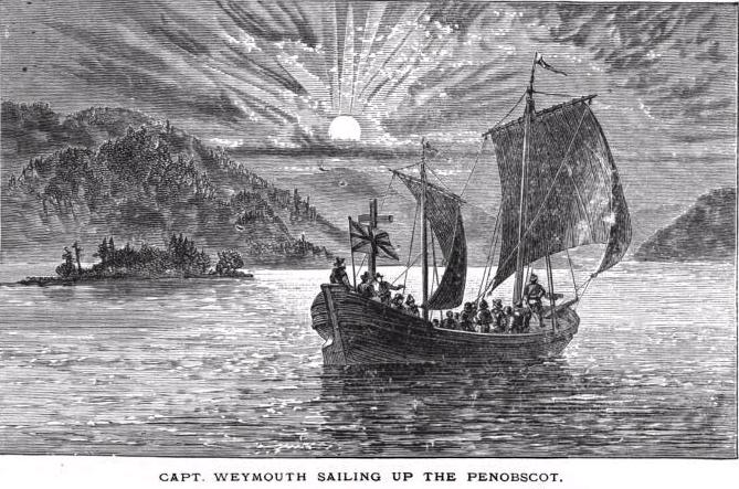
It turned out that the captives Waymouth had abducted were much more important than he had initially realized. One named  Tahánedo was a sagamore of the region and a close relative of Bashabes, the paramount chief of the whole Etchemin-Abenaki Federation. Bashabes tried frantically to get the captives back, sending canoes filled with fur and tobacco for trade, but as Waymouth’s chronicler Rozier related, “this we perceived to be only a mere device to get possession of our men to ransom all those which he had taken” (Burrage, 1906).  

As Waymouth’s ship headed out to sea,  the Etchemin on shore assumed their compatriots had been killed. In fact, not long after Waymouth left,  Samuel de Champlain, on one of his coastal Maine voyages, met an indigenous trader on Mohegan Island who told him about the assumed murders.

On board, Rosier was charged with restoring good relations with the captive five and pumping them for information about New England. The abductees proved to be cooperative, and as Rosier stated, “Although at the time when we surprised them, they made their best resistance, not knowing our purpose, nor what we were, nor how we meant to use them; yet after perceiving by their kind usage we intended them no harm, they have never since seemed discontented with us,” and he called them “very tractable, loving, and willing by their best means to satisfy us in anything we demanded of them, by words or signs for their understanding … We have brought them to understand some English, and we understand much of their language; so as we can ask them many things” (Burrage, 1906).

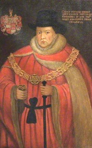
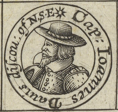
The abductees were taken to southwest England and delivered to the Fort of Plymouth and Sir Ferdinando Gorges, the commander of this coastal stronghold. Gorges kept three of the Etchemins,  Assacomet, Manido, and Skidwarres, at his manor in Devonshire, and the other two, Amooret and Tahánedo, he delivered to  Sir John Popham, then England’s Lord Chief Justice, who owned several manorial estates in Devonshire and Somerset counties.

The Etchemin from the wilds of Maine likely felt much more at ease at these rural estates than they would have in crowded cities filled with lethal diseases. “Although they were involuntary guests, they could have been given some freedom to hunt, fish, and gather, all to create long-term relationships” (Prins and McBride, 2012). 

Popham and Gorges had become interested in colonizing New England and were keen to obtain information from the “Mawooshen Five.” In his engaging article Alien Abductions, James Ring Adams (2015) wrote that Gorges left a record that he greatly enjoyed the company of his house guests. He praised them “for great civility far from the rudeness of our common people” and talked with them at length about their homeland. “And the longer I conversed with them, the better hope they gave me of those parts where they did inhabit, was proper for our uses.” Gorges would learn about the important rivers that ran into the land, the flora and fauna, the key leaders, and the major alliances.

Eventually, all the Mawooshen Five would be sent on missions back to Maine by Gorges, Popham, and the Plymouth Company. In August 1606, their first ship, Richard, set sail under the command of Captain Henry Challons with Assacomet and Manido on board. Their instructions were to make for Cape Breton and then head southwest; instead, Challons detoured to the West Indies, where all were taken prisoner by a Spanish fleet somewhere off the coast of Puerto Rico. Challons would not get free until late 1608. Manido probably died while in Spanish hands. Assacomet was eventually ransomed and moved back in with Gorges in Plymouth.  In 1614, he would return to New England when Gorges put him on a boat commanded by Nicholas Hobson that explored Martha’s Vineyard in search of gold. Traveling with them was another abductee, Epenow. who would escape. The fate of Assacomet is unrecorded.

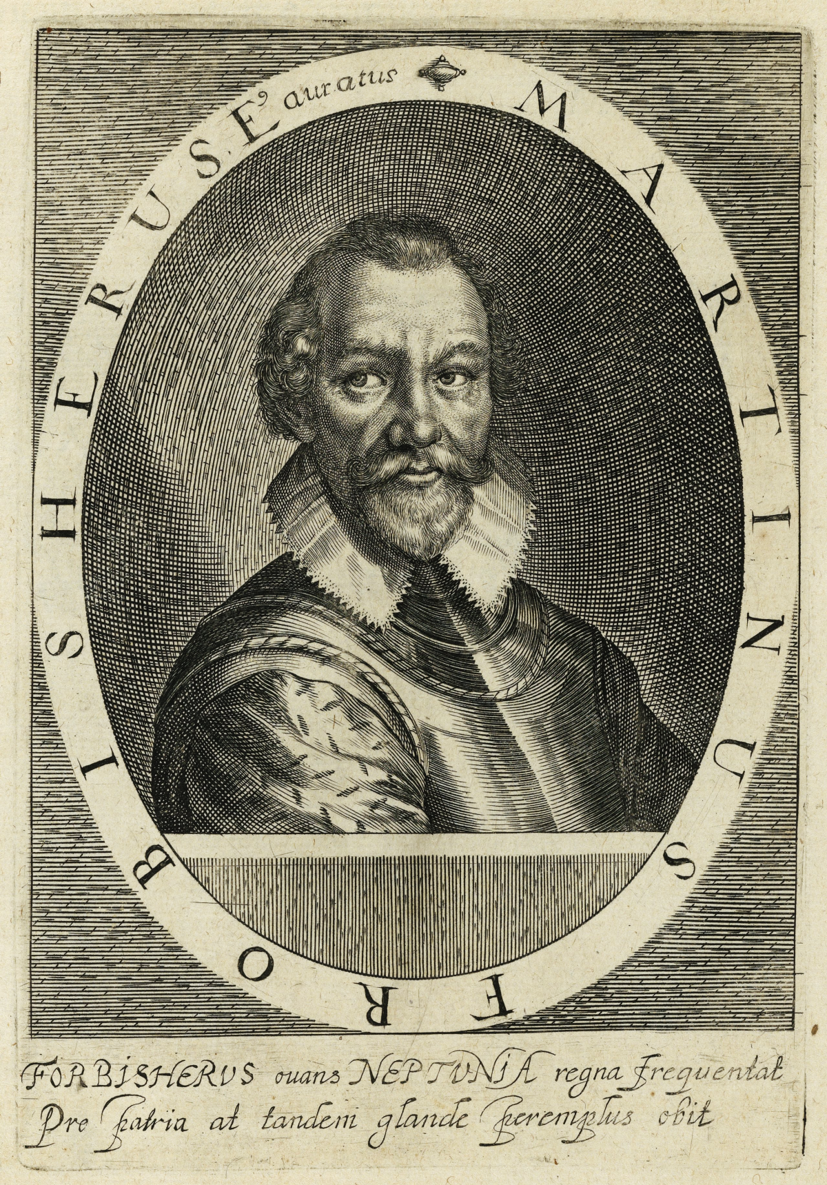
A second ship sent out in 1606, under Captain Thomas Hanham and Martin Pring, with Tahánedo and possibly  Amooret aboard, successfully arrived on the coast of Maine and explored the rivers and harbors of the Gulf, including the lower Kennebec. At the end of the voyage,  Tahánedo was allowed to rejoin his Etchemin band as a reward for his services and would resume his role as a sagamore.

Skidwarres was sent to Maine in 1607 as part of another Popham mission to build a settlement. The colonists arrived safely and settled at Sagadahoc on the Kennebec River for the winter. This proved hard, however, and they went home the following spring. They left Skidwarres behind, who had reunited with  Tahánedo and his people.  

Illustration: Sr. John Popham knight Lorde Cheife Justice of England & of her Maj. most honorable Privie Counsell. Sir John Popham (1531–1607), Lord Chief Justice. Copy by George Perfect (1781–1853) of lost original by an unknown artist. National Portrait Gallery, London,

Bibliography:

Adams, J. R. (2015). Alien abductions: How the Abenaki discovered England. Smithsonian 16(3),  1–8. https://www.americanindianmagazine.org/story/alien-abductions-how-abenaki-discovered-england

Burrage, H.S. (Ed.) (1906). Early English and French voyages chiefly from Hakluyt 1534-1608. Charles Scribner’s Sons.

Prins, H. E. L., & McBride, B. (2007). Asticou’s Island Domain: Wabanaki Peoples at Mount Desert Island 1500-2000. Acadia National Park. Ethnography Program. National Park Service. 

Precolonial North American History: George Waymouth and the abduction of five Etchemin

In 1605, Captain George Waymouth embarked on a mission that would have far-reaching consequences. Sent from England to explore the coast of Maine by the Earl of Southampton, this expedition was part of an English Catholic attempt to scout out potential sites in New England for a colony. However, the secondary goal, to kidnap a few Indigenous people for information, would leave a lasting mark on the region and its inhabitants.  

Waymouth and crew sailed from England on March 31 on the ship Archangel and landed first near Mohegan Island off the coast of Maine on May 17. After exploring the island’s bounteous resources for two days, Waymouth then sailed northward, among the St. Georges Islands, and anchored in Penobscot Bay at the mouth of the St. Georges River. “Here the master and men regaled themselves several days and recruited their strength … he and a party properly armed, explored the islands and shores, while his sailors, engaged in fishery, readily took plenty of salmon and other fishes of great bigness” (Williamson, 1839: 192).

Eleven days after the Archangel moored, the crew first encountered the local Etchemin people.  On May 30, 1605, the voyages chronicler Rosier relates: “This day, about four in the afternoon, we in the ship spied three canoes coming towards us, which went to the land adjoining, where they went ashore, and very quickly made a fire, about which they stood beholding our ship: to whom we made signs with our hands and hats, waffling onto them to come onto vs, because we had not seen any of the people yet. They sent one Canoa with three men, one of which, when they came near us, spoke in his language very loud and very boldly, seeming as though he would know why we were there and, by pointing with his oars towards the sea, we conjectured he meant we should be gone. But when we showed them knives and their use, by cutting of sticks and other trifles, as combs and glasses, they came close aboard our ship, as desirous to entertain our friends. To these, we gave such things as we perceived they liked when we showed them the use: bracelets, rings, peacock feathers, which they stuck in their hair, and tobacco pipes (Burrage, 1906, pp. 367-368).”

Over the next several days they had many encounters with the Etchemin and encouraged their trust through trade. Rosier relates: “Our Captain had two of them at supper with us in his cabin to see their demeanor, who behaved themselves very civilly, neither laughing nor talking all the time, and at supper fed not like men of rude education, neither would they eat or drink more than seemed to content nature; they desired peas to carry a shore to their women, which we gave them, with fish and bread, and lent them pewter dishes, which they carefully brought again (Burrage, 1906, p. 402)”.

At this point, Waymouth decided the time was ripe to kidnap some of the locals. Rosier justified this move by saying: “We began to join them in the rank of other Salvages, who travelers in most discoveries have found very treacherous. They never attempted mischief until, by some remissness, fit opportunity afforded them certain ability to execute the same. Therefore, after good advice, we determined so soon as we could to take some of them, least (being suspicious we had discovered their plots) they should absent themselves from us (Burrage, 1906, p. 407).”

On the next day, they abducted five Etchemin, three by duplicity and two by force. According to Rosier: “About eight a clock this day we went on shore with our boats to fetch aboard water and wood, our Captain leaving word with the gunner in the ship, by discharging a musket, to give notice if they spied any canoes coming …. there were two canoes, and in each of them were three savages; of which two came aboard, while the others stayed in their canoes about the ship; and because we could not entice them aboard, we gave them a can of peas and bread, which they carried to the shore to eat. But one of them brought back our can presently and stayed aboard with the other two, for he being young, of a ready capacity. One we most desired to bring with us into England had received exceeding kind usage at our hands and was therefore much delighted in our company (Burrage, 1906: 378).”

These three were prevented from leaving the ship, presumably by putting them in the hold.

To capture the other two that had left, Rosier tells us: “We manned the light horseman with 7 or 8 men, one standing before carried our box of merchandise a platter of peas, but before we were landed, one of them (being too suspiciously fearful of his own good) withdrew himself unto the wood. The other two met us on the shore side, to receive the peas, with whom we went up the cliff to their fire and sat down with them … showed them trifles to exchange … but suddenly laid hands upon them. And it was as much as five or six of us could do to get them into the light horseman. For they were strong and so naked as our best hold was by their long hair on their heads, and we would have been very loath to have done them any hurt … being a matter of great importance for the full accompaniment of our voyage (Burrage, 1906, p. 378-379).”

Waymouth then headed back to England with his human cargo below deck.

Illustration: Captain George Waymouth sails into Penobscot Bay in Maine. Image from Thomas Wentworth

Bibliography:

Burrage, H.S. (Ed.) (1906). Early English and French voyages chiefly from Hakluyt 1534-1608. Charles Scribner’s Sons.

Williamson, W. D. (1889) A History of the State of Maine: from its first discovery, A.D. 1602, to the separation, A.D. 1820. Hallowell: Glazier, Masters & Co.

Precolonial North American History: The Indigenous People of Maine in 1600

When the first Europeans began to arrive on the coast of Maine in the late 16th century, they encountered a rich tapestry of indigenous cultures. The region was inhabited by three distinct Algonquin-speaking ethnic groups, each with their own unique customs and ways of life. Samuel de Champlain would be the first European to come in contact with all three groups, and he called them Etchemin, Souriquios, and Armouchiquois. The Etchemin were located along the central coast in the woodlands between the Kennebec and St John River Valleys. They were flanked on their northeast by the Souriquios and to their southwest by the Armouchiquois.  The Armouchiquois and Abenaki were corn, bean, and squash farmers, while the Souriquios and Etchemin were strictly hunter-gatherers. This diversity of lifestyles and cultures is a testament to the richness and complexity of the indigenous societies in Maine.

‘Souriquois’ was a French term meaning ‘saltwater men’.  The word ‘Etchemin’ is believed to be either a French alteration of an Algonquian word for canoe or a translation of ‘skidijn’, the native word for people. ‘Armouchiquois’ was a French corruption of the Souriquois word ‘Alemousiski ‘, which meant ‘land of the little dog ‘. This term was intentionally derogatory, reflecting the power dynamics between the Souriquois and Armouchiquois. It’s important to note these derogatory terms to understand the historical context and the unequal power relations between the indigenous people and the European colonizers. 

The Souriquois were found not only in Northeastern Maine but in Canada’s Atlantic Provinces, including Nova Scotia, New Brunswick, Prince Edward Island, and Newfoundland, as well as on the Gaspé Peninsula of Quebec. Their name for themselves was U’nu’k meaning humans or people.

The Etchemin contained two groups – the Eastern Etchemins, who allied with the Souriquois and were found east of the Narraguagus River – and the Western Etchemins, who allied with the Armouchiquois and ranged along the coast and into the forested hinterland from the Narraguagus to the Kennebec River.

The Armouchiquois were spread from western Maine to Cape Cod and comprised several ethnic groups. They included corn-growing peoples from the Kennebec to Cape Cod: Abenaki, Penacook, Massachusett, and Wampanoag. Other names used to describe people in western Maine were Sacos, Pigwackers, Ossipees, and Pennacook-Abenaki. They called themselves “alnamback” or real people (Haviland, 2017).

What the French and English would call the Peoples of Maine would evolve over the next century. The term Armouchiquois would soon disappear, although the labels  Etchemen and Souriquois would survive through most of the 17th century. Today’s Passamaquoddy and Maliseet trace to the eastern Etchemen. The Souriquois are now most commonly called Micmac or Mi’kmaq. The name Wabanaki (“People of Dawnland”) would eventually come to represent all the Peoples of Maine after the Wabanaki Confederacy was formed in the 1680s to combat the growing encroachment of colonists and challenge Iroquois hostilities  (Snow, 1976).

Illustration: Symbol of the Wabanaki Union of Tribes, still in use. It was originally embroidered onto the ceremonial clothing of sakoms. Frank Speck (1927) Symbols In Penobscot art. https://en.wikipedia.org/wiki/Wabanaki_Confederacy#/media/File:Wabanaki_Union_Symbol.png

Bibliography

Anonymous (Undated). The Almouchiquois. The Falmouth Historical Society. https://thefhs.org/almouchiquois

Baker, E. W. (2004). Finding the Almouchiquois: Native American Families, Territories, and Land Sales in Southern Maine. Ethnohistory, 51(1),  73-100.

Bourque, B. J. (1989) Ethnicity on the Maritime Peninsula, 1600-1759. Ethnohistory,  36 (3),  257-284

Haviland, B. (2017). Who was here first? Abbe Museum. https://www.abbemuseum.org/blog/2017/3/10/up-from-the-depths-a-stone-axe-and-sea-level-change

Hoffman, B. G. (1955). The Souriquois, Etechemin, and Kwĕdĕch–A Lost Chapter in American Ethnography. Ethnohistory, 2(1), 65-87

Prins, H. E. L., & McBride, B. (2007). Asticou’s Island Domain: Wabanaki Peoples at Mount Desert Island 1500-2000. Acadia National Park. Ethnography Program. National Park Service. 

Precolonial North American history: Third arctic voyage of John Davis

On 19 May 1587, Davis headed again to the Arctic with three ships: the veritable Sunshine, the Elizabeth, and a little, disassembled pinnace called the Ellen. John Janes sailed along again as Davis’s friend and confidant.

On 14 June, the crew spied the rugged mountains of Greenland covered by a huge glacier, and on 16 June, the vessels anchored in Gilbert Sound. Almost immediately, the local people surrounded them in kayaks, and the Englishmen traded for seal skins.

The parts of the pinnace were taken to a nearby island for assembly while an exploration party roamed the environs. Davis decided that Sunshine and Elisabeth would be dispatched to the fishery to make the trip profitable while he would use the pinnace for exploration.

On the 21st  of June, Davis, in the Ellen, departed from Gilbert Sound and proceeded northwards along the coast of Greenland, occasionally bartering with the Inuit in kayaks. He reports that: “On the 25th in the morning at 7 of the clock, we discovered 30 savages rowing after us … they brought us salmon, pearls, birds, and caplin, and we gave them pins, needles, bracelets, nails, knives, bells, looking glasses, and other small trifles, and for a knife, a nail or a bracelet … they would sell their boat, coats, or anything they had, although they were far from the shore. We obtained from them few skins, but they made signs to us that if we would go to the shore, we should have more.” (Markham, 1880, pp. 43 – 44)

On the 30th Davis was at latitude 72° 12’ N, the furthest north he reached on this voyage. In his book The Life of John Davis, Markham (1889, p. 58) waxes eloquently that: “ A bright blue sea extended to the horizon on the north and west, obstructed by no ice floes, but here and there were a few majestic, icebergs, with snowy peaks shooting up into the sky, floated on the bosom of the deep.  Near the horizon, in the far distance, these icebergs, distorted by the refraction, were raised up into the most fantastic and beautiful forms imaginable.  To the eastward were the granite mountains of Greenland, and beyond them, the white line of the mightiest glacier in the world, upheld by the mountain buttresses like huge caryatide &  rising immediately above the tiny vessel was the beetling wall of Hope Sanderson, with its summit 850 feet above the sea-level. Its surface is slightly broken by a narrow ledge on which hundreds of thousands of guillemots rear their young; and when disturbed, they fly out in dense clouds, and return after circling many times over the water.” 

On the 2nd of July, Davis in the Ellen encountered a huge bank of ice, lying north and south, which totally checked her progress. “This was the famous middle pack, a mass of ice drifting towards the Atlantic, and sometimes extending for 200 miles, its average thickness being eight feet.” (Markham, 1889,  p. 60). 

Coasting along the pack in calm, foggy weather, they observed the western coast of Davis Strait and traded with some Inuit in kayaks. They sighted Mount Raleigh on 19 July, which they had discovered on their first voyage, and soon were at the entrance of Cumberland Gulf. Davis decided to make a second examination of this great gulf and sailed along its northern entrance until he reached a group of islands at the end. Proceeding southward, “they came to a wide opening between 62° and 63° N. latitude, to which Davis gave the name of Lord Lumley’s Inlet; and a headland passed on the 31st was called the Earl of Warwick’s Foreland. The inlet was clearly Frobisher’s Strait, and the land was no other than the Meta Incognita of that navigator.” (Markham, 1889, p. 61)

Next came the discovery of another great seaway, which would be called Hudson’s Strait. Its strong current and ice prevented him from going west, so he headed south along the Labrador coast and entered the Labrador Fjord, which now bears his name (Davis Inlet).

He then fished the Hamilton Inlet, and from there, not finding Sunshine and Elizabeth, he headed home in the tiny, leaky pinnace, stacked with as many fish as it could hold. He arrived safely at Dartmouth on  15 September 1587, having navigated through more than 20° of arctic waters.

Legacy of John Davis

Davis was by no means the first European to explore the Arctic, following in the footsteps of Cabot, Frobisher, and several Portuguese. However, none of these navigators had the scientific expertise of John Davis. He charted long stretches of Greenland, Baffin, and the Labrador coasts and carefully observed ice conditions, terrain, rock formations, weather, vegetation, and animal life.  His original logs have been lost, but his discoveries appear in detail on the great maps of the period by Edward White and on the famous Molyneux Globe (1592). He also provided one of the earliest descriptions of the Inuit, which was accurate and much more sympathetic than the other European explorers of the 16th and 17th centuries. 

Illustration: An iceberg in the Arctic Ocean. AWeith.

Bibliography:

Markham, C. R. (1889). The life of John Davis, the navigator (1550 – 1605). Discoverer of the Davis Straits. Dodd Mead and Company, New York.

Precolonial North American History: Second Arctic voyage of John Davis

Embarking on another significant historical journey, John Davis set sail from Dartmouth on 7 May 1586, leading his second expedition to the Arctic Sea. This voyage, marked by the presence of four ships-the Mermaid (120 tons), Sunshine (60 tons), Moonshine (35 tons), and North Star (10 tons)-would lead to several great adventures.  

On the 15th, Davis came in sight of the southern extremity of Greenland, but the pack ice rendered it impossible to land, so Davis named it “Cape Farewell” and continued along the strait that now bears his name. Here, he encountered severe gales of wind, and it was not until the 29th that he again sighted the towering mountains of Greenland near Gilbert Sound. He then took shelter among the islands along the coast and commenced examining the shore.

As his chronicler Jayne tells the story: “… we sent our boats to search for shole water … the people of the country having spied them, came in their canoes towards them with many shoutsand cries … After I perceived their joy … myself with the merchants and others of the company went ashore, bearing with me twenty knives. I had no sooner landed, but they leaped out of their canoes, came running to me and the rest, and embraced us with many signs of hearty welcome: at this present, there were eighteen of them, and to each of them, I gave a knife: they offered skins to me for reward, but I made signs that it was not sold, but given them of courtesy …”  (Markham, 1880, p. 16)

The next day, the pinnace was landed on an island for assembly, and while the carpenters got to work, they were surrounded by many Inuit who were again very friendly. Davis records that as many as 100 kayaks came up to the ship at one time and that the Inuit were “very diligent to attend to us, and to help us up the rocks, and likewise down.(Markham, 1880, p. 17)

The pinnace was launched on 4  July, with forty people helping them. The English were almost constantly surrounded wherever they went by Inuit in their kayaks, and thieving started to become a major problem.  One night, the Inuit began firing stones upon a ship with slings, and a large rock knocked down the boatswain of the Moonshine. Davis finally lost his patience and chased after the perpetrators in their kayaks but without success. The next day his crew did manage to capture one of the ringleaders who they hoped to exchange for their anchor. However, the wind came up, and this poor soul was carried out to sea.  

As Davis and crew traveled southward of Gilbert Sound, they came upon “an enormous iceberg on the 17th of July. Its extent and height were so extraordinary that the pinnace was sent to ascertain whether it was land or really ice. The report was that it was indeed one gigantic mass of ice, floating on the sea, with bays and capes, plateaus and towering peaks, [which] excited great astonishment.”  (Markham, 1889, p. 42)

Soon, masses of ice began to collect around the ships, and the ropes and sails became frozen and covered with ice. Further progress was checked, and the men began to despond, telling the captain: ”That he should regard the safety of his own life and the preservation of his people, and that he should not through over-boldness run the risk of making children fatherless and wives desolate.” (Markham, 1889, pp. 47-48) 

At this point, Davis decided to send the Mermaid home with the sick and feeble, while he continued on in the Moonshine.  He sailed westward and made land on the opposite side of the strait, near Exeter Sound. Then, sailing southwest, he entered the Cumberland Gulf again, passed the entrance to Hudson Strait without observing it, and sailed along the coast of Labrador. Here, they fished for cod, which they salted to take home.

While they were at anchor, several men were sent on shore to collect some fish which had been laid out on the rocks to cure. Unknown to them, several Mi’kmaq were hiding in the woods, “who sent a murderous round of arrows at the sailors. Seeing this unfold from the boat, Davis sailed towards the shore and discharged his muskets at the savages, which scattered them. Unfortunately, two of his men were killed by arrows, two were seriously wounded, and just one escaped with an arrow wound to the arm, by swimming off toward the ship.” (Markham 1889, p. 56)

Davis and the crew were then caught up in a furious gale that lasted for three days. This proved to be the tipping point for Davis, and he decided to give up and return home. He left for England on 11 September and arrived home in early October 1586.

Illustration: Map showing Davis’s northern voyages. From C. R. Markham’s The life of John Davis, the navigator (1889).

Bibliography

Markham, A. H. (ed.) (1880) The voyages and works of John Davis, the navigator. London: The Hakluyt Society.

Markham, C. R. (1889). The life of John Davis, the navigator (1550 – 1605). Discoverer of the Davis Straits. Dodd Mead and Company, New York.

Precolonial North American history: The first Arctic voyage of John Davis

Martin Frobisher failed in his attempt to extract wealth from Arctic Canada in the 1570s, but England’s passion remained strong for finding a Northwest Passage to China. John Davis would be the next in line to make that quest in three missions between 1585 and 1587.

On his first voyage, Davis left Dartmouth on 7 June 1585 with two ships, the Sunshine (50 tons, 23 crew, including a four-man band) and Moonshine (35 tons, 19 crew). The trip was backed by William Sanderson and a group of merchants from London and the West Country.   

After battling strong westerly winds, the two ships arrived on the west coast of Greenland and dropped anchor at the present site of Nuuk.  Here, they had a most pleasing interaction with the local Inuit. The encounter began with the crew hearing a “lamentable noise” that they thought must be wolves. It turned out to be the Inuit’s making a ruckus to get their attention. In response, the crew went on shore with their band, which began to play while the officers and sailors danced and “allured the Inuit by friendly embraces and signs of courtesy.” (Markham, 1980). The sailors then placed some stockings, caps, and gloves on the ground as gifts and danced and sang their way back into their boats and rowed back to the mother ships.

This strange behavior apparently proved effective, and the next day, the Inuit came back and actively traded with them. Despite Frobisher’s previous altercations with them, the Inuit reacted quite favorably towards Davis and his crew. As Davis’s chronicler, Jayne tells the story:  

The ships being within tile sounds, we sent our boats to search for shole water, where we might anchor, which in this place is very hard to find: and as the boat went sounding and searching, the people of the country having spied them, came in their canoes towards them with many shoutsand cries: but after they had spied in the boat, some of our company that was the year before here with us, they presently rowed to the boat, and took hold in the oar, and hung about the boat with such comfortable joy as would require a long discourse to be uttered: they came with the boats to our ships, making signs that they all those that yere before had been with them. 

After I perceived their joy … myself with the merchants and others of the company went ashore, bearing with me twenty knives. I had no sooner landed, but they leaped out of their canoes and came running to me and the rest and embraced us with many signs of hearty welcome: at this present, there were eighteen of them, and to each of them, I gave a knife: they offered skins to me for reward, but I made signs that it was not sold, but given them of courtesy: and so dismissed them for that time, with signs that they should return again after certain hours.

The next day, with all possible speed, the pinnace was landed upon an Isle there to be finished …  During the time that the pinnace was there setting up, the people came continually unto us, sometimes a hundred canoes at a time, sometimes forty, fifty, more and Jess, asoccasion served.  They brought with them sealskins, stag  skins, white hares, seal fish, salmon, small cod, dry caplin, with  other  fish, and  birds, such  as the country  did yield.” (Markham, 1880: 16).

The expedition then sailed west across the cold, icy waters of what is now called Davis Strait and discovered a wide and deep sound that Davis was certain was the opening to the Northwest Passage. They sailed for miles into this waterway (now called Cumberland Gulf), but by August 20th, the blustery wintry winds convinced Davis and his officers that they had better turn and head home or risk spending the winter icebound.  Unbeknownst to them, they had not gone far enough to find that the waterway was not the Passage at all but, in fact, ended in the center of Baffin Island.

Davis and crew arrived back at Dartmouth on the 30th of September. On his return, Davis immediately wrote a letter to Sir Frances Walsingham Knight, a member of Her Majesty’s Privy Council, in which he enthusiastically boasted he had found the Northwest Passage:  “Right honorable most dutifully craving pardon for this my rash boldness, I am herby, according to my duty, to signify to your honor that the north-west passage is a matter nothing doubtful! but at any time almost to be passed, the sea navigable, the air tolerable, and the waters very deep.  I have also found a very great quantity, not in any globe or map described, yielding a sufficient trade of fur and leather. Although this passage hath been supposed very impassible, yet through God’s mercy, I am in experience and eye witness to the contrary, yea in this most desperate climate;  which,  by Gods help, I will very shortly most at large reveal onto your honor so soon as I can possibly take orders for my mariners and shipping.  Thus, depending on your honors good favor, I humbly commit you to God this third of October.” (Markham, 1880: xix).

Illustration: A miniature portrait (1624) of John Davis from the title page of Samuel Purchas’s collection of travel stories, Hakluytus Posthumus or Purchas his Pilgrimes.

Bibliography

Markham, A. H. (ed.) (1880) The voyages and works of John Davis, the navigator. London: The Hakluyt Society.

Markham, C. R. (1889). The life of John Davis, the navigator (1550 – 1605). Discoverer of the Davis Straits. Dodd Mead and Company, New York.

Precolonial North American History: Tarrentine Wars

About the time the English and French began to explore the northern coast of Atlantic America,  what had been mostly friendly trading interactions between the Tarrentines and the other coastal New England nations turned to violence. The Etcheman west of the Kennebec (Penobscot, Kennebec) and the southern Almouchiquois would ally, form the Mawooshen Confederation, and become the sworn enemies of the Tarrentines.

The arrival of French fur traders in the St. Lawrence Valley stimulated a crisis among the Indigenous nations that lasted over 25 years. A growing scarcity of fur-bearing animals intensified inter-tribal competition, and a major power imbalance arose when the French provided the Tarrentines with firearms.

While there are few European eyewitness reports of these battles, Champlain and Lescarbot published numerous accounts of the Indigenous participants. During the Champlain and Poutrincourt excursions along the Maine coast, Lescarbot writes that in 1606 at the village of Chouacoet near Saco Bay, Almouchiquois chiefs Marchin and Onemechin “brought Monsieur de Poutrincourt a Souriquois [Mi’kmaq] prisoner, and therefore their enemy, whom they freely handed over to him” (Biggar, 1928: 99).

During the same visit, Champlain told of two Sagamos who came there from the east in their own shallot, an Etchemin named Messamouet and a Souriquios [Mi’kmaq] named Secoudon. These two Tarrentine had come to trade with French merchandise gained by barter, even though they were traditional enemies of the Almouchiquois. After a long oratory by Messamouet, he made presents of kettles, axes, knives, and other manufactured articles, to which Onemechin gave him back Indian corn, squashes, and Brazilian beans. This produce did not altogether satisfy Messamouet, “who departed much displeased because he had not been suitably repaid for what he had given them, and with the intention of making war upon them before long…” (Bigger, 1922: 395-396). After this encounter, Secoudon stayed with Champlain’s expedition while Messamouet returned to Nova Scotia.

During Champlain’s return voyage, as he passed Great Wass Island on the coast of Maine, a group of Eastern Etchemin informed Secoudon that a Mi’kmaq chieftain named “Iouaniscou and his companions had killed some other [Armouchiquois] and carried off some women as prisoners, and that near Mount Desert Islandthey had put these to death.” (Biggar, 1922: 426). When Champlain dropped Secoudon off at St. Croix after the voyage, Champlain reported that the Etchemin chief returned with scalps he had obtained at Cape Cod, although the details of how these were obtained are not given.

In the autumn of 1606, the murders of Iouaniscou were avenged by the Etchemin with the murder of the Mi’kmaq Panonias, who had guided Champlain the previous summer. He was killed by Mawooshen warriors in the Penobscot Bay area.  After his death, the Eastern Etchemin chief  Ouagimout of  Passamaquoddy  Bay asked  Bashaba, the grand chief of Mawooshen, for Panonias’ body. The body was then delivered by Ouagimout, wrapped in moosehide, to a Mi’kmaq encampment near Port Royal. Membertou, Panonias’s father-in-law and grand chief, welcomed Ouagimout and presented ritual gifts of mourning to Panonias’ relatives. Panonias was then buried on an island near Cape Sable.

In response, Membertou, with 500 warriors, attacked the town of Chouacoet, that Champlain had previously visited on July 1607, killing twenty people, including two grand chiefs, Onmechin and Marchin.  The Tarrentine also suffered losses in this raid, including Chief Ouagimout of Passamaquoddy Bay, who was grievously wounded, and Chief Secoudon. who was killed.   

Membertou conducted his attack as a surprise offensive. He appeared before the Abenakis unarmed, pretending that he wanted to negotiate, and then, he and his men seized hidden weapons and attacked. Membertou’s force was composed of Mi’kmaqs from his band and Messamouet’s, along with Eastern Etchemins from the St. John River under Chief Secoudon and from the Passamaquoddy Bay area under Chief Ouagimout (Prins and McBride, 2000).

Thus began what has been called the Tarratine or Mi’kmaq Wars, where bands of Tarrentine warriors in fleets of canoes and shallops began raiding Mawooshen villages, killing people and taking captives along with corn, furs, and moose hides. These wars culminated with the slaughter of the Mawooshen grand chief Basaba in 1615. This was followed by the great plague (“Great Dying’) of 1616-19. An estimated 2,500 out of 7,500 eastern Etchemins died, while as many as  9,000 out of 12,000 western Etchemins perished. The Almouchiquois must have also suffered staggering casualties. 

Even after the collapse of the western Etchemin, Mik’maq raids against the Amouchiquois continued until as late as 1631. However, the Tarrentine entrepreneurs’ fortunes declined rapidly after Europeans appeared in the Gulf and began trading directly with local fur producers.

Illustration: Alan Syliboy’s portrait of Grand Chief Henri Memberton that was presented to Queen Elizabeth the Second on 28 June 2010 by Grand Chief Benjamin Sylliboy and placed on permanent display in Government House Halifax.

Bibliography:

Biggar, H. P. (1922). The works of Samuel de Champlain. Vol. 1: 1599 – 1607. The Champlain Society.

Prins, H. E. L., & McBride, B. (2007). Asticou’s Island Domain: Wabanaki Peoples at Mount Desert Island 1500-2000. Acadia National Park. Ethnography Program. National Park Service. 

Precolonial North American History: Third Arctic voyage of Martin Frobisher

On 31 May 1578, Frobisher, in the Ayde, led a fleet of 15 vessels from Harwich. He was directed to bring back 2,000 tons of ore and establish a settlement to gather more. McFee (1928, p. 80) suggests that “without being aware of it, we are now witnessing the inception of the first authentic scheme of colonial expansion in the history of North America.”

The plan was to leave one hundred miners there with enough supplies for the winter and summer. Three ships would be left behind in case the colonists needed to return home before the supply ships came back the next year. Unfortunately, this was a flawed strategy, as the sea in the area was frozen from late November until July, and the miners could not have left even if they had wanted to.

The expedition arrived at Greenland on 20 June and found it to be a forbidding place.   As McFee (1928, p. 65) describes: “Frisland, or Greenland as we call it now, was a singularly unpromising coast. The shore was practically inaccessible, the visible highland consisted of grim snow-covered ranges, and the fogs came down with terrifying suddenness whenever the Admiral wanted to seek a landing. Frobisher had the natural horror of a shipmaster losing sight of his ship. He gave it up and set forward for Meta Incognita.”

From Greenland, the group traveled towards Frobisher’s Strait and, according to Frobisher’s chronicler, Best, met with many great whales. One of the ships, named the Salamander, struck a great whale “with such a blow that the ship stood still neither forward nor backward. The whale made a great and ugly noise and cast up his body and tail, and so went underwater, and within two days after, there was found a great whale dead, swimming above the water, which we supposed was that of the Salamander stroke.” (Collinson, 1867, p.  234) 

The fleet then suffered a period of great difficulty where they were forced to battle ice floes, strong currents, and foul weather.   They were driven south into an unknown strait, which Frobisher named the “Mistaken Strait.” He was, of course, sure that this was a Northwest Passage but left without further investigation, as the fabled passage was now outside his voyage’s specific mission. It would be determined later that his “Mistaken Strait” was the Hudson Strait leading into Hudson Bay and not to Cathay. A similar misconception would lead to Henry Hudson’s death 30 years later. 

Windswept ice floes kept the fleet from its intended destination for about a month, during which time the ship carrying most of their building materials was crushed in the ice, and another one deserted and went back to England. Finally, at the end of July, Frobisher found the strait he was looking for, and the miners were deployed to dig for ore on an island he named the Countess of Warwick.

Using the building materials they still had on hand, a house was built near the mining site, but the idea of a winter colony was dropped because they had too few remaining materials to build any other structures. The remains of this house are still clearly visible on the summit of Kodlunarn Island. These are the oldest known remains of a European house built in America north of the Caribbean.

As soon as the miners began working at the ore, Best went exploring. He climbed to the top of what became known as Hatton’s Headland, to look at the fleet and set up a cross of stone, “in token of Christian possession.” A week later, he and some other officers chased and killed “a great white bear, which adventured and gave a fierce assault upon twenty men being weaponed. And he served them for good meat many days” (McFee, 1928, p. 101).

Within a month after beginning the dig,  the ships were fully loaded with bags of ore and were ready for the voyage home. After seeing a massive display of the Aurora Borealis, which Frobisher took as a warning that they should leave, “they all departed, or more appropriately escaped, on the thirty-first of August 1578 (McCoy, 2014).

At the end of August, the vessels arrived home and the refiners immediately set out to extract the gold, but none was ever found. Repeated attempts went on until 1583, but there was no longer any room for denial, and the Queen and all the investors were forced to accept failure. Seas of litigations followed “and needing a scapegoat, they focused their anger on poor Michael Lok. In gross unfairness, the gullible investors accused Lok of dishonesty, with Frobisher himself among the accusers. Michael Lok furiously accused Frobisher of bringing back valuable ore on the first voyage but worthless ore on other trips … Lok became the focus of creditors’ efforts to collect, and he was bankrupted, sued, and imprisoned. Lok later claimed to have seen the inside of every jail in London. (McCoy, 2014b,  n.p.)

Frobisher would continue his naval service in many capacities over the next 16 years but would never return to the Arctic.

Illustration: Canadian commemorative postage stamp of Martin Frobisher issued in 1963.

Bibliography

Collinson, R. (1867) The three voyages of Martin Frobisher, in search of a passage to Cathaia and India by the North-west, A.D. 1576-8. Reprinted from the first ed. of Hakluyt’s Voyages, with selections from manuscript documents in the British Museum and State Paper Office. Hakluyt Society, London.

McCoy, R.M. (2014) Explorer Martin Frobisher infects the Queen with gold fever. Part 2. Explorer’s tales. https://www.newworldexploration.com/explorers-tales-blog/explorer-martin-frobisher-infects-the-queen-with-gold-fever-part-2

McFee, W. (1928) Sir Martin Frobisher. John Lane the Bodley Head LTD: London

Precolonial North American History: The second Arctic voyage of Martin Frobisher

On Frobisher’s second voyage to the Arctic, all thoughts of the Northwest Passage were forgotten, and the quest became simply to find gold. On 31 May 1577, Frobisher sailed from Harwich with three ships and about 120 men. He captained Queen Elizabeth’s ship the Ayde, piloted by the expedition’s chronicler George Best. Aboard the three ships were a group of miners, and the artist John White who would produce the first pictures of Inuits and later would gain fame as the artist of the Raleigh’s Roanoke Colony.

They arrived at the shore of Greenland on 4 July, but ice prevented them from landing. On 17 July they reached the island from which the now famous little black stone had originally been taken that led to the gold speculation. Little additional ore was found there but on another nearby island (now Kodlunarn Island) they did discover a large quantity. While five miners and some of the crew dug ore and loaded it into the Ayde, Frobisher and a group of 40 men explored the Island.

Frobisher began by claiming this land and its supposed riches for England. In a brief ceremony, Frobisher and crew piled a cairn of stones to mark possession at the island’s highest point, which Frobisher dubbed Mount Warwick in honor of the Earl of Warwick, one of the investors in the expedition.

The land claim did not go unnoticed by the Inuit. As Best described: “… marching towards our boats, we spied a certain number of the country people on the top of Mount Warwicke with a flag, waving us back again and making a great noise, with cries like the mowing of bulls, seemingly desirous of a conference with us … “(Collinson, 1867, p.129)

Each side sent two unarmed representatives to the center of the mountain to trade. The English representatives were Frobisher and a compatriot who tried to take captive one of the  Inuit’s in a prearranged plan. The man proved to be too slippery to grab and ran away, and the two Inuits recovered their weapons, and then chased the two Englishmen down the mountain to their boats, wounding Frobisher with an arrow in the buttock. A volley from the English guns sent the two fleeing, but a man named Nicolas Conyer charged after them and was able to capture one and bring him back to the boat.  

Frobisher and the landing party then rowed to the other side of the island, where they were assaulted by another group of Inuit on the bluffs above them. Frobisher and his party were eventually able to land, located an abandoned village, and destroyed a group of Inuit tents.  They then attacked a nearby settlement, where five or six Inuit were killed, and one Englishman was seriously wounded. The English aptly named the location “Bloody Point.”

They also captured two women and a child. One of the women they described as being so old and ugly that they were sure she must be a witch. They had “her buskins picked off to see if she had cloven feet” and they let her go when her feet proved normal. The other woman and the child were taken back to their ship (Morison, 1971, p. 523).

Best suggested that the female captive was taken on board for the comfort of their male captive: “The two were brought together, surrounded by a circle of Englishman to see what would happen.” The Inuit behaved with great dignity, and even though the two were forced to bunk together on the voyage home, they “did never use as man and wife.” (Collinson, 1867:144-145)

A few days after visiting “Bloody Point,” the crew discovered on a small island  “a tomb, wherein the bones of a dead man lay together … Here they also found hid under stones a good store of fish and other things of the inhabitants including sleds, bridles, kettles of fish skins, knives of bone and such other like.” Their male captive “took in his hand one of these country bridles, he caught one of our doggies, and hampered him handsomely therein, as we do our horses, and with a whip in his hand, he taught the dog to draw a sled.” (Collinson, 1867, p. 136)

Another discovery, which gave them particular delight, was a dead narwhal on the shore with a two yard long unicorn-like nose. The horn was taken back to England and given to Queen Elizabeth, who kept it in her wardrobe, handy for bringing out to stimulate the art of bawdy conversation that she is said to have loved.  (Collinson, 1867, p.136)

On 20 August, the mining work was done. The minors had gathered 200 tons of supposed gold ore while Frobisher and the others were exploring. The ice was now forming around their ship at night, signaling it was time to return home. On 22 August, after lighting bonfires and firing Volleys into the sky, Frobisher and crew headed back to England. 

Once home, the ore samples were sent to a number of assessors who again produced a wide range of estimates on the amount of gold in the ore. Several reported no sign of gold, while others claimed it contained up to ten profitable ounces of gold per hundred pounds. The Queen chose to believe the highest estimate, and incredibly, another larger expedition was organized without any ore having been processed.

Illustration:

A painting by John White of a violent encounter with Inuit during the second Arctic voyage of Martin Frobisher. (British Museum, London) https://www.worldhistory.org/image/12371/inuit-skirmish-by-john-white/

Bibliography:

Collinson, R. (1867) The three voyages of Martin Frobisher, in search of a passage to Cathaia and India by the North-west, A.D. 1576-8. Reprinted from the first ed. of Hakluyt’s Voyages, with selections from manuscript documents in the British Museum and State Paper Office.  Hakluyt Society, London.

Cooke, A. (2003) Frobisher, Sir Martin.  In: Dictionary of Canadian Biography,vol. 1, University of Toronto/Université Laval, http://www.biographi.ca/en/bio/frobisher_martin_1E.html.

McCoy, R.M. (2014a) Explorer Martin Frobisher infects the Queen with gold fever. Part 1. Explorer’s tales. https://www.newworldexploration.com/explorers-tales-blog/archives/08-2014

McCoy, R.M. (2014b) Explorer Martin Frobisher infects the Queen with gold fever. Part 2. Explorer’s tales. https://www.newworldexploration.com/explorers-tales-blog/explorer-martin-frobisher-infects-the-queen-with-gold-fever-part-2

McFee, W. (1928) Sir Martin Frobisher. John Lane the Bodley Head LTD: London

Precolonial North American History: The first Arctic expedition of Martin Frobisher

In 1576, Queen Elizabeth’s seadog Martin Frobisher decided that he would find the Northwest Passage to China through the bitter cold of the Arctic. With the backing of merchant Michael Lok, a ship of about 20 tons was built for the mission named the Gabriel, and two ships were purchased – the Michael of 25 tons, and a pinnace of 10 tons. To man the ships, a crew of 35 was employed. On 7 June 1576, the fleet sailed from Ratcliff with Frobisher as its admiral and pilot, Christopher Hall as captain of the Gabriel, and Owen Griffyn as captain of the Michael.  

On 1 July, they sighted the east coast of Greenland, where they were hit by a massive storm. The three ships got separated, and the pinnace was lost.  The captain of the Michael became so intimidated by the ice that he turned back, and the Gabriel was nearly swamped and wound up on its side. Frobisher kept the ship afloat by ordering the men to cut the mizzenmast to lighten the weight and right the ship. This saved the day, but the ship was full of water, and they had lost many supplies.

Undaunted Frobisher continued westward, and on 28 July he sighted a barren rocky headland which he dubbed “Queen Elizabeth’s Foreland”, now known as Resolution Island, the most easterly outpost of Arctic Canada. From here, Frobisher headed west in a great bay reaching into the heart of Baffin Island, and at its head, Frobisher dispatched a party on a small island, he named Hall’s,  after the master of Gabriel. As they departed, he told the group to bring him anything that they found “in token of Christian possession” of the land.

In McFee’s biography of Frobisher’s life, he relates: “Some of his company brought flowers, some green grass, and one brought a piece of a black stone, much like to a Seacoal in color, which by the weight seemed to be some metal or Mineral. This was a thing of no account, in the judgment of the Captain at the first sight. And yet for novelty, it was kept, in respect of the place from whence it came.” (1928: 48)

This little rock would later lead to a mad search for gold in Frobisher Bay.

Frobisher then sailed into a “greate gutte bay”, which he assumed was the Northwest passage. Frobisher traveled about 60 leagues into the bay and named it Frobisher’s Strait.  Unfortunately, it was not the Northwest Passage at all but a dead end inside Baffin Island, a mistake that would go uncorrected until the middle of the 19th century.

At this point, Frobisher decided to visit Hall’s Island himself and, for the first time, realized that the country was inhabited. “He saw a number of small things fleeting in the Sea afar off, which he supposed to be Porpoises, or Seals, or some kind of strange fish: but coming nearer, he discovered them to be men, in small boats made of leather.” (Collinson, 1867, p. 73)

These were the Inuit of Baffin Island.

Over the next several days, the two groups traded cautiously with one another, sometimes ashore and sometimes aboard the Gabriel. The Inuit seemed familiar with ships such as the Gabriel, and they willingly consumed English food, drank wine, and competed in acrobatics with the mariners among the ropes of the ship’s rigging.

One of the Inuit, through signs, agreed to show them the way to a western sea and Frobisher sent him with five seamen back to the shore to prepare for the journey. These five sailors disobeyed their orders to stay in sight of the ship and were never seen again. Frobisher waited three days for their return and then searched the coast in vain for his men or some Inuit that might be captured and ransomed. He did not find any of his men and was able to capture only one poor local who had inadvertently come to the ship in his kayak to trade. Frobisher would take this unfortunate man back to England as proof to Queen Elizabeth that he had reached a far and strange land. Sadly, the Inuit died shortly after reaching England.

Frobisher now realized that it was time to turn homeward, as snow had begun falling on deck, and the seas were beginning to freeze around the Gabriel. He claimed Baffin Island as a possession of Queen Elizabeth and then sailed back to England.  

Soon after his return, Frobisher gave the black stone that had been collected on Hall’s Island to Lok, who took pieces of it to three different assessors to determine its worth. All three deemed it worthless as marcasite, a sulfide of iron very similar to pyrite (fool’s gold). Disappointed but undaunted, Lok took one more piece of it to another person named Giovanni Agnello, who gave the opposite opinion and claimed he could extract gold from it with a special process known only to himself.

Lok wrote Queen Elizabeth an account of all these findings, and she decided to support a second voyage, even with the shaky evidence of gold. In  March 1577,  the Cathay Company was formed and given a royal charter, with Lok as governor and Frobisher as “high admiral.” All was now in place for an expedition to specifically find gold.

Illustration: Martin Frobisher Frobisher from the Heroologia Anglica, a collection of engraved portraits of illustrious English people (1620).

Bibliography:

Collinson, R. (1867) The three voyages of Martin Frobisher, in search of a passage to Cathaia and India by the North-west, A.D. 1576-8.  Hakluyt Society, London.

McFee, W. (1928) Sir Martin Frobisher. John Lane the Bodley Head LTD: London